Ahaura
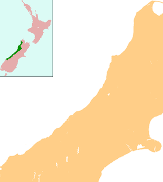
Ahaura is a town in the West Coast region of New Zealand's South Island, sited where the Ahaura River flows into the Grey River. State Highway 7 and the Stillwater - Westport railway line pass through the town. Greymouth is 34 kilometres (21 mi) to the south-west, and Reefton is 44 kilometres (27 mi) to the north-east.[1][2]
Ahaura | |
|---|---|
 Ahaura | |
| Coordinates: 42°20′54″S 171°32′26″E | |
| Country | New Zealand |
| Region | West Coast |
| District | Grey District |
| Population (2013) | |
| • Total | 372 |
| Local iwi | Ngāi Tahu |

According to the 2013 New Zealand census, the Ahaura statistical area, which covers a much larger area than the town, has a population of 372, a decrease of 18 people since the 2006 census. There were 192 males and 177 females. Figures have been rounded and may not add up to totals.[3]
European settlement of the area began with the establishment of a pastoral run near the junction of the Ahaura and Grey Rivers in 1858.[4]
At one time the town supported six hotels, two butcheries, a bakery, a blacksmith's shop, and a printing office.[5]
Education
Awahono School – Grey Valley is a coeducational full primary (years 1–8) school with a roll of 82 students as of March 2020.[6][7] The school was formed at the beginning of 2005 from the merger of Ahaura, Moonlight, Ngahere and Totara Flat schools.[8]
Notes
- Peter Dowling (editor) (2004). Reed New Zealand Atlas. Reed Books. pp. map 69. ISBN 0-7900-0952-8.CS1 maint: extra text: authors list (link)
- Roger Smith, GeographX (2005). The Geographic Atlas of New Zealand. Robbie Burton. pp. map 148. ISBN 1-877333-20-4.
- 2013 Census QuickStats about a place : Ahaura
- Rogers, Anna (2005). Illustrated History of the West Coast. p. 35. ISBN 0-7900-1022-4.
- The Cyclopedia of New Zealand (1906)
- "New Zealand Schools Directory". New Zealand Ministry of Education. Retrieved 26 April 2020.
- Education Counts: Awahono School - Grey Valley
- "School Mergers, Closures and New Schools" (XLS). Education Counts. 2005.