Reefton
Reefton is a small town in the West Coast region of New Zealand, some 80 km northeast of Greymouth, in the Inangahua River valley. State Highway 7 passes through the southern part of the town, and State Highway 69 runs north to connect to State Highway 6. Ahaura is 44 km south-west of Reefton, Inangahua Junction is 34 km to the north, Maruia is 63 km to the east, and the Lewis Pass is 66 km to the south-east.[1][2]
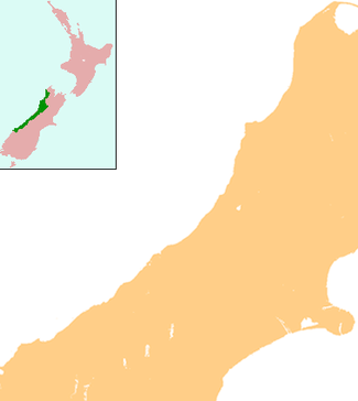
Reefton | |
|---|---|
 Reefton, seen in 2009 | |
 Reefton | |
| Coordinates: 42°6′55″S 171°51′47″E | |
| Country | New Zealand |
| Region | West Coast |
| District | Buller District |
| Population (2013) | |
| • Total | 1,026 |

In 1888 Reefton became the first town in New Zealand and the Southern Hemisphere to receive electricity,[3] the work of Walter Prince,[4] and its streets were lit by commercial electricity generated by the Reefton Power Station.
The population was 1,026 in the 2013 census, an increase of 8.2 percent since the 2006 Census.[5]
Industry
Rich veins of gold found in a quartz reef near the town led to its name, and also its nickname of "Quartzopolis".[6] Gold was first discovered near the town in 1866, although the major discovery was made in 1870. Soon after, the town briefly boasted a population of several thousand. This later dwindled to less than a thousand. Other industries in the town are coal mining, forestry, tourism and angling.
Locally received radio stations include repeaters of both The Hits from Greymouth and Coast FM from Westport. The Greymouth Star newspaper is also received daily in the town.
Railways
Reefton is located on the Stillwater–Westport Line railway, which diverges from the Midland Line in Stillwater. On 29 February 1892, the line was opened to Reefton, but it terminated on the southern bank of the Inangahua River opposite the town. Early in the 20th century, a bridge was built across the river and the present-day station established in Reefton. The line was opened beyond Reefton to Cronadun in 1908, but it was not until 5 December 1943 that the line officially became a through route to Westport, though trains had been operating the length of the line since July 1942. On 3 August 1936, a railcar passenger service began operating in the morning between Hokitika and Reefton utilising small Leyland diesel railcars, but low patronage meant this service ceased to operate all the way to Reefton in August 1938. In the early 1940s, much larger Vulcan railcars were introduced to New Zealand and they provided two services to Reefton: one local service from Greymouth that terminated in Reefton, and a service that ran between Westport and Stillwater to connect with the West Coast Express. In 1967, all passenger services through Reefton ceased. Today, the primary traffic on the railway is coal, with multiple coal trains operating daily.
Climate
Located in the Inangahua Valley at an altitude of 194 m, Reefton falls under the Köppen-Geiger climate classification of Cfb (Oceanic). At an average temperature of 15.9°C, February is the warmest month. July is the coldest month, at 6.8°C. Reefton's average annual temperature is 11.4°C. Snowfall happens about once or twice every winter, with sleet occurring more frequently. Reefton experiences temperatures below freezing on about 15-20 mornings each winter. During the summer, it is not uncommon for temperatures to reach above 25°C, but days above 30°C only happen on a few summer afternoons per year.
| Climate data for Reefton, 194 m | |||||||||||||
|---|---|---|---|---|---|---|---|---|---|---|---|---|---|
| Month | Jan | Feb | Mar | Apr | May | Jun | Jul | Aug | Sep | Oct | Nov | Dec | Year |
| Average high °C (°F) | 19.8 (67.6) |
20.1 (68.2) |
18.8 (65.8) |
16.4 (61.5) |
13.7 (56.7) |
11.5 (52.7) |
11 (52) |
11.8 (53.2) |
13.4 (56.1) |
14.9 (58.8) |
16.6 (61.9) |
18.3 (64.9) |
15.5 (59.9) |
| Daily mean °C (°F) | 15.6 (60.1) |
15.9 (60.6) |
14.6 (58.3) |
12.2 (54.0) |
9.5 (49.1) |
7.3 (45.1) |
6.8 (44.2) |
7.7 (45.9) |
9.3 (48.7) |
11 (52) |
12.6 (54.7) |
14.3 (57.7) |
11.4 (52.5) |
| Average low °C (°F) | 11.5 (52.7) |
11.7 (53.1) |
10.5 (50.9) |
8.1 (46.6) |
5.4 (41.7) |
3.2 (37.8) |
2.6 (36.7) |
3.6 (38.5) |
5.3 (41.5) |
7.1 (44.8) |
8.7 (47.7) |
10.4 (50.7) |
7.3 (45.1) |
| Average rainfall mm (inches) | 157 (6.2) |
111 (4.4) |
130 (5.1) |
171 (6.7) |
191 (7.5) |
175 (6.9) |
185 (7.3) |
172 (6.8) |
196 (7.7) |
201 (7.9) |
188 (7.4) |
180 (7.1) |
2,057 (81.0) |
| Source: Climate-data.org[7] | |||||||||||||
History timeline
| Population of Reefton | ||
|---|---|---|
| Year | Pop. | ±% |
| 1996[8] | 1,044 | — |
| 2001[9] | 987 | −5.5% |
| 2006[10] | 951 | −3.6% |
| 2013[11] | 1,026 | +7.9% |
| Population counts from the New Zealand census | ||
- 1866 – Gold discovered
- 1888 – Town electricity supply commenced
- 1892 – Railway line opened
- 1908 – Rail line to Cronadun opened
- 1912 – Mine workers locked out[12]
- 1967 – Rail passenger services ceased
Education
The first state school in Reefton was founded in 1878, and there were once 24 schools in the area.[13]
Reefton Area School is a composite (years 1–13) school with a decile rating of 3 and a roll of 238.[14] It was formed by the merger of Reefton School and Inangahua College (earlier called Reefton District High School)[13] in 2004.[15] Sacred Heart School is a full primary (years 1–8) school with a decile rating of 4 and a roll of 32.[16] It is a state integrated Catholic school.[17] Both schools are coeducational.
References
- Peter Dowling, ed. (2004). Reed New Zealand Atlas. Reed Books. map 64. ISBN 0-7900-0952-8.
- Roger Smith, GeographX (2005). The Geographic Atlas of New Zealand. Robbie Burton. map 149. ISBN 1-877333-20-4.
- McKinnon, Malcolm, ed. (1997). New Zealand Historical Atlas. David Bateman. Plate 88.
- "Reefton Power Station". Engineering Heritage New Zealand. Retrieved 29 June 2016.
- 2013 Census QuickStats about a place : Reefton
- "Reefton History". New Zealand: Reef Cottage.
-
[en.climate-data.org "Climate-data.org – Climate Data for Cities Worldwide"] Check
|url=value (help). openstreetmap.org. Retrieved 17 December 2019. - http://www2.stats.govt.nz/domino/external/web/commprofiles.nsf/htmldocs/Reefton+Urban+Area+Community+Profile
- http://www2.stats.govt.nz/domino/external/web/commprofiles.nsf/htmldocs/Reefton+Urban+Area+Community+Profile
- http://www.stats.govt.nz/Census/2006CensusHomePage/QuickStats/AboutAPlace/SnapShot.aspx?id=3584600
- http://www.stats.govt.nz/Census/2013-census/profile-and-summary-reports/quickstats-about-a-place.aspx?request_value=14654&parent_id=14642&tabname=#14654
- "The Reefton lockout," Maoriland Worker, 14 June 1912. Archived at paperspast.natlib.govt.nz. Retrieved 29 March 2018.
- "District School Reunion" (PDF). 2003. Archived from the original (PDF) on 2010-05-26.
- Education Counts: Reefton Area School
- "School Mergers, Closures and New Schools" (XLS). Education Counts. 2004.
- Education Counts: Sacred Heart School
- "Education Review Report: Sacred Heart School". Education Review Office. December 2007.
External links
| Wikimedia Commons has media related to Reefton, New Zealand. |
| Wikivoyage has a travel guide for Reefton. |
- Reefton i-SITE Visitor Centre
- Department of Conservation – Reefton short walks
- Reefton Area School