Gold River, British Columbia
Gold River is a village municipality located close to the geographic centre of Vancouver Island in British Columbia, Canada. In terms of the Island's human geography it is considered to be part of the "North Island", even though it technically is on the Island's west coast.
Gold River | |
|---|---|
| Village of Gold River[1] | |
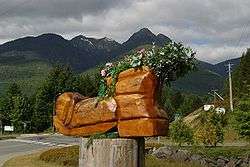 The Blossoming Boot by Chainsaw Carver Lee Yateman. Made for the Great Walk. | |
 Gold River Location of Gold River in British Columbia | |
| Coordinates: 49°46′37″N 126°3′5″W | |
| Country | |
| Province | |
| Region | Vancouver Island |
| Regional district | Strathcona |
| Incorporated | 1965 |
| Government | |
| • Mayor | Brad Unger [2] |
| • Governing body | Gold River Village Council |
| Area | |
| • Total | 10.78 km2 (4.16 sq mi) |
| Elevation | 160 m (520 ft) |
| Population (2019) | |
| • Total | 1,500~ |
| Time zone | UTC-8 (PST) |
| Highways | 28 |
| Climate | Cfb |
| Website | villageofgoldriver.com |

History
Taking advantage of its deep water and abundant forests, Gold River developed in 1967 as a prototypical logging and pulp and paper industry community. Gold River quickly sprang into prosperity and established excellent community facilities. When shifting world markets brought the mill closure in 1998, many of Gold River's inhabitants were forced to relocate. Since then, the village has attempted to capitalize on its idealistic setting among picturesque mountains, lakes, rivers, ocean, and forests to develop tourism and sport fishing as its main economic supports.
Currently, Gold River serves as a base for such famous activities as the Nootka Island trek, hiking the Elk Lake trail and mountain climbing Golden Hinde (Vancouver Island's highest peak), Crest Creek climbing crags, MV Uchuck III, and the Great Walk.
Gold River also serves as a historic point, being the closest village to the famous Yuquot, or "Friendly Cove", where British explorer Captain James Cook first set ashore. There Cook met the Mowachaht native band's chief, Chief Maquinna.
Luna, the orca
In 2001, a two-year-old male orca, later named Luna, was seen in Nootka Sound alone as far inland as the marina at Gold River.[3] Presumed to be an orphan separated from his pod, Luna became a local and international celebrity by his playful and curious behavior with lumber tugboats and recreational watercraft on Nootka Sound, and with people, including young children, on the Gold River dock.[3] The popularity of Luna made Gold River an international attraction from early 2002 through March 2006 when Luna was killed in an accidental collision with a tugboat propeller.[3][4][5]
Climate
Gold River has a Marine west coast climate (Köppen climate classification Cfb). With warm dry summers and mild rainy winters, during the winter constant Low Pressure Systems moving off of the Pacific Ocean causes winter to be the wettest season. Most precipitation falls as rain year round but snow is not uncommon in the winter months averaging 118 cm (46.5 in) but does not usually stay long. Summers are warm with an average summer temperate of 17.6 °C (63.7 °F) in July. The summer months are the driest of the year with only 55.4 mm (2.2 in) of rain in July compared to 481.9 mm (19.0 in) in November. The average rain fall all year is 2,846.7 mm (112.1 in) making the west coast of Vancouver Island the wettest place in Canada. The record high recorded for the village was 41.5 °C (106.7 °F) recorded on July 28, 2009. The record low was −19 °C (−2.2 °F) recorded on January 28, 1980.
| Climate data for Gold River (1981–2010 normals) | |||||||||||||
|---|---|---|---|---|---|---|---|---|---|---|---|---|---|
| Month | Jan | Feb | Mar | Apr | May | Jun | Jul | Aug | Sep | Oct | Nov | Dec | Year |
| Record high °C (°F) | 16.0 (60.8) |
19.0 (66.2) |
24.0 (75.2) |
31.5 (88.7) |
37.0 (98.6) |
37.0 (98.6) |
38.5 (101.3) |
39.0 (102.2) |
37.0 (98.6) |
27.0 (80.6) |
17.0 (62.6) |
12.8 (55.0) |
39.0 (102.2) |
| Average high °C (°F) | 4.7 (40.5) |
7.2 (45.0) |
10.4 (50.7) |
14.2 (57.6) |
18.3 (64.9) |
21.3 (70.3) |
24.9 (76.8) |
25.4 (77.7) |
21.8 (71.2) |
13.8 (56.8) |
7.1 (44.8) |
3.9 (39.0) |
14.4 (57.9) |
| Daily mean °C (°F) | 2.1 (35.8) |
3.3 (37.9) |
5.6 (42.1) |
8.5 (47.3) |
12.1 (53.8) |
15.1 (59.2) |
17.9 (64.2) |
18.1 (64.6) |
14.8 (58.6) |
9.4 (48.9) |
4.4 (39.9) |
1.6 (34.9) |
9.4 (48.9) |
| Average low °C (°F) | −0.6 (30.9) |
−0.7 (30.7) |
0.8 (33.4) |
2.7 (36.9) |
5.9 (42.6) |
8.9 (48.0) |
10.9 (51.6) |
10.8 (51.4) |
7.8 (46.0) |
4.9 (40.8) |
1.7 (35.1) |
−0.7 (30.7) |
4.4 (39.9) |
| Record low °C (°F) | −19.0 (−2.2) |
−14.0 (6.8) |
−11.0 (12.2) |
−5.0 (23.0) |
−2.0 (28.4) |
1.0 (33.8) |
2.5 (36.5) |
4.0 (39.2) |
−2.0 (28.4) |
−8.0 (17.6) |
−17.0 (1.4) |
−17.0 (1.4) |
−19.0 (−2.2) |
| Average precipitation mm (inches) | 424.1 (16.70) |
286.4 (11.28) |
266.3 (10.48) |
186.6 (7.35) |
120.2 (4.73) |
90.9 (3.58) |
55.5 (2.19) |
71.1 (2.80) |
109.2 (4.30) |
358.8 (14.13) |
490.9 (19.33) |
391.0 (15.39) |
2,851.1 (112.25) |
| Average snowfall cm (inches) | 27.2 (10.7) |
28.4 (11.2) |
10.0 (3.9) |
1.5 (0.6) |
0.0 (0.0) |
0.0 (0.0) |
0.0 (0.0) |
0.0 (0.0) |
0.0 (0.0) |
1.0 (0.4) |
8.2 (3.2) |
28.3 (11.1) |
104.6 (41.2) |
| Source: Environment Canada[6] | |||||||||||||
References
- "British Columbia Regional Districts, Municipalities, Corporate Name, Date of Incorporation and Postal Address" (XLS). British Columbia Ministry of Communities, Sport and Cultural Development. Archived from the original on July 13, 2014. Retrieved November 2, 2014.
- CivicInfo BC "CivicInfo BC Municipalities".
- Parfit, Michael (November 2004). "Whale of a Tale". Smithsonian Magazine. Retrieved 17 September 2019.
- "Luna killed by tugboat". CBC News - British Columbia. 10 March 2006. Retrieved 17 September 2019.
- Suzanne and Mike Chisholm (March 11, 2006). "Luna (L98) – Nootka Sound's friendly orca: A true tale of a legendary whale (includes 24 minute documentary video)". Gold River Chamber of Commerce. Retrieved 17 September 2019.CS1 maint: uses authors parameter (link)
- Environment Canada—Canadian Climate Normals 1981–2010, accessed July 11, 2017
External links
- Village of Gold River official website
- Gold River Chamber of Commerce
- "Gold River". BC Geographical Names.
- Highway to Gold River BC
| Subdivisions |  | |
|---|---|---|
| Communities | ||
| Metro areas and agglomerations |
| |
| Villages |
| |
| ||