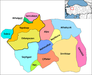
Günyüzü
Günyüzü is a town and district of Eskişehir Province in the Central Anatolia region of Turkey. According to 2010 census, population of the district is 7,025 of which 2,104 live in the town of Günyüzü.[3][4] The district covers an area of 740 km2 (286 sq mi), and the average elevation is 864 m (2,835 ft).
Günyüzü | |
|---|---|
District | |
 Location of Günyüzü within Turkey. | |
 Günyüzü Location of Günyüzü within Turkey. | |
| Coordinates: 39°23′N 31°48′E | |
| Country | |
| Region | Central Anatolia |
| Province | Eskişehir |
| Government | |
| • Governor | Murtaza Dayanç |
| • Mayor | Mehmet Rezmi Arayıt (AKP) |
| Area | |
| • District | 1,396.14 km2 (539.05 sq mi) |
| Elevation | 864 m (2,835 ft) |
| Population (2012)[2] | |
| • Urban | 1,975 |
| • District | 6,439 |
| • District density | 4.6/km2 (12/sq mi) |
| Time zone | UTC+2 (EET) |
| • Summer (DST) | UTC+3 (EEST) |
| Postal code | 26xxx |
| Area code(s) | 0222 |
| Licence plate | 26 |
| Website | www.gunyuzu.gov.tr |
Places of interest
Ruins of the Byzantine shrine St Michael at Germia are located in the village of Gümüşkonak, formerly known as Yörme, 8 km south of Günyüzü.
Notes
- "Area of regions (including lakes), km²". Regional Statistics Database. Turkish Statistical Institute. 2002. Retrieved 2013-03-05.
- "Population of province/district centers and towns/villages by districts - 2012". Address Based Population Registration System (ABPRS) Database. Turkish Statistical Institute. Retrieved 2013-02-27.
- Statistical Institute
- GeoHive. "Statistical information on Turkey's administrative units". Retrieved 2008-04-04.
References
- Falling Rain Genomics, Inc. "Geographical information on Günyüzü, Turkey". Retrieved 2008-04-04.
- Governorship of Eskişehir, Turkey. "General information on Günyüzü, Eskişehir" (in Turkish). Archived from the original on 2007-11-19. Retrieved 2008-04-04.
External links
- District governor's official website (in Turkish)
- District municipality's official website (in Turkish)
- Map of Günyüzü district
Günyüzü in Eskişehir Province of Turkey | |||||||||||||||||||||||||||
|---|---|---|---|---|---|---|---|---|---|---|---|---|---|---|---|---|---|---|---|---|---|---|---|---|---|---|---|
| Districts | Districts of Eskişehir | ||||||||||||||||||||||||||
| |||||||||||||||||||||||||||
Metropolitan municipalities are bolded. | |||||||||||||||||||||||||||
| |||||||||||||||||||
| |||||||||||||||||||
| |||||||||||||||||||
| |||||||||||||||||||
This article is issued from Wikipedia. The text is licensed under Creative Commons - Attribution - Sharealike. Additional terms may apply for the media files.