Si Bun Rueang District
Si Bun Rueang (Thai: ศรีบุญเรือง; IPA: [sǐː būn rɯ̄aŋ]) is a district (amphoe) in the southwestern part of Nong Bua Lamphu Province, northeastern Thailand. It may also be spelled Sri Bun Rueang.
Si Bun Rueang ศรีบุญเรือง | |
|---|---|
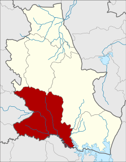 District location in Nongbua Lamphu Province | |
| Coordinates: 16°57′57″N 102°16′48″E | |
| Country | Thailand |
| Province | Nong Bua Lamphu |
| Seat | Mueang Mai |
| Area | |
| • Total | 830.643 km2 (320.713 sq mi) |
| Population (2005) | |
| • Total | 107,804 |
| • Density | 129.8/km2 (336/sq mi) |
| Time zone | UTC+7 (ICT) |
| Postal code | 39180 |
| Geocode | 3904 |
History
The area was Ban Non Sung Plueai of Tambon Yang Lo, Nong Bua Lamphu District, Udon Thani Province. The government created it to be a minor district (king amphoe) on 16 July 1965,[1] which was upgraded to a full district on 1 March 1969.[2]
Geography
Neighboring districts are (from the north clockwise) Na Wang, Na Klang, Mueang Nong Bua Lamphu, and Non Sang of Nong Bua Lamphu Province, Nong Na Kham and Si Chomphu of Khon Kaen Province, Phu Kradueng, Pha Khao, and Erawan of Loei Province.
The important water resource is the Phong River.
Administration
The district is divided into 12 sub-districts (tambons), which are further subdivided into 153 villages (mubans). There are two townships (thesaban tambons): Non Sung Plueai covers parts of tambon Mueang Mai, and Chom Thong covers parts of tambon Si Bun Rueang. There are a further 12 tambon administrative organizations (TAO).
| No. | Name | Thai name | Villages | Pop. | |
|---|---|---|---|---|---|
| 1. | Mueang Mai | เมืองใหม่ | 15 | 10,913 | |
| 2. | Si Bun Rueang | ศรีบุญเรือง | 15 | 10,594 | |
| 3. | Nong Bua Tai | หนองบัวใต้ | 10 | 7,294 | |
| 4. | Kut Sathian | กุดสะเทียน | 8 | 5,276 | |
| 5. | Na Kok | นากอก | 22 | 15,750 | |
| 6. | Non Sa-at | โนนสะอาด | 17 | 12,367 | |
| 7. | Yang Lo | ยางหล่อ | 15 | 8,954 | |
| 8. | Non Muang | โนนม่วง | 11 | 8,423 | |
| 9. | Nong Kung Kaeo | หนองกุงแก้ว | 12 | 7,159 | |
| 10. | Nong Kae | หนองแก | 11 | 8,093 | |
| 11. | Sai Thong | ทรายทอง | 9 | 8,478 | |
| 12. | Han Na Ngam | หันนางาม | 8 | 4,503 |
References
- ประกาศกระทรวงมหาดไทย เรื่อง แบ่งท้องที่ตั้งเป็นกิ่งอำเภอ (PDF). Royal Gazette (in Thai). 82 (57 ง): 1878. July 20, 1965.
- พระราชกฤษฎีกาจัดตั้งอำเภอสมเด็จ อำเภอสีชมพู อำเภอหนองบัวแดง อำเภอบ้านแท่น อำเภอดอนตูม อำเภอนากลาง อำเภอศรีบุญเรือง และอำเภอป่าติ้ว พ.ศ. ๒๕๑๒ (PDF). Royal Gazette (in Thai). 86 (16 ก): 225–229. February 25, 1969.