Emerald, Queensland
Emerald is a rural town and locality in the Central Highlands Region, Queensland, Australia.[3][4] As at June 2018, Emerald had an urban population of 14,119.[1] The town is the business centre for the Central Highlands Regional Council.
| Emerald Queensland | |||||||||
|---|---|---|---|---|---|---|---|---|---|
 | |||||||||
 Emerald | |||||||||
| Coordinates | 23°31′0″S 148°09′0″E | ||||||||
| Population | 14,119 (2018)[1] | ||||||||
| • Density | 360.2/km2 (932.9/sq mi) | ||||||||
| Established | 1879 | ||||||||
| Postcode(s) | 4720 | ||||||||
| Elevation | 189 m (620 ft) | ||||||||
| Area | 39.2 km2 (15.1 sq mi)[2] (2011 urban) | ||||||||
| Location |
| ||||||||
| LGA(s) | Central Highlands Region | ||||||||
| State electorate(s) | Gregory | ||||||||
| Federal Division(s) | Flynn | ||||||||
| |||||||||
Geography
Emerald lies on the Nogoa River, a tributary of the Fitzroy River.[5] The town lies approximately 270 kilometres (170 mi) from the Coral Sea coast and approximately 270 km west of the city of Rockhampton by road at the junction of the Capricorn and Gregory highways. Emerald sits approximately 10 km south of the Tropic of Capricorn.
Cultural Heritage
The traditional owners include the Gayiri people who occupied the area for tens of thousands of years before European colonisation began in the nineteenth century. The Gayiri (Kairi, Khararya) language region takes in the landscape of the Central Highlands Regional Council, including Emerald and Nogoa River.[6]
History
The first European to explore the area was Ludwig Leichhardt between 1843 and 1845.[5] The British Colony of Queensland was established in 1859.
The town takes its name for the emerald and other precious stones found in the area as well as from the pastoral run Emerald Downs, a name assigned circa 1860 by pastoralist Peter Fitzallan Macdonald.[3]
Emerald was established in 1879 as a base for the Central line from Rockhampton.[5] Emerald Post Office opened on 5 June 1879.[7]
Emerald State School opened on 3 November 1879. A secondary department was added to the school in 1919 but that department was closed in 1921. The secondary department reopened in 1959 and operated until the separate Emerald State High School opened in 1969.[8]
St Patrick's Catholic School was established on 31 January 1902 with 80 students by the Presentation Sisters.[8] They providing boarding facility for girls and boys from 1906 to 1961. The last of the Presentation Sisters left the school in 1992 after which it was operated by the Rockhampton Catholic Education Office.[9]
Emerald North State School opened on 29 January 1980. A preschool was added on 20 February 1980. A special education unit opened on 23 January 1984. The preschool and special education units closed in 1999.[8]
The Emerald campus of the Capricornia School of Distance Education opened on 1 February 1993.[8]
The new Emerald Library building opened in 1994.[10]
Marist College was established in 1996 by the Marist Brothers.[8][11]
Denison State School opened on 28 January 1997.[8]
Emerald Christian College (also known as Emerald Educational College) opened in 2001.[8]
St Brigid's Catholic Primary School was established in 2014 by the Rockhampton Catholic Education Office.[12]
In the 2016 census, Emerald had a population of 14,356 people.[13]
Ontrack School opened in February 2018.[14]
Flooding
Some of the recorded floods to have occurred in the region include 1863, 1864, 1868, 1870, 1871, 1872, 1875, 1876, 1878, 1882, 1887, 1890, 1894, 1896, 1898, 1906, 1912, 1918, 1920s, 1950 (where 1103.77 mm rain was recorded in Queensand), 1956 was the wettest year on record with 1032.29 mm rainfall. The 1970s also had similar rainfall to the 1860s and 1870s.
Prior to the 1990s, flood damage to residential properties was almost non-existent. The biggest impact of flooding of the Nogoa River in Emerald itself was that one side of Emerald was cut off from the other and caravans at the Carinya Caravan Park would be towed to higher ground each time the Nogoa River rose, to prevent the caravans from being completely submerged. This caravan park is now the site of the Centro Property where Coles Supermarket and other businesses operate. A former swamp area is now part of Kidd Street (a housing development) which was an old river course. The watercourse that extended along the back of the hospital, past the rear of Woolworths and past the Information Centre has been converted into a channel with a concrete section on one side near the information centre, reducing the channel in size by approximately two-thirds. This area has been allowed to be developed in the vicinity of Creek Street.[15]
Fairbairn Dam overflowed for the first time in 17 years on 19 January 2008.[16] Major flooding in Emerald occurred a few days later as the Nogoa River broke its banks. The floods resulted in 1,000 houses being affected and more than 2,500 people being evacuated. The 2008 floods did not reach the heights of flooding in previous years.
Heritage listings
Emerald has a number of heritage-listed sites, including:
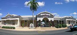
- Clermont Street (Capricorn Highway): Emerald railway station[17]
Population
According to the 2016 census of Population, there were 13,532 people in Emerald.
- Aboriginal and Torres Strait Islander people made up 3.6% of the population.
- 73.8% of people were born in Australia. The next most common countries of birth were New Zealand 4.3%, Philippines 1.6%, South Africa 1.1% and England 1.1%.
- 81.4% of people spoke only English at home. Other languages spoken at home included Afrikaans at 0.8%.
- The most common responses for religion were Catholic 26.3%, No Religion 21.1% and Anglican 15.4%.[18]
Industry
Emerald is a service town for a large number of industries in the area. Extensive coal mining operations are carried out in the district. Cotton is grown in the area, and is processed at the Yamala Cotton Gin, while other agricultural activities include grape, citrus and grain growing.
The citrus industry was severely affected by a citrus canker outbreak that started in 2004 and was declared over in early 2009.[19] More than half a million citrus trees located around Emerald had to be destroyed.[19]
Emerald Solar Park is immediately west of the town and generates up to 65MW of electricity since October 2018.
Climate
Emerald has a humid subtropical climate with warm to hot summers and mild, dry winters. Maximum temperatures range from 34 °C in January to 22 °C in July, while minimums range from 22 °C to 7 °C. The average annual rainfall is 641.2 mm. The wettest year on record was 1407.2 mm in 1956. Extremes of temperature have ranged from 48.6 °C to −5.6 °C, while the wettest 24 hours on record was 182.0 mm on 25 February 1975.[20]
| Climate data for Emerald | |||||||||||||
|---|---|---|---|---|---|---|---|---|---|---|---|---|---|
| Month | Jan | Feb | Mar | Apr | May | Jun | Jul | Aug | Sep | Oct | Nov | Dec | Year |
| Record high °C (°F) | 48.6 (119.5) |
44.8 (112.6) |
42.9 (109.2) |
38.1 (100.6) |
33.5 (92.3) |
31.7 (89.1) |
32.8 (91.0) |
38.2 (100.8) |
39.7 (103.5) |
41.7 (107.1) |
44.6 (112.3) |
46.2 (115.2) |
48.6 (119.5) |
| Average high °C (°F) | 34.2 (93.6) |
33.2 (91.8) |
32.0 (89.6) |
29.4 (84.9) |
25.7 (78.3) |
22.7 (72.9) |
22.4 (72.3) |
24.8 (76.6) |
28.3 (82.9) |
31.6 (88.9) |
33.7 (92.7) |
34.8 (94.6) |
29.4 (84.9) |
| Average low °C (°F) | 21.7 (71.1) |
21.0 (69.8) |
19.4 (66.9) |
15.7 (60.3) |
11.5 (52.7) |
8.4 (47.1) |
6.9 (44.4) |
8.1 (46.6) |
11.8 (53.2) |
16.0 (60.8) |
18.9 (66.0) |
20.4 (68.7) |
15.0 (59.0) |
| Record low °C (°F) | 7.8 (46.0) |
6.7 (44.1) |
7.2 (45.0) |
0.0 (32.0) |
−1.2 (29.8) |
−3.9 (25.0) |
−5.6 (21.9) |
−3.6 (25.5) |
−2.2 (28.0) |
2.2 (36.0) |
1.8 (35.2) |
7.2 (45.0) |
−5.6 (21.9) |
| Average rainfall mm (inches) | 103.4 (4.07) |
99.7 (3.93) |
69.3 (2.73) |
35.9 (1.41) |
35.2 (1.39) |
33.9 (1.33) |
28.8 (1.13) |
20.7 (0.81) |
25.3 (1.00) |
39.2 (1.54) |
58.8 (2.31) |
91.0 (3.58) |
641.2 (25.23) |
| Average rainy days (≥ 0.2 mm) | 8.3 | 7.7 | 6.1 | 3.8 | 3.7 | 3.3 | 3.2 | 2.8 | 2.8 | 4.6 | 5.8 | 7.4 | 59.5 |
| Source: Bureau of Meteorology[20] | |||||||||||||
Attractions
[21] To the west of the town is an area known as The Gemfields, with small towns such as Sapphire and Rubyvale indicating the type of gems found there. The sapphire fields located here are the largest in the southern hemisphere.[22]
The Fairbairn Dam, a short drive to the south of the town, was opened in 1972, and holds back the waters of Lake Maraboon.[5] The lake covers an area of up to 150 square kilometres (58 sq mi), making it one of the largest artificial lakes in the country. When full, it holds three times more water than Sydney Harbour. This extensive water supply has allowed the cotton industry to flourish in the area, and the lake is a boon for local water sports.[23]
Education
Emerald State School is a government primary (Prep-6) school for boys and girls at Anakie Street (23.5237°S 148.1605°E).[24][25] In 2017, the school had an enrolment of 316 students with 25 teachers (21 full-time equivalent) and 14 non-teaching staff (8 full-time equivalent).[26]
Emerald North State School is a government primary (Early Childhood-6) school for boys and girls at Campbell Street (23.5132°S 148.1641°E).[24][27] In 2017, the school had an enrolment of 249 students with 25 teachers (23 full-time equivalent) and 29 non-teaching staff (18 full-time equivalent).[26] It includes a special education program.[24]
Denison State School is a government primary (Prep-6) school for boys and girls at 16 Gray Street (23.5322°S 148.1512°E).[24][28] In 2017, the school had an enrolment of 497 students with 36 teachers (33 full-time equivalent) and 20 non-teaching staff (14 full-time equivalent).[26] It includes a special education program.[24]
Capricornia School of Distance Education is a government primary and secondary (Early Childhood-12) school for boys and girls at the corner Gray and Gladstone Streets (23.5323°S 148.1520°E).[24][29] In 2017, the school had an enrolment of 775 students with 72 teachers (64 full-time equivalent) and 21 non-teaching staff (15 full-time equivalent).[26] It includes a special education program.[24] The school operates from the Denison State School campus.
Emerald State High School is a government secondary (7-12) school for boys and girls at Old Airport Drive (23.5136°S 148.1582°E).[24][30] In 2017, the school had an enrolment of 780 students with 62 teachers (59 full-time equivalent) and 33 non-teaching staff (22 full-time equivalent).[26] It includes a special education program.[24][31]
St Patrick's Catholic Primary School is a Catholic primary (Prep-6) school for boys and girls at 41 Yamala Street (23.5233°S 148.1621°E).[24][32] In 2017, the school had an enrolment of 491 students with 31 teachers (29 full-time equivalent) and 16 non-teaching staff (9 full-time equivalent).[26]
St Brigid's Catholic Primary School is a Catholic primary (Prep-6) school for boys and girls at Gregory Highway (23.5597°S 148.1696°E).[24][33] In 2017, the school had an enrolment of 202 students with 16 teachers (15 full-time equivalent) and 8 non-teaching staff (5 full-time equivalent).[26]
Marist College is a Catholic secondary (7-12) school for boys and girls at Jeppesen Drive (23.5435°S 148.1592°E).[24][34] In 2017, the school had an enrolment of 569 students with 50 teachers (47 full-time equivalent) and 25 non-teaching staff (19 full-time equivalent).[26]
Emerald Christian College is a private primary and secondary (Prep-12) school for boys and girls at Lot 2 Gregory Highway (23.5528°S 148.1708°E).[24][35] In 2017, the school had an enrolment of 196 students with 22 teachers (20 full-time equivalent) and 18 non-teaching staff (10 full-time equivalent).[26]
Ontrack is a private primary and secondary (5-10) school at 114 Borilla Street (23.5266°S 148.1614°E).[24][36] It seeks to provide for students from Years 6 to 10 who have disengaged from mainstream schools.[14]
The small community of Gindie exists approximately 23 kilometres (14 mi) south of Emerald on the Gregory Highway. It is also home to a primary school established in 1897, Gindie State School. The school closed in 1949 and subsequently reopened.[37]
Central Queensland University has a campus in Emerald.
Amenities
Central Highlands Regional Council operates Emerald Library at 44 Borilla Street, Emerald.[38]
The Emerald branch of the Queensland Country Women's Association meets at the QCWA Rooms at 45 Borilla Street.[39]
Media
Newspapers
The Central Queensland News is the local Emerald newspaper, now a weekly incorporating the Blackwater Herald. It was until recently published each Wednesday and Friday. The newspaper focuses on local news and sport directly relevant to the Central Highlands region.
Radio
Emerald is served by two local commercial stations, one local ABC station and one local community station.
4HI is the oldest local radio station in Emerald, beginning transmissions from their local studio in November 1981. The station offers local breakfast and drive programming from their Emerald studio and carries nationally syndicated programming from 2GB Sydney.
In the late 1990s, youth-orientated commercial station Hot FM was launched in Emerald. Even though the station plays local commercials and imaging on a local frequency, no programming on the station originates from Emerald. Until 2013, the breakfast program which aired on Hot FM in Emerald was a regionally networked program from Townsville. It was subsequently replaced with the Hot FM CQ breakfast program that originates from Gladstone.
Emerald is served by ABC Capricornia, the region's ABC Local Radio station. ABC Capricornia is broadcast on a local frequency, but no programming originates from Emerald as the station's local breakfast and morning programs are relayed to the Emerald transmitter from Rockhampton.
Emerald is also served by local community radio station, 4EEE.
Television
Emerald receives all available ABC and commercial television stations from Rockhampton, and therefore local news bulletins Seven Local News and WIN News are broadcast to Emerald, with the bulletins occasionally featuring local news from the Central Highlands region.
Notable people
- Mitchell Langerak, Australian footballer who currently plays as a goalkeeper for the J1 League club Nagoya Grampus (Japan), and the Australian National Football Team.
- Alan McIndoe, Former Penrith Panthers, Illawarra Steelers, Queensland and Australian Rugby League player.
See also
References
- "3218.0 – Regional Population Growth, Australia, 2017-18: Population Estimates by Significant Urban Area, 2008 to 2018". Australian Bureau of Statistics. Australian Bureau of Statistics. 27 March 2019. Archived from the original on 27 March 2019. Retrieved 25 October 2019. Estimated resident population, 30 June 2018.
- "2011 Census Community Profiles: Emerald". ABS Census. Australian Bureau of Statistics. Retrieved 15 September 2016.
- "Emerald - town in Central Highlands Region (entry 11598)". Queensland Place Names. Queensland Government. Retrieved 16 November 2019.
- "Emerald - locality in Central Highlands Region (entry 46949)". Queensland Place Names. Queensland Government. Retrieved 16 November 2019.
- "Travel: Emerald". theage.com.au. The Age Company. 8 February 2004. Archived from the original on 24 May 2007. Retrieved 22 August 2009.
-

- Premier Postal History. "Post Office List". Premier Postal Auctions. Retrieved 10 May 2014.
- Queensland Family History Society (2010), Queensland schools past and present (Version 1.01 ed.), Queensland Family History Society, ISBN 978-1-921171-26-0
- "Our History". St Patrick's Emerald. Archived from the original on 28 November 2019. Retrieved 28 November 2019.
- "Public Libraries Statistical Bulletin 2016-17" (PDF). Public Libraries Connect. State Library of Queensland. November 2017. p. 12. Archived (PDF) from the original on 30 January 2018. Retrieved 31 January 2018.
- "College History". Marist College Emerald. Archived from the original on 28 November 2019. Retrieved 28 November 2019.
- "Our History". St Brigid's Catholic Primary School, Emerald. Archived from the original on 14 March 2017. Retrieved 28 November 2019.
- Australian Bureau of Statistics (27 June 2017). "Emerald (SSC)". 2016 Census QuickStats. Retrieved 20 October 2018.

- "OnTrack" (PDF). OnTrack. Archived (PDF) from the original on 6 March 2019.
- "Emerald engulfed by spreading flood waters". ABC News Online. Australian Broadcasting Corporation. 22 January 2008. Archived from the original on 6 January 2010. Retrieved 22 October 2009.
- "Overflowing dam to supply years of water to Emerald district". ABC News Online. Australian Broadcasting Corporation. 19 January 2008. Archived from the original on 19 November 2010. Retrieved 22 October 2009.
- "Emerald Railway Station Complex (entry 600490)". Queensland Heritage Register. Queensland Heritage Council. Retrieved 7 July 2013.
- Australian Bureau of Statistics (27 June 2017). "Emerald (Significant Urban Area)". 2016 Census QuickStats. Retrieved 3 December 2017.
- "Citrus canker disease officially eradicated from Qld". ABC News Online. Australian Broadcasting Corporation. 23 January 2009. Archived from the original on 3 February 2009. Retrieved 22 October 2009.
- "Emerald Post Office". Climate statistics for Australian locations. Bureau of Meteorology. April 2014. Retrieved 10 April 2014.
- "Nogoa Mackenzie Scheme". Sunwater. 2019. Archived from the original on 27 January 2020. Retrieved 27 January 2020.
- Penguin Books Australia (2002). Explore Queensland. Camberwell, Victoria: Penguin Books Australia. p. 40. ISBN 0-14-300015-2.
- "Fairbairn Dam, Lake Maraboon". Queensland Uncovered. Archived from the original on 15 November 2019. Retrieved 27 January 2020.
- "State and non-state school details". Queensland Government. 9 July 2018. Archived from the original on 21 November 2018. Retrieved 21 November 2018.
- "Emerald State School". Archived from the original on 28 April 2013. Retrieved 21 November 2018.
- "ACARA School Profile 2017". Archived from the original on 22 November 2018. Retrieved 22 November 2018.
- "Emerald North State School". Archived from the original on 21 April 2013. Retrieved 21 November 2018.
- "Denison State School". Archived from the original on 2 May 2012. Retrieved 21 November 2018.
- "Capricornia School of Distance Education". Archived from the original on 25 April 2013. Retrieved 21 November 2018.
- "Emerald State High School". Archived from the original on 21 June 2012. Retrieved 21 November 2018.
- "Emerald SHS - Special Education Program". Archived from the original on 21 June 2012. Retrieved 21 November 2018.
- "St Patrick's Catholic Primary School". Archived from the original on 20 November 2018. Retrieved 21 November 2018.
- "St Brigid's Catholic Primary School". Archived from the original on 10 October 2018. Retrieved 21 November 2018.
- "Marist College". Archived from the original on 22 November 2018. Retrieved 21 November 2018.
- "Emerald Christian College". Archived from the original on 27 January 2019. Retrieved 21 November 2018.
- "ONTRACK". ONTRACK. Retrieved 28 November 2019.
- "Opening and closing dates of Queensland Schools". Queensland Government. Retrieved 18 April 2019.
- "Emerald Library". Public Libraries Connect. State Library of Queensland. 8 September 2016. Archived from the original on 31 January 2018. Retrieved 31 January 2018.
- "Branch Locations". Queensland Country Women's Association. Archived from the original on 26 December 2018. Retrieved 26 December 2018.
External links
| Wikimedia Commons has media related to Emerald, Queensland. |
- "Emerald". Queensland Places. Centre for the Government of Queensland, University of Queensland.
- Town map of Emerald, 1985
- Emerald State High School Homepage