Rubyvale, Queensland
Rubyvale is a rural town in the Central Highlands Region, Queensland, Australia.[2] In the 2016 census, Rubyvale had a population of 640 people.[1] It is one of three towns within the locality of The Gemfields.
| Rubyvale Queensland | |
|---|---|
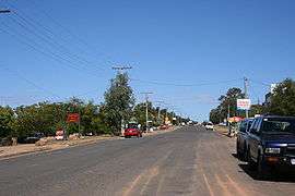 Main street of Rubyvale | |
 Rubyvale | |
| Coordinates | 23.4191°S 147.6983°E |
| Population | 640 (2016 census)[1] |
| Postcode(s) | 4702 |
| Time zone | AEST (UTC+10:00) |
| Location | |
| LGA(s) | Central Highlands Region |
| State electorate(s) | Gregory |
| Federal Division(s) | Flynn |
Geography
Rubyvale is approximately 61 kilometres (38 mi) west of Emerald. Situated in a locality called The Gemfields, sapphires are mined extensively in the area.
History
The name Rubyvale derives from a ruby weighing 5 to 6 pennyweights (0.27 to 0.33 oz; 7.8 to 9.3 g) found near the town by miner William Dunn in the early 1900s.[2] Dunn was very proud of the ruby and did not sell it but showed it to people he trusted; after his death the ruby could not be found.[3]
Rubyvale Provisional School opened on 19 October 1908. On 1 January 1909 it became Rubyvale State School. It closed in 1963.[4]
At the 2006 census, Rubyvale had a population of 510.[5]
In the 2016 census, Rubyvale had a population of 640 people.[1]
Amenities
Rubyvale is home to a small library, a convenience store/news agents, post office, hotel and take-away bottle shop, as well as a variety of accommodation and fossicking areas. Some popular places to go fossicking are the Bob n John Mine, Bobby Dazzler and Pats Gems.
The Central Highlands Regional Council operate a public library at 7 Burridge Road, Rubyvale.[6]
Education
There are no schools in Rubyvale. The nearest primary school is Anakie State School in Anakie to the south. The nearest secondary schools are Emerald State High School in Emerald to the east and Capella State High School in Capella to the north-east.[7]
Climate
The area can get up to 40'C during summer, and can reach 0 °C in winter.
Heritage listings
Rubyvale has a number of heritage-listed sites, including:
References
- Australian Bureau of Statistics (27 June 2017). "Rubyvale (L) (Urban Centre/Locality)". 2016 Census QuickStats. Retrieved 22 February 2020.

- "Rubyvale - town in Central Highlands Region (entry 29264)". Queensland Place Names. Queensland Government. Retrieved 26 January 2020.
- "The State's mystery town of wealth". The Courier-mail. Queensland, Australia. 18 November 1950. p. 2. Retrieved 23 April 2020 – via Trove.
- Queensland Family History Society (2010), Queensland schools past and present (Version 1.01 ed.), Queensland Family History Society, ISBN 978-1-921171-26-0
- Australian Bureau of Statistics (25 October 2007). "Rubyvale (L) (Urban Centre/Locality)". 2006 Census QuickStats. Retrieved 21 July 2009.
- "Locations". Central Highlands Regional Council. Archived from the original on 31 January 2018. Retrieved 31 January 2018.
- "Queensland Globe". State of Queensland. Retrieved 23 April 2020.
- "Tomahawk Creek Huts (entry 602661)". Queensland Heritage Register. Queensland Heritage Council. Retrieved 7 July 2013.
External links
| Wikimedia Commons has media related to Rubyvale, Queensland. |
- "Rubyvale". Queensland Places. Centre for the Government of Queensland, University of Queensland.
- Map and facilities list
- A Gemfields home page