Cycling infrastructure
Cycling infrastructure refers to all infrastructure which may be used by cyclists. This includes the same network of roads and streets used by motorists, except those roads from which cyclists have been banned (e.g., many freeways/motorways), plus additional bikeways that are not available to motor vehicles, such as bike paths, bike lanes, cycle tracks and, where permitted, sidewalks, plus amenities like bike racks for parking and specialized traffic signs and signals. Cycling modal share is strongly associated with the size of local cycling infrastructure.[1]
The manner in which the public road network is designed, built and managed can have a significant effect on the utility and safety of cycling. The cycling network may be able to provide the users with direct, convenient routes minimizing unnecessary delay and effort in reaching their destinations. Settlements with a dense road network of interconnected streets tend to be viable utility cycling environments.
History
The history of cycling infrastructure starts from shortly after the bike boom of the 1880s when the first short stretches of dedicated bicycle infrastructure were built, through to the rise of the automobile from the mid-20th century onwards and the concomitant decline of cycling as a means of transport, to cycling's comeback from the 1970s onwards.
Bikeways
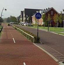
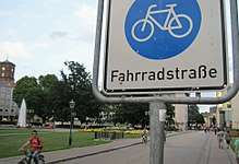
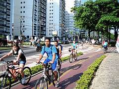
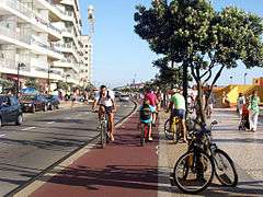
A bikeway is a lane, route, way or path which in some manner is specifically designed and /or designated for bicycle travel.[2] Bike lanes demarcated by a painted marking are quite common in many cities. Cycle tracks demarcated by barriers, bollards or boulevards are quite common in some European countries such as the Netherlands, Denmark and Germany. They are also increasingly common in major cities elsewhere, such as New York, Melbourne, Ottawa, Vancouver and San Francisco. Montreal and Davis, California, which have had segregated cycling facilities with barriers for several decades, are among the earliest examples in North America.
Various guides exist to define the different types of bikeway infrastructure, including UK Department for Transport manual The Geometric Design of Pedestrian, Cycle and Equestrian Routes,[3] Sustrans Design Manual,[4] UK Department of Transport Local Transport Note 2/08: Cycle infrastructure design[5] the Danish Road Authority guide Registration and classification of paths,[6] the Dutch CROW,[7] the American Association of State Highway and Transportation Officials (AASHTO) Guide to Bikeway Facilities, the Federal Highway Administration (FHWA) Manual on Uniform Traffic Control Devices (MUTCD),[8][9] and the US National Association of City Transportation Officials (NACTO) Urban Bikeway Design Guide.[10]
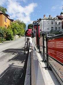
In the Netherlands, most one way cycle paths are at least 2.5 metres wide.[11] The Netherlands also has protected intersection to cyclists crossing roads.
Terms
Some bikeways are separated from motor traffic by physical constraints (e.g. barriers, parking or bollards)—bicycle trail, cycle track—but others are partially separated only by painted markings—bike lane, buffered bike lane, and contraflow bike lane. Some share the roadway with motor vehicles—bicycle boulevard, sharrow, advisory bike lane—or shared with pedestrians—shared use paths and greenways
Segregation
The term bikeway is largely used in North America to describe all routes that have been designed or updated to encourage more cycling or make cycling safer. In some jurisdictions such as the United Kingdom, segregated cycling facility is sometimes preferred to describe cycling infrastructure which has varying degrees of separation from motorized traffic, or which has excluded pedestrian traffic in the case of exclusive bike paths.[12]
There is no single usage of segregation; in some cases it can mean the exclusion of motor vehicles and in other cases the exclusion of pedestrians as well. Thus, it includes bike lanes with solid painted lines but not lanes with dotted lines and advisory bike lanes where motor vehicles are allowed to encroach on the lane.[13] It includes cycle tracks as physically distinct from the roadway and sidewalk (e.g. barriers, parking or bollards).[14] And it includes bike paths in their own right of way exclusive to cycling. Paths which are shared with pedestrians and other non-motorized traffic are not considered segregated and are typically called shared use path, multi-use path in North America and shared-use footway in the UK.
Safety
There have been a lot of studies on the safety of all types of bikeways. Proponents say that segregation of cyclists from fast or frequent motorized traffic is necessary to provide a safe and welcoming cycling environment. Opponents point out the increased risk from various types of infrastructure including shared use paths.
Legislation
Different countries have different ways to legally define and enforce bikeways.
Bikeway controversies
Some detractors argue that one must be careful in interpreting the operation of dedicated or segregated bikeways/cycle facilities across different designs and contexts; what works for the Netherlands won't necessarily work elsewhere, or claiming that bikeways increase urban air pollution.[15]
Proponents point out that cycling infrastructure including dedicated bike lanes has been implemented in many cities; when well-designed and well-implemented they are popular and safe, and they are effective at relieving both congestion and air pollution.[16]
Bikeway selection
Jurisdictions have guidelines around the selection of the right bikeway treatments in order make routes more comfortable and safer for cycling.
A study reviewing the safety of "road diets" (motor traffic lane restrictions) for bike lanes found in summary that crash frequencies at road diets in the period after installation were 6% lower, road diets do not affect crash severity, or result in a significant change in crash types. This research was conducted by looking at areas scheduled for conversion before and after the road diet was performed. While also comparing similar areas that had not received any changes. It is noted that further research is recommended to confirm findings.[17]
Bikeway types
Bikeways can fall into these main categories: separated in-roadway bikeways such as bike lanes and buffered bike lanes; physically separated in-roadway bikeways such as cycle tracks; right-of-way paths such as bike paths and shared use paths; and shared in-roadway bikeways such as bike boulevards, shared lane markings, and advisory bike lanes. The exact categorization changes depending on the jurisdiction and organization, while many just list the types by their commonly used names[18][19][20]
Separated in-roadway bikeway
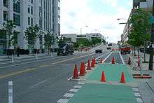
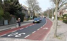
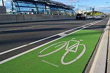
- Bike lanes, or cycle lanes, are on-road lanes marked with paint dedicated to cycling and typically excluding all motorized traffic.
- A buffered bike lane is typically a lane with a wide painted buffer to demarcate a larger gap between the cycle lane and other traffic.[21]
- Contraflow bike lanes are typically a painted lane added to some one-way streets, to allow cycling traffic to safely travel in the opposite direction of all other traffic, including motorized vehicles and bicycles.
Physically separated, in-roadway
A Cycle track, also called separated bike lane or protected bike lane, is a physically marked and separated lane dedicated for cycling that is on or directly adjacent to the roadway but typically excludes all motorized traffic with some sort of vertical barrier.[23]
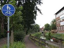
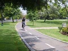
Bike paths
Bike paths are paths with their own right of way dedicated to cycling, though in many cases shared with pedestrians and other non-motorized traffic.
- A greenway is a long, narrow piece of land, often used for recreation and pedestrian and bicycle user traffic, and sometimes for streetcar, light rail or retail uses.
- A shared use path supports multiple modes, such as walking, bicycling, inline skating and people in wheelchairs.
Shared in-roadway bikeways
Bicycle boulevards
A bicycle boulevard is a low speed street which has been optimized for bicycle traffic. Bicycle boulevards discourage cut-through motor vehicle traffic but allow local motor vehicle traffic. They are designed to give priority to cyclists as through-going traffic.
Shared lane markings
A shared lane marking is a street marking that indicates the preferred lateral position for cyclists (to avoid the door zone and other obstacles) where dedicated bike lanes are not available.
Advisory bike lane
An advisory bike lane is a roadway striping configuration which provides for two-way motor vehicle and bicycle traffic using a central vehicular travel lane and “advisory” bike lanes on either side. The center lane is dedicated to, and shared by, motorists traveling in both directions. The center lane is narrower than two vehicular travel lanes and has no centerline; some are narrower than the width of a car. Cyclists are given preference in the bike lanes but motorists can encroach into the bike lanes in order to pass other motor vehicles after yielding to cyclists. Advisory bike lanes are normally installed on low volume streets.[13]
Advisory bike lanes have a number of names. The U.S. Federal Highway Administration calls them "Advisory Shoulders".[24] In New Zealand, they are called 2-minus-1 roads. They are called Schutzstreifen (Germany), Suggestiestrook (Netherlands), and Suggestion Lanes (a literal English translation of Suggestiestrook).[25]
Roadways with legal access for cycling
Cyclists are legally allowed to travel on many roadways in accordance with the rules of the road for drivers of vehicles.
Road shoulder
A road shoulder is a reserved lane on the verge of a roadway that is often used by bicyclists and also serves as an emergency stopping lane for motor vehicles.
Bicycle superhighways
Denmark and the Netherlands have pioneered the concept of “bicycle superhighways”. The first Dutch route opened in 2004 between Breda and Etten-Leur; many others have been added since then.[26] In 2017 several bicycle superhighways were opened in the Arnhem-Nijmegen region, with the RijnWaalpad as the best example of this new type of cycling infrastructure.
The first Danish route, C99, opened in 2012 between the Vesterbro rail station in Copenhagen and Albertslund, a western suburb. The route cost 13.4 million DKK and is 17.5 km long, built with few stops and new paths away from traffic. “Service stations” with air pumps are located at regular intervals, and where the route must cross streets, handholds and running boards are provided so cyclists can wait without having to put their feet on the ground.[27] Similar projects have since been built in Germany among other countries.
The cost of building a bicycle super highway depends on many things, but is usually between €300000/km (for a wide dedicated cycle track) and €800000/km (when complex civil engineering structures are needed).[28]
Cycling-friendly streetscape modifications
There are various measures cities and regions often take on the roadway to make it more cycling friendly and safer. Aspects of infrastructure may be viewed as either cyclist-hostile or as cyclist-friendly. Measures to encourage cycling include traffic calming; traffic reduction; junction treatment; traffic control systems to recognize cyclists and give them priority; exempt cyclists from banned turns and access restrictions; implement contra-flow cycle lanes on one-way streets; implement on-street parking restrictions; provide advanced stop lines/bypasses for cyclists at traffic signals; marking wide curb/kerb lanes; and marking shared bus/cycle lanes.[29]
Traffic reduction
Removing traffic can be achieved by straightforward diversion or alternatively reduction. Diversion involves routing through-traffic away from roads used by high numbers of cyclists and pedestrians. Examples of diversion include the construction of arterial bypasses and ring roads around urban centres.
Indirect methods involve reducing the infrastructural capacity dedicated to moving motorized vehicles. This can involve reducing the number of road lanes, closing bridges to certain vehicle types and creating vehicle restricted zones or environmental traffic cells. In the 1970s the Dutch city of Delft began restricting private car traffic from crossing the city center.[30] Similarly, Groningen is divided into four zones that cannot be crossed by private motor-traffic, (private cars must use the ring road instead).[31] Cyclists and other traffic can pass between the zones and cycling accounts for 50%+ of trips in Groningen (which reputedly has the third-highest proportion of cycle traffic of any city). The Swedish city of Gothenburg uses a similar system of traffic cells.[32]
Another approach is to reduce the capacity to park cars. Starting in the 1970s, the city of Copenhagen, where now 36% of the trips are done by bicycle,[33] adopted a policy of reducing available car parking capacity by several per cents per year. The city of Amsterdam, where around 40% of all trips are by bicycle,[34] adopted similar parking reduction policies in the 80s and 90s.
Direct traffic reduction methods can involve straightforward bans or more subtle methods like road pricing schemes or road diets. The London congestion charge reportedly resulted in a significant increase in cycle use within the affected area.[35]
Traffic calming
Speed reduction has traditionally been attempted by statutory speed limits and enforcing the assured clear distance ahead rule.
Recent implementations of shared space schemes have delivered significant traffic speed reductions. The reductions are sustainable, without the need for speed limits or speed limit enforcement. In Norrköping, mean traffic speeds in 2006 dropped from 21 to 16 km/h (13 to 10 mph) since the implementation of such a scheme.[36]
Even without shared street implementation, creating 30 km/h zones (or 20 mph zone) has been shown to reduce crash rates and increase numbers of cyclists and pedestrians.[37] Other studies have revealed that lower speeds reduce community severance caused by high speed roads. Research has shown that there is more neighborhood interaction and community cohesion when speeds are reduced to 20 mph.[38]
One-way streets
German research indicates that making one-way streets two-way for cyclists results in a reduction in the total number of collisions.[39] In Belgium, all one-way streets in 50 km/h zones are by default two-way for cyclists.[40] A Danish road directorate states that in town centres it is important to be able to cycle in both directions in all streets, and that in certain circumstances, two-way cycle traffic can be accommodated in an otherwise one-way street.[41]
Two-way cycling on one-way streets
One-way street systems can be viewed as either a product of traffic management that focuses on trying to keep motorized vehicles moving regardless of the social and other impacts, such as by some cycling campaigners,[42] or seen as a useful tool for traffic calming, and for eliminating rat runs, in the view of UK traffic planners.[43]
One-way streets can disadvantage cyclists by increasing trip-length, delays and hazards associated with weaving maneuvers at junctions.[29] In northern European countries such as the Netherlands, however, cyclists are frequently granted exemptions from one-way street restrictions, which improves cycling traffic flow while restricting motorized vehicles.[44]
German research indicates that making one-way streets two-way for cyclists results in a reduction in the total number of collisions.[45]
There are often restrictions to what one-way streets are good candidates for allowing two-way cycling traffic. In Belgium road authorities can in principle allow any one-way streets in 50 kilometres per hour (31 mph) zones to be two-way for cyclists if the available lane is at least 3 metres (9.8 ft) wide (area free from parking) and no specific local circumstances prevent it.[46] Denmark, a country with high cycling levels, does not use one-way systems to improve traffic flow.[47] Some commentators argue that the initial goal should be to dismantle large one-way street systems as a traffic calming/traffic reduction measure, followed by the provision of two-way cyclist access on any one-way streets that remain.[48]
Intersection/Junction design
In general, junction designs that favour higher-speed turning, weaving and merging movements by motorists tend to be hostile for cyclists. Free-flowing arrangements can be hazardous for cyclists and should be avoided.[29] Features such as large entry curvature, slip-roads and high flow roundabouts are associated with increased risk of car–cyclist collisions.[49][50] Cycling advocates argue for modifications and alternative junction types that resolve these issues such as reducing kerb radii on street corners, eliminating slip roads and replacing large roundabouts with signalized intersections.[48][51]
Protected intersection
Another approach which the Netherlands innovated is called in North America a protected intersection that reconfigures intersections to reduce risk to cyclists as they cross or turn. Some American cities are starting to pilot protected intersections.
Bike box
A bike box or an advanced stop line is a designated area at the head of a traffic lane at a signalized intersection that provides bicyclists with a safer and more visible way to get ahead of queuing traffic during the red signal phase.[52]
Roundabouts
On large roundabouts of the design typically used in the UK and Ireland, cyclists have an injury accident rate that is 14-16 times that of motorists.[50] Research indicates that excessive sightlines at uncontrolled intersections compound these effects.[49][53] In the UK, a survey of over 8,000 highly experienced and mainly adult male Cyclists Touring Club members found that 28% avoided roundabouts on their regular journey if at all possible.[54] The Dutch CROW guidelines recommend roundabouts only for intersections with motorized traffic up to 1500 per hour. In order to accommodate greater volumes of traffic, they recommend traffic light intersections or grade separation for cyclists.[55] Examples of grade separation for cyclists include tunnels, or more spectacularly, raised "floating" roundabouts for cyclists.[56]
Traffic signals/Traffic control systems
How traffic signals are designed and implemented directly impacts cyclists.[57] For instance, poorly adjusted vehicle detector systems, used to trigger signal changes, may not correctly detect cyclists. This can leave cyclists in the position of having to "run" red lights if no motorized vehicle arrives to trigger a signal change.[58] Some cities use urban adaptive traffic control systems (UTCs), which use linked traffic signals to manage traffic in response to changes in demand.[57] There is an argument that using a UTC system merely to provide for increased capacity for motor traffic will simply drive growth in such traffic.[59] However, there are more direct negative impacts. For instance, where signals are arranged to provide motor traffic with so-called green waves, this can create "red waves" for other road users such as cyclists and public transport services.[57] Traffic managers in Copenhagen have now turned this approach on its head and are linking cyclist-specific traffic signals on a major arterial bike lane to provide green waves for rush hour cycle-traffic.[60] However, this would still not resolve the problem of red-waves for slow (old and young) and fast (above average fitness) cyclists. Cycling-specific measures that can be applied at traffic signals include the use of advanced stop lines and/or bypasses. In some cases cyclists might be given a free-turn or a signal bypass if turning into a road on the nearside.[29]
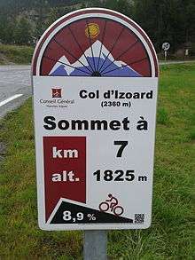
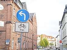
Signposting
In many places worldwide special signposts for bicycles are used to indicate directions and distances to destinations for cyclists. Apart from signposting in and between urban areas,[61] mountain pass cycling milestones have become an important service for bicycle tourists. They provide cyclists with information about their current position with regard to the summit of the mountain pass.[62]
Widening outside lanes
One method for reducing potential friction between cyclists and motorized vehicles is to provide "wide kerb", or "nearside", lanes (UK terminology) or "wide outside through lane" (U.S. terminology). These extra-wide lanes increase the probability that motorists pass cyclists at a safe distance without having to change lanes.[63][64] This is held to be particularly important on routes with a high proportion of wide vehicles such as buses or heavy goods vehicles (HGVs). They also provide more room for cyclists to filter past queues of cars in congested conditions and to safely overtake each other. Due to the tendency of all vehicle users to stay in the center of their lane, it would be necessary to sub-divide the cycle lane with a broken white line to facilitate safe overtaking. Overtaking is indispensable for cyclists, as speeds are not dependent on the legal speed limit, but on the rider's capability.
The use of such lanes is specifically endorsed by Cycling: the way ahead for towns and cities, the European Commission policy document on cycle promotion.[65]
Shared space
Shared space schemes extend this principle further by removing the reliance on lane markings altogether, and also removing road signs and signals, allowing all road users to use any part of the road, and giving all road users equal priority and equal responsibility for each other's safety. Experiences where these schemes are in use show that road users, particularly motorists, undirected by signs, kerbs, or road markings, reduce their speed and establish eye contact with other users. Results from the thousands of such implementations worldwide all show casualty reductions and most also show reduced journey times.[66] After the partial conversion of London's Kensington High Street to shared space, accidents decreased by 44% (the London average was 17%).[66]
CFI argues for a marked lane width of 4.25 metres (13.9 ft).[29] On undivided roads, width provides cyclists with adequate clearance from passing HGVs while being narrow enough to deter drivers from "doubling up" to form two lanes. This "doubling up" effect may be related to junctions. At non-junction locations, greater width might be preferable if this effect can be avoided. The European Commission specifically endorses wide lanes in its policy document on cycling promotion, Cycling: the way ahead for towns and cities.[65]
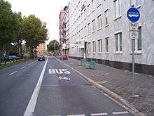
Shared bus and cycle lanes
Shared bus and cycle lanes are also a method for providing a more comfortable and safer space for cyclists. Depending on the width of the lane, the speeds and number of buses, and other local factors, the safety and popularity of this arrangement vary.
In the Netherlands mixed bus/cycle lanes are uncommon. According to the Sustainable Safety guidelines they would violate the principle of homogeneity and put road users of very different masses and speed behaviour into the same lane, which is generally discouraged.[67]
Road surface
Bicycle tires being narrow, road surface is more important than for other transport, for both comfort and safety. The type and placement of storm drains, manholes, surface markings, and the general road surface quality should all be taken into account by a bicycle transportation engineer. Drain grates, for example, must not catch wheels.
Trip-end facilities
Bicycle parking/storage arrangements
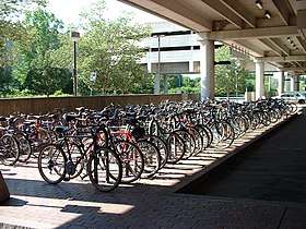
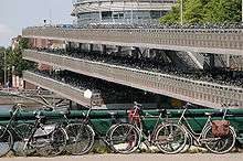
As secure and convenient bicycle parking is a key factor in influencing a person's decision to cycle, decent parking infrastructure must be provided to encourage the uptake of cycling.[68] Decent bicycle parking involves weather-proof infrastructure such as lockers, stands, manned or unmanned bicycle parks,[69] as well as bike parking facilities within workplaces to facilitate bicycle commuting. It also will help if certain legal arrangements are put into place to enable legitimate ad hoc parking, for example to allow people to lock their bicycles to railings, signs and other street furniture when individual proper bike stands are unavailable.[70]
Other trip end facilities
Some people need to wear special clothes such as business suits or uniforms in their daily work. In some cases the nature of the cycling infrastructure and the prevailing weather conditions may make it very hard to both cycle and maintain the work clothes in a presentable condition. It is argued that such workers can be encouraged to cycle by providing lockers, changing rooms and shower facilities where they can change before starting work.[71]
Theft reduction measures
The theft of bicycles is one of the major problems that slow the development of urban cycling. Bicycle theft discourages regular cyclists from buying new bicycles, as well as putting off people who might want to invest in a bicycle.
Several measures can help reduce bicycle theft:
- Bicycle registration to enable recovery if stolen
- Making cyclists aware of antitheft devices and their effective use
- Mounting sting operations to catch thieves
- Secure bicycle parking: offering safe bicycle parking facilities[72] such as guarded bicycle parking (manned or with camera surveillance) or bicycle lockers
- Promoting devices to enable remote tracking of a bicycle's location
- Targeting cycle thieves
- Using folding bicycles which can be safely stored (for example) in cloakrooms or under desks.
Certain European countries apply such measures with success, such as the Netherlands or certain German cities using registration and recovery. Since mid-2004, France has instituted a system of registration, in some places allowing stolen bicycles to be put on file in partnership with the urban cyclists' associations. This approach has reputedly increased the stolen bicycle recovery rate to more than 40%. By comparison, before the commencement of registration, the recovery rate in France was about 2%.
In some areas of the United Kingdom, bicycles fitted with location tracking devices are left poorly secured in theft hot-spots. When the bike is stolen, the police can locate it and arrest the thieves. This sometimes leads to the dismantling of organized bicycle theft rings, as bike theft generally enjoys a very low priority with the police.
Bicycle lift
Some cyclists have difficulty climbing steep hills, and devices such as the Trampe bicycle lift, in Trondheim, have been developed to help alleviate this problem.
Integration with public transit
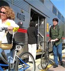
Cycling is often integrated with other transport. For example, in the Netherlands and Denmark a large number of train journeys may start by bicycle. In 1991, 44% of Dutch train travelers went to their local station by bicycle and 14% used a bicycle at their destinations.[73] The key ingredients for this are claimed to be:
- an efficient, attractive and affordable train service
- secure bike parking at train stations
- a quick and easy bicycle rental system for commuters, the OV-bicycle scheme,[74] at train stations
- a town planning policy that results in a sufficient proportion of the potential commuter population (e.g. 44%) living/working within a reasonable cycling distance of the train stations.
It has been argued in relation to this aspect of Dutch or Danish policy that ongoing investment in rail services is vital to maintaining their levels of cycle use.
Cycling and public transport are well integrated in Japan.[75] Starting in 1978, Japan expanded bicycle parking supply at railway stations from 598,000 spaces in 1977 to 2,382,000 spaces in 1987. As of 1987, Japanese provisions included 516 multi-story garages for bicycle parking.[76]
In January 2007, the European parliament adopted a motion decreeing that all international trains must carry bicycles.[77] In some cities, bicycles may also be carried on local trains, trams and buses so that they may be used at either end of the trip. The Rheinbahn transit company in Düsseldorf permits bicycle carriage on all its bus, tram and train services at any time of the day.[78] In Munich bicycles are allowed on the S-Bahn commuter trains outside of rush hours,[79] and folding bikes are allowed on city busses. In Copenhagen, you can take your bicycle with you in the S-tog commuter trains, all times a day with no additional costs.[80] In France, the prestigious TGV high-speed trains are even having some of their first class capacity converted to store bicycles.[81] There have also been schemes, such as in Victoria, British Columbia, Acadia, and Canberra, Australia to provide bicycle carriage on buses using externally mounted bike carriers.[82][83][84]
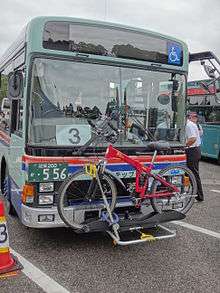
In some Canadian cities, including Edmonton, Alberta and Toronto, Ontario, busses on most city routes have externally mounted carriers for bicycles, and bikes are allowed on the light rail trains at no extra cost outside of rush hour.[85][86] All public transit buses in Chicago and suburbs allow up to two bikes at all times.[87][88][89] The same is true of Grand River Transit buses in the Region of Waterloo, Ontario, Canada.[90] Trains allow bikes with some restrictions.[88][91] Where such services are not available, some cyclists get around this restriction by removing their pedals and loosening their handlebars as to fit into a box or by using folding bikes that can be brought onto the train or bus like a piece of luggage. The article on buses in Christchurch, New Zealand lists 27 routes with bike racks.
However, there are strong cultural variations in how cycling is treated in such situations. For instance in the Irish university city of Galway, the same town that suggested cyclists dismount and walk across each intersection, the secure parking of bikes is forbidden within the grounds of the central train station. However, cut-price car parking is available for motorists holding a valid train ticket.
Bikesharing systems
A bicycle sharing system, public bicycle system, or bike share scheme, is a service in which bicycles are made available for shared use to individuals on a very short-term basis. Bike share schemes allow people to borrow a bike from point "A" and return it at point "B". Many of the bicycle sharing systems are on a subscription basis.
Examples of cycling infrastructure
 Trans Canada Trail along Coal Harbour in downtown Vancouver, British Columbia
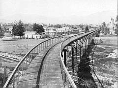 Cycling in Los Angeles, California Cycleway in 1900
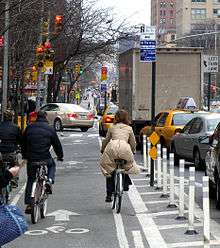
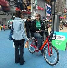 New York City Times Square bicycle sharing system
 Bikeway in Minsk
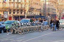
See also
- Removal of curbside parking spaces: frees up space for bicycle lanes
- History of cycling infrastructure
- Outline of cycling
- Rail trail
- Shared space
Organizing bodies:
Muli-modal road safety:
References
- Mueller, N (2018). "Health impact assessment of cycling network expansions in European cities". Preventive Medicine. 109: 62–70. doi:10.1016/j.ypmed.2017.12.011. hdl:10230/42143. PMID 29330030.
- "Urban Bikeway Design Guide". National Association of City Transportation Officials. 27 June 2012. Retrieved 30 June 2015.
- "Standards for Highways online resources - Detailed guidance - GOV.UK" (PDF).
- "Sustrans Design Manual" (PDF). Archived from the original (PDF) on 24 September 2015. Retrieved 8 July 2015.
- "Cycle Infrastructure Design" (PDF). Department of Transport. Retrieved 9 July 2015.
- "Stiklassificering" (PDF). vejdirektoratet.dk.
- "Home - CROW". crow.nl. Retrieved 6 March 2018.
- "Bicycle Facilities and the Manual on Uniform Traffic Control Devices". Federal Highway Administration (FHWA). Retrieved 8 July 2015.
- "2009 MUTCD with Revisions 1 and 2, May 2012". U.S. Federal Highway Administration (FHWA). Retrieved 8 July 2015.
- "Urban Bikeway Design Guide - National Association of City Transportation Officials". 27 June 2012.
- "How wide is a Dutch cycle path?". wordpress.com. 29 June 2011.
- "Sustrans Handbook for Cycle-friendly Design" (PDF). Sustrans. Archived from the original (PDF) on 24 September 2015. Retrieved 9 July 2015.
- "Advisory bike lane". Association of Pedestrian and Bicycle Professionals. Retrieved 8 July 2015.
- "Cycle Tracks - National Association of City Transportation Officials".
- Solomon, Lawrence (1 December 2017). "Ban the Bike". Financial Post.
- Norman, Will (1 December 2017). "Bike lanes don't clog up our roads, they keep London moving". the Guardian. Retrieved 6 March 2018.
- Herman, F. (2019-05-30). "Evaluation of Lane Reduction "Road Diet" Measures and Their Effects on Crashes and Injuries" (PDF). FDLP Electronic Collection Archive. Archived from the original on 5/30/209. Check date values in:
|archive-date=(help) - "Highway Design Manual, Chapter 1000" (PDF). California Department of Transportation. Retrieved 7 July 2015.
- "City of Portland Bicycle Master Plan" (PDF). Retrieved 7 July 2015.
- "NYC Street Design Manual" (PDF). Retrieved 8 July 2015.
- "Buffered bike lanes". NACTO Urban Bikeway Design Guide. Retrieved 8 July 2015.
- "The world's busiest bike path is in Copenhagen - INDEX: Design to Improve Life®". INDEX: Design to Improve Life®. 30 March 2011. Retrieved 10 June 2016.
- "The Green Lane Project's style guide". Archived from the original on 25 October 2015. Retrieved 3 November 2015.
- "Small Towns - Publications - Bicycle and Pedestrian Program - Environment - FHWA". fhwa.dot.gov.
- "Advisory bicycle lanes - Home". Advisory Bicycle Lanes.
- "A view from the cycle path: First cycle "superhighway" revisited".
- Buekers, J; Dons, E; Elen, B; Int Panis, L (2015). "Health impact model for modal shift from car use to cycling or walking in Flanders: application to two bicycle highways". Journal of Transport and Health. 2 (4): 549–562. doi:10.1016/j.jth.2015.08.003.
- Cycle-Friendly Infrastructure: Guidelines for Planning and Design Archived 7 February 2012 at the Wayback Machine, Institution of Highways and Transportation, Cyclists Touring Club, 1996.
- Woonerf revisited Archived 9 April 2008 at the Wayback Machine Delft as an example, Steven Schepel, Childstreet2005 conference, Delft 2005 (Accessed 2007-02-21
- Transport Planning in Groningen, Holland Bicycle Fixation (Accessed 2007-01-27)
- The Impacts of Reallocating road space on Accident Rates: Some Initial Evidence Sally Cairns Note from Road Danger Reduction Forum conference, Leicester, 16 February 1999. (Accessed 2014-03-07)
- Copenhagens Bicycle Account 2014
- DIVV Amsterdam Archived 27 January 2005 at the Wayback Machine
- "Cycling in London Report, May 2008 section 4.6" (PDF). tfl.gov.uk.
- "No accidents after road conversion in Norrköpping" (PDF). Newsletter. Shared Space. 2007. Archived from the original (PDF) on 9 April 2008. Retrieved 18 March 2008.
- Elizabeth Press (30 August 2010). "No Need for Speed: 20′s Plenty for Us". Streetfilms. Retrieved 27 November 2011.
- Joshua Hart. "Driven To Excess: A Study of Motor Vehicle Impacts on Three Streets in Bristol UK" (PDF). Walk21. Archived from the original (PDF) on 26 April 2012. Retrieved 27 November 2011.
- Traffic safety on one-way streets with contraflow bicycle traffic, Alrutz, D., Angenendt, W., Draeger, W., Gündel, D., Straßenverkehrstechnik, 6/2002
- Le SUL Cyclistes a contresens dans les sens uniques Groupe de Recherche et d’Action des Cyclistes Quotidiens, Brussels 2006, (Accessed 27 January 2007)
- "Collection of Cycle Concepts". Danish Roads Directorate. 2000. Archived from the original on 27 September 2007. Retrieved 18 March 2008.
- Hanka, Matt; Gilderbloom, John (31 January 2008). "Oped: Time to end one-way thinking". The Courier-Journal. Retrieved 31 January 2015.(subscription required)
- "Traffic calming schemes: One way streets, banned turning movements and no entry restrictions". Bury Metropolitan Borough Council. Archived from the original on 16 May 2010. Retrieved 26 March 2008.
- "Ministerieel rondschrijven betreffende de toepassing van het beperkt éénrichtingsverkeer". Belgisch Staatsblad. 13 November 1998., "Circulaire ministérielle relative à l'application du sens unique limité". Moniteur Belge. 13 November 1998.
- Verkehrssicherheit in Einbahnstraßen it gegengerichtetem Radverkehr Archived 14 May 2009 at the Wayback Machine, Alrutz, D., Angenendt, W., Draeger, W., Gündel, D., Straßenverkehrstechnik, 6/2002
- Le SUL Cyclistes a congress dans les sens uniques Groupe de Recherche et d’Action des Cyclistes Quotidiens, Brussels 2006, (Accessed 2007-01-27)
- Collection of Cycle Concepts Archived 27 September 2007 at the Wayback Machine, Danish Roads Directorate, Copenhagen, 2000
- Infrastructure position document Archived 9 June 2009 at the Wayback Machine, Dublin Cycling Campaign (Accessed 2007-01-27)
- Layout and Design Factors Affecting Cycle Safety at T-Junctions, Henson R. and Whelan N., Traffic Engineering and Control, October 1992
- Pedal cyclists at dual carriage-way slip roads, M.C. Williams and R.E. Layfield, Traffic Engineering and Control, pp. 597-600, November, 1987
- Multilane Roundabouts Archived 2 December 2012 at the Wayback Machine, An Information Sheet, Galway Cycling Campaign, February 2001
- "Bike box". National Association of City Transportation Officials. Retrieved 9 July 2015.
- Accidents at Three Arm Priority Junctions on Urban Single Carriageway Roads Summersgill I., Kennedy J.V. and Baynes D. TRL Report 184, Transport Research Laboratory, 1996.
- Cyclists and Roundabouts-A review of literature, Allot, and Lomax, 1991
- "The best roundabout design for cyclists. The safest Dutch design described and an explanation of why this is the most suitable for adoption elsewhere". A view of the cycle path. Retrieved 9 July 2015.
- "Spectacular New Floating Cycle Roundabout". Bicycle Dutch. Retrieved 9 July 2015.
- Priority for cycling in an urban traffic control system, Stephen D. Clark, Matthew W. Page, Institute for Transport Studies, University of Leeds, Velomondial Conference Proceedings, Amsterdam 2000
- Traffic Signal Actuators: Am I Paranoid? John S. Allen, 2003 (Accessed 25 March 2008)
- Assessing the Impact of Local Transport Policy Instruments Susan Grant-Muller (Editor), it is Working Paper 549, Institute of Transport Studies, Leeds University, April 2000
- Green wave for cycles Archived 27 February 2008 at the Wayback Machine, Cycle Campaign Network News, No 85, November 2006
- "Holland-Cycling.com - Signposting". Holland-cycling. Retrieved 28 August 2014.
- "Cycling - Pra Loup". Valée Ubaye. Retrieved 25 August 2014.
- "Legally Speaking - with Bob Mionske: Law of the land". velonews.com. Archived from the original on 11 October 2008.
- Steven G. Goodridge Ph.D. (18 February 2005). "Wide Outside Through Lanes: Effective Design of Integrated Passing Facilities" (PDF). Archived from the original (PDF) on 9 April 2008. Retrieved 7 March 2008.
The function of wide outside through lanes as passing facilities is presented.
- Cycling: the way ahead for towns and cities Archived 10 May 2008 at the Wayback Machine, European Commission, 1999
- Simon Jenkins (29 February 2008). "Rip out the traffic lights and railings. Our streets are better without them". The Guardian. Guardian News and Media. Retrieved 18 March 2008.
- "Sustainable Safety". wordpress.com. 2 January 2012.
- "Federal Highway Administration Research and Technology-- - Federal Highway Administration". Archived from the original on 30 May 2010. Retrieved 19 October 2011.
- Michael Baltes (2005), Integration of bicycles and transit, National Research Council (U.S.). Transportation Research Board, p. 39,
The first staffed bicycle parking facility in the United States was opened in Long Beach, California.
- Success is on the cards, London Cyclist, June–July 2009, p. 6
- Guide for Employers: Showers, lockers and drying room Archived 19 December 2010 at the Wayback Machine, London Cycling Campaign, 13 September 2006 (Accessed 16 August 2007)
- Staples, Steven. "Holland-Cycling.com - Bicycle parking". holland-cycling.com. Retrieved 6 March 2018.
- Ton Welleman: The autumn of the Bicycle Master Plan: after the plans, the products in: Proceedings of the 8th VELO-CITY Conference, Basel, 26–30 September 1995
- Staples, Steven. "Holland-Cycling.com - Bicycle rental". holland-cycling.com. Retrieved 6 March 2018.
- Cycling for Transportation: The Japanese Example By Paul Dorn (Accessed 2007-01-27)
- Bicycle Access to Public Transportation: Learning from Abroad by Michael Replogle, Journal of the Institute for Transportation Engineers, December 1992
- Article 4a European Parliament legislative resolution on the Council common position on international rail passengers' rights and obligations (5892/1/2006 – C6-0311/2006–2004/0049(COD)) January 2007
- Taking bicycles on the VRR Archived 19 October 2007 at the Wayback Machine Rheinische Bahngesellschaft AG (Accessed 2007-02-23)
- eCommerce, Deutsche Bahn AG, Unternehmensbereich Personenverkehr, Marketing. "Fahrradtageskarte".
- "What are you allowed to bring on public transportation?". Visitcopenhagen. Retrieved 10 June 2016.
- First class to bike class Archived 28 September 2007 at the Wayback Machine Cycle Campaign Network News Archive 2006 (Accessed 2007-02-23)
- "BC Transit - Welcome to Victoria". Archived from the original on 1 May 2008. Retrieved 19 October 2011.
- "New Ways to Explore Acadia". exploreacadia.com. Archived from the original on 12 March 2008.
- "Home". action.act.gov.au. 4 June 2017.
- "Bikes on ETS". edmonton.ca. Archived from the original on 10 September 2015.
- "TTC Bike Racks". City of Toronto Knowledge Base. City of Toronto. Retrieved 12 October 2018.
- "Archived copy". Archived from the original on 27 October 2014. Retrieved 2014-10-27.CS1 maint: archived copy as title (link)
- http://www.yourcta.com/downloads/brochures/biketran.pdf%5B%5D
- "Pace Bus - Bicycle Racks".
- "Bus 'n' Bike". grt.ca. Archived from the original on 8 February 2011.
- "Metra - Bikes on Trains Program". 9 February 2006. Archived from the original on 9 February 2006. Retrieved 6 March 2018.CS1 maint: BOT: original-url status unknown (link)
External links
| Wikimedia Commons has media related to Cycling infrastructure. |
| Wikimedia Commons has media related to Bikeways. |
- Urban Bikeway Design Guide from National Association of City Transportation Officials
- Bicycle infrastructure in the Netherlands video and blog explaining the Dutch approach of addressing cycling infrastructure safety
- CyclOSM and Opencyclemap are global maps of cycling infrastructure
- Bicycle Facilities is a world map and statistics of cycling infrastructure
| General and technical | |
|---|---|
| Utility and slow recreation | |
| Sports-related cycling and fast-paced recreation | |
| Health, safety and infrastructure |
|
| Other |
|
| Lists | |
| |
| In-roadway bikeways |
| ||||||
|---|---|---|---|---|---|---|---|
| Right-of-way paths |
| ||||||
| Health, safety and infrastructure |
| ||||||
| Design Guidelines |
| ||||||
| |||||||