Centreville, Illinois
Centreville is a city in St. Clair County, Illinois, United States. The population was 5,309 in 2010, down from 5,951 at the 2000 census.
Centreville, Illinois | |
|---|---|
City | |
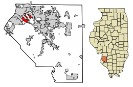 Location of Centreville in Clair County, Illinois. | |
| Coordinates: 38°35′4″N 90°6′14″W | |
| Country | United States |
| State | Illinois |
| County | St. Clair |
| Area | |
| • Total | 4.24 sq mi (10.98 km2) |
| • Land | 4.18 sq mi (10.83 km2) |
| • Water | 0.06 sq mi (0.15 km2) |
| Population (2010) | |
| • Total | 5,309 |
| • Estimate (2018)[2] | 4,965 |
| • Density | 1,203.68/sq mi (464.79/km2) |
| Time zone | UTC-6 (CST) |
| • Summer (DST) | UTC-5 (CDT) |
| ZIP Code(s) | 62207 |
| Area code(s) | 618 |
| FIPS code | 17-12203 |
| Wikimedia Commons | Centreville, Illinois |
| Website | www |
Geography
Centreville is located at 38°35′4″N 90°6′14″W (38.584583, -90.103768).[3]
According to the 2010 census, Centreville has a total area of 4.287 square miles (11.10 km2), of which 4.23 square miles (10.96 km2) (or 98.67%) is land and 0.057 square miles (0.15 km2) (or 1.33%) is water.[4]
Demographics
| Historical population | |||
|---|---|---|---|
| Census | Pop. | %± | |
| 1870 | 1,116 | — | |
| 1960 | 12,769 | — | |
| 1970 | 11,378 | −10.9% | |
| 1980 | 9,747 | −14.3% | |
| 1990 | 7,489 | −23.2% | |
| 2000 | 5,951 | −20.5% | |
| 2010 | 5,309 | −10.8% | |
| Est. 2018 | 4,965 | [2] | −6.5% |
| U.S. Decennial Census[5] | |||
At the 2000 census there were 5,951 people in 2,125 households, including 1,476 families, in the city. The population density was 1,373.3 people per square mile (530.6/km²). There were 2,363 housing units at an average density of 545.3 per square mile (210.7/km²). The racial makeup of the city was 95.46% African American, 3.38% White, 0.13% Native American, 0.02% Pacific Islander, 0.13% from other races, and 0.87% from two or more races. Hispanic or Latino of any race were 0.57%.[6]
Of the 2,125 households 34.8% had children under the age of 18 living with them, 27.5% were married couples living together, 35.2% had a female householder with no husband present, and 30.5% were non-families. 26.8% of households were one person and 11.8% were one person aged 65 or older. The average household size was 2.80 and the average family size was 3.38.
The age distribution was 33.5% under the age of 18, 9.2% from 18 to 24, 23.9% from 25 to 44, 20.1% from 45 to 64, and 13.2% 65 or older. The median age was 31 years. For every 100 females, there were 85.3 males. For every 100 females age 18 and over, there were 77.2 males.
The median household income was $23,500 and the median family income was $27,310. Males had a median income of $32,024 versus $23,528 for females. The per capita income for the city was $11,150. About 28.7% of families and 34.4% of the population were below the poverty line, including 48.4% of those under age 18 and 14.6% of those age 65 or over.
Notable people
- Edward Burch, alternative country musician
- John Dettmer, pitcher for the Texas Rangers
- Byron Gettis, outfielder for the Kansas City Royals
- Reginald Hudlin, film director
Education
Some of the city is served by Cahokia Unit School District 187. Lalumier K-8 School is located in Centreville.[7] Centerville K-8 is located in an unincorporated area near Centreville.[8]
Some of the city is served by East St. Louis School District 189. Brown Elementary School is located in Centreville.[9][10]
Poverty
Centreville is the poorest city in the state of Illinois, as well as one of the poorest cities in the nation. The town median household income of $17,441, while the typical home in the area is worth approximately $47,900.[11] The city is located on a Mississippi River floodplain known as American Bottom, and experiences chronic flooding and raw sewage disposal problems due to the area’s inadequate system of drainage ditches, levees and emergency pumps.[12][13]
References
- "2016 U.S. Gazetteer Files". United States Census Bureau. Retrieved Jun 29, 2017.
- "Population and Housing Unit Estimates". Retrieved September 16, 2019.
- "US Gazetteer files: 2010, 2000, and 1990". United States Census Bureau. 2011-02-12. Retrieved 2011-04-23.
- "G001 - Geographic Identifiers - 2010 Census Summary File 1". United States Census Bureau. Archived from the original on 2020-02-13. Retrieved 2015-12-25.
- "Census of Population and Housing". Census.gov. Retrieved June 4, 2015.
- "U.S. Census website". United States Census Bureau. Retrieved 2008-01-31.
- "Lalumier Elementary School." Cahokia Unit School District 187. Retrieved on January 24, 2011. "6702 Bond Ave."
- "Centerville Elementary School." Cahokia Unit School District 187. Retrieved on January 24, 2011. "3429 Camp Jackson."
- "Brown Elementary School Archived 2011-01-19 at the Wayback Machine." East St. Louis School District 189. Retrieved on January 24, 2011. "4901 Market St. East St. Louis , IL 62207."
- "Centreville city, Illinois." U.S. Census Bureau. Retrieved on January 24, 2011.
- Stebbins, Samuel. "These are the poorest cities in every state in the US". 24/7 Wall Street. USA Today. Retrieved 29 February 2020.
- Munz, Michele (23 February 2020). "A plea for help: Centreville's sewage and drainage problems pose health, safety risks". St. Louis Post-Dispatch. Lee Enterprises. Retrieved 29 February 2020.
- Johnson, Walter (23 January 2020). "American Bottom". Boston Review. Retrieved 29 February 2020.
Municipalities and communities of St. Clair County, Illinois, United States | ||
|---|---|---|
| Cities | Map of Illinois highlighting St. Clair County | |
| Villages | ||
| Townships | ||
| CDPs | ||
| Other unincorporated communities | ||
| Footnotes | ‡This populated place also has portions in an adjacent county or counties | |
| Counties | 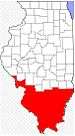 | |
|---|---|---|
| Mid-sized cities (25,000+) | ||
| Small Cities (10,000-25,000) | ||
| Small Cities (5,000-10,000) | ||
| Interstates | ||
| Airports/Military bases |
| |
| Universities | ||
| Colleges | ||
| Sports teams based in the Southern Illinois | ||