Hecker, Illinois
Hecker is a village in Monroe County in the U.S state of Illinois. The population was 481 at the 2010 census.
Hecker | |
|---|---|
Village | |
| Etymology: Friedrich Franz Karl Hecker, German revolutionary, orator, and American Civil War Colonel | |
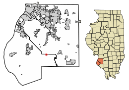 Location of Hecker in Monroe County, Illinois. | |
.svg.png) Location of Illinois in the United States | |
| Coordinates: 38°18′20″N 89°59′39″W | |
| Country | United States |
| State | Illinois |
| County | Monroe |
| Precinct | 1 |
| Founded | 1895 |
| Government | |
| • Mayor | Charles Kujawski |
| Area | |
| • Total | 0.22 sq mi (0.58 km2) |
| • Land | 0.22 sq mi (0.58 km2) |
| • Water | 0.00 sq mi (0.00 km2) |
| Population (2010) | |
| • Total | 481 |
| • Estimate (2018)[2] | 473 |
| • Density | 2,202.70/sq mi (849.64/km2) |
| Time zone | UTC-6 (CST) |
| • Summer (DST) | UTC-5 (CDT) |
| ZIP Code(s) | 62248 |
| Area code(s) | 618 |
| FIPS code | 17-33877 |
| Wikimedia Commons | Hecker, Illinois |
| Website | hecker |
History
Hecker was originally named Freedom. The town was laid out on land of Theodore Hilgard. It was platted and surveyed by Thomas Singleton, county surveyor, December 18, 1840,[3] the first home being built in 1849. In 1895 the citizens of what was then Freedom decided to incorporate, to facilitate improvements to the nascent town's infrastructure. Due to complaints from the Post Office, there being another town calling itself Freedom in Illinois, they were forced to change the name. Col. Friedrich Franz Karl Hecker, whose farm was near Summerfield in adjacent St Clair County, was known to and well respected by the town's inhabitants, and they decided to honor him by naming the town after him.
Geography
According to the 2010 census, the village has a total area of 0.24 square miles (0.62 km2), all land.[4]
Demographics
| Historical population | |||
|---|---|---|---|
| Census | Pop. | %± | |
| 1900 | 200 | — | |
| 1910 | 187 | −6.5% | |
| 1920 | 159 | −15.0% | |
| 1930 | 177 | 11.3% | |
| 1940 | 205 | 15.8% | |
| 1950 | 204 | −0.5% | |
| 1960 | 313 | 53.4% | |
| 1970 | 380 | 21.4% | |
| 1980 | 531 | 39.7% | |
| 1990 | 534 | 0.6% | |
| 2000 | 475 | −11.0% | |
| 2010 | 481 | 1.3% | |
| Est. 2018 | 473 | [2] | −1.7% |
| U.S. Decennial Census[5] | |||
At the 2000 census there were 475 people, 188 households, and 134 families in the village. The population density was 1,993.8 people per square mile (764.2/km²). There were 201 housing units at an average density of 843.7 per square mile (323.4/km²). The racial makeup of the village was 99.16% White, 0.21% African American, and 0.63% from two or more races. Hispanic or Latino of any race were 0.63%.[6]
Of the 188 households 31.9% had children under the age of 18 living with them, 60.1% were married couples living together, 9.6% had a female householder with no husband present, and 28.2% were non-families. 23.4% of households were one person and 10.1% were one person aged 65 or older. The average household size was 2.53 and the average family size was 3.02.
The age distribution was 22.3% under the age of 18, 9.7% from 18 to 24, 31.2% from 25 to 44, 23.6% from 45 to 64, and 13.3% 65 or older. The median age was 36 years. For every 100 females there were 106.5 males. For every 100 females age 18 and over, there were 100.5 males.
The median household income was $43,333 and the median family income was $51,071. Males had a median income of $38,125 versus $21,447 for females. The per capita income for the village was $18,423. About 2.8% of families and 4.7% of the population were below the poverty line, including 10.1% of those under age 18 and none of those age 65 or over.
References
- "2016 U.S. Gazetteer Files". United States Census Bureau. Retrieved Jun 29, 2017.
- "Population and Housing Unit Estimates". Retrieved March 19, 2020.
- Combined History of Randolph, Monroe and Perry Counties, Illinois, J. L. McDonough & Co., Philadelphia, 1883
- "2010 Census U.S. Gazetteer Files for Places – Illinois". United States Census. Archived from the original on 2013-01-12. Retrieved 2012-10-13.
- "Census of Population and Housing". Census.gov. Retrieved June 4, 2015.
- "U.S. Census website". United States Census Bureau. Retrieved 2008-01-31.
External links
| Counties |  | |
|---|---|---|
| Major Cities (25,000+) | ||
| Cities (5,000-25,000) | ||
| Communities (1,000-5,000) |
| |
| Interstates | ||
| Airports | ||
| Colleges | ||
| Sports teams |
| |
Municipalities and communities of Monroe County, Illinois, United States | ||
|---|---|---|
| Cities | Map of Illinois highlighting Monroe County | |
| Villages | ||
| Unincorporated communities | ||
| Footnotes | ‡This populated place also has portions in an adjacent county or counties | |