Cartagena, Spain
Cartagena (Spanish pronunciation: [kaɾtaˈxena]; Latin: Carthago Nova) is a Spanish city and a major naval station located in the Region of Murcia, by the Mediterranean coast, south-eastern Spain. As of January 2018, it has a population of 213,943 inhabitants,[2] being the region's second-largest municipality and the country's sixth-largest non-provincial-capital city. The metropolitan area of Cartagena, known as Campo de Cartagena, has a population of 409,586 inhabitants.
Cartagena | |
|---|---|
 .JPG) _(cropped).jpg) 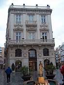 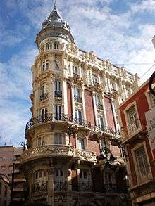 Cartagena | |
 Flag  Coat of arms | |
| Motto(s): Muy noble, muy leal y siempre heroica ciudad de Cartagena | |
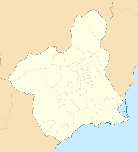 Cartagena Location in Spain 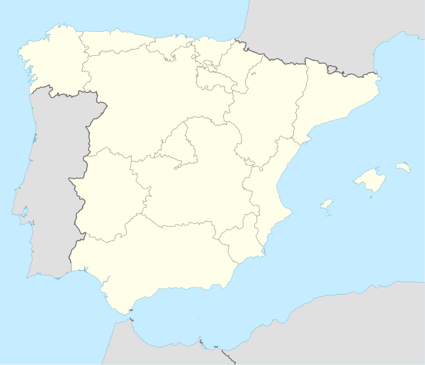 Cartagena Cartagena (Spain) | |
| Coordinates: 37°36′N 0°59′W | |
| Country | |
| Autonomous community | |
| Province | Province of Murcia |
| Comarca | Campo de Cartagena |
| Judicial district | Cartagena |
| Founded | 227 BC |
| Government | |
| • Mayor | Ana Belén Castejón Hernández (Ind.) |
| Area | |
| • Total | 558.08 km2 (215.48 sq mi) |
| Elevation | 10 m (30 ft) |
| Highest elevation | 50 m (160 ft) |
| Lowest elevation | 0 m (0 ft) |
| Population (2018)[1] | |
| • Total | 213,943 |
| • Density | 380/km2 (990/sq mi) |
| Demonym(s) | Cartageneros |
| Time zone | UTC+1 (CET) |
| • Summer (DST) | UTC+2 (CEST) |
| Postal code | 302xx and 303xx |
| Dialing code | (+34) 968 |
| Website | www |
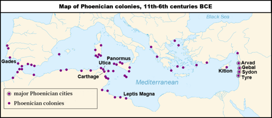
Cartagena has been inhabited for over two millennia, being founded around 227 BC[3] by the Carthaginian Hasdrubal the Fair[4] as Qart Hadasht (Phoenician, meaning 'New Town'), the same name as the original city of Carthage. The city had its heyday during the Roman Empire, when it was known as Carthago Nova (the New Carthage) and Carthago Spartaria, capital of the province of Carthaginensis. It was one of the important cities during the Umayyad invasion of Hispania, under its Arabic name of Qartayannat al-Halfa.[5]
Much of the historical weight of Cartagena in the past goes to its coveted defensive port, one of the most important in the western Mediterranean. Cartagena has been the capital of the Spanish Navy's Maritime Department of the Mediterranean since the arrival of the Spanish Bourbons in the 18th century.[6] As far back as the 16th century it was one of the most important naval ports in Spain, together with Ferrol in the North. It is still an important naval seaport, the main military haven of Spain, and is home to a large naval shipyard.[7]
The confluence of civilizations as well as its strategic harbour, together with the rise of the local mining industry is manifested by a unique artistic heritage, with a number of landmarks such as the Roman Theatre, the second largest of the Iberian Peninsula after the one in Mérida, an abundance of Phoenician, Roman, Byzantine and Moorish remains, and a plethora of Art Nouveau buildings, a result of the bourgeoisie from the early 20th century. Cartagena is now established as a major cruise ship destination[8] in the Mediterranean and an emerging cultural focus.
It was the first of a number of cities that have been named Cartagena, most notably Cartagena, Colombia.
Geography and climate
Geography and relief
The city of Cartagena is located in the southeastern region of Spain in the Campo de Cartagena. The Cartagena region can be viewed as a great plain inclined slightly in the direction NW-SE, bordered at the north and the northwest by pre-coastal mountain ranges (Carrascoy, El Puerto, Los Villares, Columbares and Escalona), and at the south and southwest by coastal mountain ranges (El Algarrobo, La Muela, Pelayo, Gorda, La Fausilla y Minera, with its last spurs in Cape Palos). The dominant geology of the region is metamorphic (slate, marble) and sedimentary (limestone).
The city is located just at the end of the new AP-7 motorway. The following villages are part of Cartagena municipality: La Azohía, Isla Plana, Los Urrutias and Los Nietos.
The Old Town is limited by five small hills (Molinete, Monte Sacro, Monte de San José, Despeñaperros and Monte de la Concepción) following the example of Rome.[9] In the past, there was an inner sea between the hills called the Estero that eventually dried up. On this site, the "Ensanche" (Expansion or New Town) was built at the beginning of the 20th century.[10][11]
The urban area is delimited or crossed by several watercourses, some of which go deep into the urban network during a large part of their courses.[11]
Climate
Cartagena has a hot semi-arid climate. Its location near the ocean moderates the temperature, and annual precipitation typically does not surpass 300 mm (12 in). The annual average temperature goes up to around 20.4 °C (69 °F), making it the warmest city in Europe for the year 2014. The coldest month is January, with an average temperature of 13.7 °C (57 °F). In August, the warmest month, the average temperature is 28.7 °C (84 °F). The wind is an important climatic factor in the region.
| Climate data for Cartagena, Murcia | |||||||||||||
|---|---|---|---|---|---|---|---|---|---|---|---|---|---|
| Month | Jan | Feb | Mar | Apr | May | Jun | Jul | Aug | Sep | Oct | Nov | Dec | Year |
| Record high °C (°F) | 25.8 (78.4) |
28.2 (82.8) |
30.5 (86.9) |
34.8 (94.6) |
37.3 (99.1) |
39.6 (103.3) |
43.8 (110.8) |
42.1 (107.8) |
38.7 (101.7) |
34.1 (93.4) |
30.8 (87.4) |
24.6 (76.3) |
43.8 (110.8) |
| Average high °C (°F) | 18.2 (64.8) |
19.3 (66.7) |
20.4 (68.7) |
22.0 (71.6) |
24.3 (75.7) |
28.4 (83.1) |
33.5 (92.3) |
33.1 (91.6) |
30.0 (86.0) |
27.5 (81.5) |
22.7 (72.9) |
19.6 (67.3) |
24.9 (76.8) |
| Daily mean °C (°F) | 13.7 (56.7) |
14.6 (58.3) |
15.4 (59.7) |
17.3 (63.1) |
20.1 (68.2) |
24.0 (75.2) |
28.2 (82.8) |
28.7 (83.7) |
25.7 (78.3) |
22.8 (73.0) |
19.0 (66.2) |
15.1 (59.2) |
20.4 (68.7) |
| Average low °C (°F) | 9.1 (48.4) |
9.9 (49.8) |
10.4 (50.7) |
12.6 (54.7) |
15.8 (60.4) |
19.7 (67.5) |
22.9 (73.2) |
24.3 (75.7) |
21.5 (70.7) |
18.1 (64.6) |
15.3 (59.5) |
10.6 (51.1) |
15.9 (60.6) |
| Average precipitation mm (inches) | 27 (1.1) |
19 (0.7) |
24 (0.9) |
30 (1.2) |
26 (1.0) |
12 (0.5) |
3 (0.1) |
6 (0.2) |
26 (1.0) |
49 (1.9) |
37 (1.5) |
36 (1.4) |
295 (11.5) |
| Average rainy days | 5.0 | 4.0 | 4.0 | 3.0 | 2.0 | 1.0 | 1.0 | 1.0 | 3.0 | 4.0 | 6.0 | 5.0 | 39 |
| Mean daily sunshine hours | 5.0 | 6.0 | 6.0 | 7.0 | 9.0 | 9.0 | 10.0 | 9.0 | 7.0 | 6.0 | 6.0 | 5.0 | 7.1 |
| Percent possible sunshine | 50 | 55 | 50 | 54 | 64 | 60 | 71 | 64 | 58 | 55 | 60 | 50 | 58 |
| Source 1: AEMET"Atlas Climático de Murcia". AEMET. 2014. | |||||||||||||
| Source 2: Various sources: Atlas de Murcia,[12] University of Murcia,[13] rain amount is from climate-data.org[14] Weather Atlas (sunshine data)[15] | |||||||||||||
| Climate data for Cartagena | |||||||||||||
|---|---|---|---|---|---|---|---|---|---|---|---|---|---|
| Month | Jan | Feb | Mar | Apr | May | Jun | Jul | Aug | Sep | Oct | Nov | Dec | Year |
| Average sea temperature °C (°F) | 14.8 (58.6) |
14.4 (57.9) |
14.6 (58.3) |
16.6 (61.9) |
18.9 (66.0) |
22.0 (71.6) |
24.7 (76.5) |
25.9 (78.6) |
24.4 (75.9) |
22.0 (71.6) |
19.3 (66.7) |
16.6 (61.9) |
19.5 (67.1) |
| Mean daily daylight hours | 10.0 | 11.0 | 12.0 | 13.0 | 14.0 | 15.0 | 15.0 | 14.0 | 13.0 | 12.0 | 11.0 | 10.0 | 12.6 |
| Average Ultraviolet index | 2 | 3 | 5 | 7 | 8 | 9 | 10 | 9 | 7 | 5 | 3 | 2 | 5.8 |
| Source: Weather Atlas[15] | |||||||||||||
Human geography
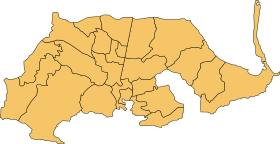
The municipality has 24 districts, known as diputaciones (councils). The origin of this administrative structure has its date in the beginning of the 18th century when population was increasing and the municipality was becoming less tractable.[16] The districts are:[17]
- Cartagena Casco: This is the district where the main town (also named Cartagena) is placed and is located in the south of the municipality.
- San Antonio Abad
- El Plan
- Rincón de San Ginés: It is located in the southeast end of the municipality. Its population consisted of 10,214 people in the year 2019.
- Canteras: This coastal district is placed in the south of the territory and faces the Mediterranean Sea in its south. It is also adjoining to Perín in its west and San Antonio Abad in its east. There were 10,167 people living in the year 2019.
- El Algar: It is located in the east of Cartagena and adjoins Lentiscar in its north. The number of inhabitants consisted in 7,961.
- Santa Lucía: It is placed in the south of the municipality and faces the Mediterranean sea in its south.
- La Palma: It is located in the north of the municipality. It shares borders with Lentiscar in its east.
- Pozo Estrecho: It is placed in the north of Cartagena and shares borders with La Palma in its east and with El Albujón in its west. There were 5,149 people who resided in the area in the year 2019.
- La Aljorra: This district occupies the northwestern end of the municipality. The number of inhabitants equalled to 4,962 people in the year 2019.
- La Magdalena: It occupies part of the west of the municipality and adjoins La Aljorra in its north. Its population consisted of 3,893 in the year 2019.
- Alumbres: It is located in the southeast quarter of Cartagena.
- Albujón: It is placed in the northwest of Cartagena and shares borders with La Aljorra in its west.
- San Félix: It is located in the approximate centre of Cartagena and is adjacent to Lentiscar in its northeast. The territory was inhabited by 2,694 people in the year 2019.
- Santa Ana: This district is placed in the northern half of Cartagena. It adjoins Pozo Estrecho in its norht. Its population consisted of 2,501 people in the year 2019.
- El Beal: The territory is located in the east of the municipality and shares borders with Rincón de San Ginés in its south. There were 2,342 residents present in the year 2019.
- Lentiscar: This district is placed in the norheast end of Cartagena. There were 2,022 residents in the year 2019.
- Perín: It is located in the south of the municipality and adjoins the Mediterranean Sea in its south and Los Puertos in its west. Perín was home to 1,591 people in the year 2019.
- Los Puertos: It occupies the southwest end, but also part of inner west that is not end of the municipality and is adjoining Campo Nubla in its west. This was inhabited by 1,349 people in the year 2019.
- Miranda: This district is placed in the northwest quarter of Cartagena. It shares borders with Pozo Estrecho in its northeast and El albujón in its northwest.
- Hondón: It is located in the southeast quarter and is adjoining San Félix in its south. The district was inhabited by 1,117 people in the year 2019.
- Campo Nubla: This district occupies part of the west end of the municipality. The territory was home to 203 people in the year 2019.
- Los Médicos: It is placed in the northern half of the territory. The district shares borders with La Palma and Pozo Estrecho in its north.
- Escombreras: It is located in the south of Cartagena. There were 9 people living in the area in the year 2019.
Environment
Despite the intense mining, tourist and industrial exploitation that the area has suffered for centuries, the territory around Cartagena city hosts an extraordinary natural wealth and diversity, with a large number of botanical endemic species. Part of its area is subject to different levels of legal protection.
Flora
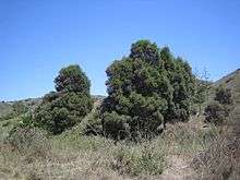
Cartagena's coastal mountains have one of the highest levels of botanical biodiversity on the Iberian Peninsula. A number of surprising Ibero-African species, which are only found in southern Spain (mostly in the provinces of Murcia and Almería) and North Africa. Among these, there stands out Tetraclinis articulata or Sandarac (sabina mora o ciprés de Cartagena—Cartagena's cypress in Spanish) native to Morocco, Algeria, Tunisia, Malta, and Cartagena, growing at relatively low altitudes in a hot, dry Mediterranean woodland. Some species are seriously endangered like the siempreviva de Cartagena (Limonium carthaginense), the rabogato del Mar Menor (Sideritis marmironensis), the zamarrilla de Cartagena (Teucrium carthaginense), the manzanilla de escombreras (Anthemis chrysantha), the garbancillo de Tallante (Astragalus nitidiflorus) and the jara de Cartagena Cistus heterophyllus carthaginensis).[18][19]
Fauna
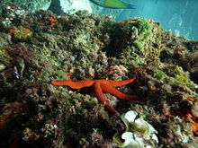
Among the animal species includes some threatened or endangered ones like the peregrine falcon, the Eurasian eagle-owl, the golden eagle and the Bonelli's eagle, the Spur-thighed tortoise, the Greater Horseshoe Bat and, especially, the Spanish toothcarp, an fish endemic to south-eastern Spain.[20] In addition, the presence of the common chameleon (the only chameleon in Europe) has been documented for about 30 years, although it is not clear whether it is native or introduced.[21] Some other species of note include the greater flamingo, the red fox, the European rabbit, the European badger, the Beech marten, the common genet, the wildcat and the wild boar.[22][23]
Protected areas
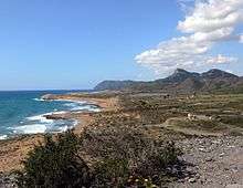
- Mar Menor, a salty lagoon separated from the Mediterranean Sea by a sand bar 22 kilometres (14 miles) in length and with a variable width from 100 to 1,200 metres (328 to 3,937 feet). It has a surface area of nearly 170 km2 (66 sq mi), a coastal length of 70 km (43 mi), and warm and clear water with relatively high salinity, which does not exceed 7 metres (23 feet) in depth. It belongs to four municipalities, including Cartagena. In 1994, it was included on the list of the Ramsar Convention (nº706) for the conservation and sustainable utilization of wetlands. It is also one of the Specially Protected Areas of Mediterranean Importance (SPAMI) by the United Nations. Its five volcanic islands (Perdiguera, Mayor or del Barón, del Ciervo, Redonda and del Sujeto) just like El Carmolí and San Ginés hills, the Hita and Amoladora beaches, the Lo Poyo salt marsh and the salt mines of Marchamalo are protected as well.[24][25]
- Calblanque, Monte de las Cenizas and Peña del Águila, declared a Natural Park and Site of Community Importance (SCI).[26]
- Sierra de la Muela, Cabo Tiñoso and Roldán mountain, Natural Park, Site of Community Importance and Special Protection Area (SPA).[27]
- Sierra de la Fausilla, Special Protection Area[27]
- Islands and Islets of the Mediterranean coast, including Grossa Island (belonging to the municipality of San Javier, Hormigas Islands, Palomas Islands and Escombreras Islands, some of them also designed as Special Protection Area.[27][28]
History
Prehistory
There is mention of the presence of individuals belonging to the genus Homo in the cave Cueva Victoria 1,300,000 years ago. This cave is located in the district Rincón de San Ginés.[29]
Remains of individuals belonging to the species Homo neanderthalensis and the Mousterian culture were found in the Cave of Los Aviones. This place is located close to Cartagena.[30][31] There were also remains of Neanderthals belonging to the Mousterian culture in the cave Cueva Bermeja, which is placed in the district Perín.[30]
At the southeast corner of the municipality remains of human beings of the Upper Paleolithic were discovered. The paleonthological sites are the Abrigo de Los Déntoles cove, the Cueva de Los Mejillones cave, and the Cabezo de San Ginés (hill). The West of the municipality was also the scene of human activity in that period. Concrete evidence of this are the Cueva del Caballo and Cueva Bermeja caves.[32][33]
The southeast end of Cartagena was inhabited again during the Mesolithic. Important spots are the Cueva de Los Pájaros and Cueva de Los Mejillones (caves). Neolithic components such as ceramic remains were located.[34]
The southeast of Cartagena was again inhabited during the Neolithic. The sites are Las Amoladeras and Calblanque. The south of the Alumbres district was also inhabited during that period. The archeological site is located in the Cerro del Gorguel hill and in it a characteristic Neolithic hamlet was discovered.[32][35]
The reasons for the dearth of human presence and structures in this municipality during the Neolithic period were the lack of rainfall and the absence of water beds. During the Bronze Age there was a similar situation.[36]
The Argaric civilization inhabited the southeast of the Iberian Peninsula (Región de Murcia and Almería) during the Bronze Age. Nevertheless, they did not significantly occupy this municipality, there were few structures belonging to them and they had little relevance here. They lived in the northwest in the La Aljorra and Tallante districts.[37][38]
Ancient history
The town was originally named Mastia. Possessing one of the best harbors in the Western Mediterranean, it was re-founded by the Carthaginian general Hasdrubal in 228 BC as Qart Hadasht ("New City"), a name identical to Carthage, for the purpose of serving as a stepping-off point for the conquest of Spain. The Roman general Scipio Africanus conquered it in 209 BC and renamed it as Carthago Nova (literally "New New City") to distinguish it from the mother city. Julius Caesar gave the town Latin Rights, and Octavian renamed it in his honor as the colony Colonia Victrix Iulia Nova Carthago or Colonia Vrbs Iulia Nova Carthago (C. V. I. N. C.) depending on the source. The city was very relevant both in the Carthaginian and the Roman conquest of the Iberian Peninsula. In 298 AD, Diocletian constituted a new Roman province in Hispania called Carthaginensis and settled the capital in this city. It remained important until it was sacked by the Vandals in 435 AD.[39][40]
During the Roman period, it was the site of major silver mines, yielding a daily revenue of 25,000 drachmae. It was known also for the production of garum, a fermented fish sauce, and for esparto grass[41] which granted it a new name, Cartago Spartaria.
Middle Ages
The demise and fall of Western Roman sovereignty caused the city to go into decline. It was occupied successively by the Vandals (409–425), the Visigoths (425–551 and 624–714) and the Eastern Romans (551–624), who made it the capital of Spania (the Byzantine Empire's westernmost province).[42] Cartagena was re-conquered by the Visigoths, who held it until the Muslim conquest in 714 AD, when it was called Qartayannat-al-Halfa. It was subsequently ruled by the Umayyads (714–756), the Caliphate of Cordova (756–1031), the Taifa of Denia (1031–1076), the Taifa of Saragossa (1076–1081), the Taifa of Tortosa (1081–1092), the Almoravids (1092–1145), the Almohads (1145–1229) and the Taifa of Murcia (1229–1245). King Alfonso X of Castile (Alfonso the Wise) conquered Cartagena in 1245; he established Christian rule and the Bishopric of Cartagena. In 1270, Alfonso created the Order of Santa María de España for the naval defense of the Crown of Castile and established its headquarters in Cartagena. In 1296, Cartagena was briefly annexed to the Crown of Aragon, but returned to Castile by the Treaty of Elx in 1305, which fixed the final boundary between the sub-kingdoms of Valencia and Murcia. After the fall of Muslim Granada in 1492 Cartagena entered a period of great decadence and decay, despite a short economic revival in the 16th century, because Spain's colonial activities used ports to the west. Cartagena didn't fully recover until the 18th century, when it became a leading naval port in the Mediterranean.[43]
Modern history
On 3 September 1643, the French led by Grand Admiral Jean Armand de Maillé-Brézé defeated most of Spain's fleet here.[44]
In 1728, Cartagena became the capital of the Spanish Navy's Maritime Department of the Mediterranean and the city was heavily fortified with the construction of a modern Castle in the place of a former Moorish Kasbah, several barracks and a huge arsenal. In a relatively short period of time, the population of the city grew from around 10,000 to 50,000 inhabitants.[10]
In 1757, during the Seven Years' War, a French naval force was forced to take shelter in the port. A squadron under Duquesne sent to reinforce them was attacked and defeated by a British squadron under Henry Osborn at the Battle of Cartagena.
In 1873, the city established a self-governing government and become the center of the Cantonal Revolution. Governmental forces besieged the city for several months until they surrendered.[10][45]
During the Spanish Civil War (1936–1939), Cartagena was the main base of the Spanish Republican Navy and one of the primary strongholds of the Republican Government. It held out against the forces of General Francisco Franco longer than any other city in Spain, being the last of its cities to surrender.[46] The city saw its industrial activity increased during the 1950s, resulting in more prosperity and this trend continued until a general decline in manufacturing throughout Europe in the late 1980s and early 1990s.
Present
At the moment, Cartagena comprises part of the autonomous community of the Region of Murcia, and is the seat of the Regional Assembly of Murcia. It is also capital of the maritime province of Cartagena, which was granted by the Royal Decree of 5 October 1607 under the reign of Philip III.
Demographics
According to the Municipal census, as of January 2011, Cartagena has 218,210 inhabitants, ranking 24th in Spain in terms of population (and 6th among the non-capitals). 182,021 people live in the urban area and 39,840 in the several satellite quarters. According to the official population data, 14.73% of the municipality's population had a foreign nationality.
Its metropolitan area, which includes the municipalities of La Unión, Fuente Álamo de Murcia, Los Alcázares, San Javier, Torre Pacheco, San Pedro del Pinatar and Mazarrón, has a total of 390,983 inhabitants.
| Demographic evolution of Cartagena since 1842 | |||||||||||||||||||||||||||||||||||||||||||||||||||||||||||
|---|---|---|---|---|---|---|---|---|---|---|---|---|---|---|---|---|---|---|---|---|---|---|---|---|---|---|---|---|---|---|---|---|---|---|---|---|---|---|---|---|---|---|---|---|---|---|---|---|---|---|---|---|---|---|---|---|---|---|---|
|
|
| |||||||||||||||||||||||||||||||||||||||||||||||||||||||||
| Source: INE[47] Nota: The municipal extension varies from the 1857 census and the previous one because of the annexion of La Palma and La Unión segregated. | |||||||||||||||||||||||||||||||||||||||||||||||||||||||||||
Economy
Economy activities related to energy are among the main ones in the municipality. They are located in Valle de Escombreras. This spot, which is a valley, is located in a district named Escombreras that is placed in the south of the municipality and of 5–10 km from the main locality by its west.[11][48][49] Agriculture is another noteworthy activity in the Cartagena and 37.9% of the territory consisted of crop lands in 2017.[50] The most widely grown products are melons, lettuces, potatoes, lemons and almonds.[51] 52.77% of the agreements occurred in this sector and 42.83% of the workers were hired as labourers in 2012.[52] the Shipbuilding has less weight than some centuries ago, but it is still moderately important. This is performed in the port of Cartagena, the main locality of the municipality. Plastic production is also performed, specifically in the northwest of the territory. The tertiary sector has risen during the last decades, specifically tourism and hotel industry. 14,12% of the agreements in the municipality were aimed at waiters in 2012.[53][11][49]
Main sights
Thanks to its strategic position on the Mediterranean, Cartagena has been inhabited by many different cultures, which have left their mark on its rich cultural heritage during a glorious and turbulent history.[6]
The “Cartagena, Port of Cultures” initiative was created to allow visitors to enjoy a wide range of activities and visits, discovering the cultural wealth and rich history of the city. It is one of several projects to energize the tourist possibilities of this potential major cultural destination,[54] frequently neglected by the mass-tourism, due to the proximity of several holiday resorts, and the refinery and other industrial development, which gave a bad reputation to the city because of pollution; these last have now fortunately been eradicated.
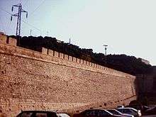
Archaeological sites
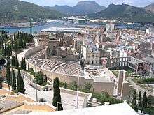
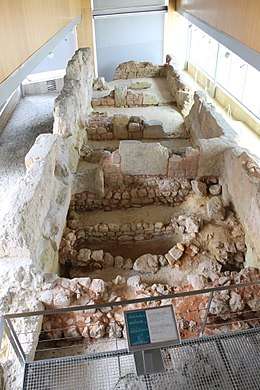
Although there are some ruins from the Carthaginian period, like the remains of the Punic rampart (built in 227 BC with the foundation of the city), most of its oldest monuments date from the time of the Roman Empire when Cartagena flourished. The archaeologist Blanca Roldán studied this Punic Rampart and other Punic remains, especially on the Molinete Hill. Among its numerous Roman remains, the recently restored Roman theatre of Carthago Nova is prominent and is one of the city's landmarks. work on it started at the end of the 2nd century BC. The Roman Theatre Museum was recently officially inaugurated. In Roman Republican Times, the mines near Cartagena provided silver and lead for all the Roman Empire.[55]
Other Roman remains can be found in several buildings and interpretative centres, including the Roman Colonnade, the House of Fortune, the decumanus/cardo and the Augusteum. The Torre Ciega was built by the Romans for burials; it formed part of the Necropolis.[55]
The Roman Amphitheatre (1st century AD) was sited where the now abandoned Bullring was built, but only some of the surrounding walls and part of the rooms under the stands are still visible. Recent work is revealing more evidence.
Besides the Roman heritage, archaeological sights include the remains of the Santa María la Vieja Cathedral, which was irreversibly destroyed during the Spanish Civil War. It dates from the end of the 13th century. The decorated floor of a Roman house of the 1st century BC can be found in the crypt.[56]
A Byzantine rampart can be found, close to the Roman Theatre and the Cathedral.[55]
The Concepción Castle (now Centre for the Interpretation of the History of Cartagena) was reconstructed in the 13th century using large structures from the Amphitheatre. Apart from the Roman Theatre Museum, there are also two important archaeological museums: the Municipal Archaeological Museum and the recently opened Arqua (National Museum of Maritime Archaeology).[55]
Baroque and Neo-classical buildings
The Campus Muralla del Mar, an old military hospital, was one of the first works carried out after the transformation of the city into the main Spanish naval base in the Mediterranean, and is now the seat of the Polytechnic University. In the vicinity, there is the Autopsy Theatre, which is where anatomy classes used to be given. Rehabilitation for tourism provides for the interpretation of the nearby buildings at the time of their construction.[57]
These buildings and several other baroque or neo-classical buildings demonstrate the military importance of Cartagena. These include the Charles III Rampart, the Castillo de San Julián, the Arsenal, the Midshipmen's Barracks (academy and naval barracks), the Naval Headquarter Palace (built in 1740 and subsequently rebuilt) and the Artillery Headquarters, which also houses the Military Museum. Among the Baroque or Neo-classical Churches in Cartagena are El Carmen, Santo Domingo and Santa Maria de Gracia.[57]
The austere façade of the Molina House hides the Centre of Arts and Craft.[58]
Modernist and Eclectic buildings
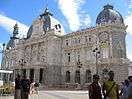
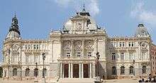
Cartagena is home to numerous Art Nouveau buildings from the early 20th century, when a bourgeoisie settled in the city due to the growth of the local mining industry. These buildings include the City Hall, the Grand Hotel, the Casino (all of them among the city's landmarks).
The Railway Station has some outstanding iron doors and columns on its façade, and inside can still be seen the original ticket office, doorframe, ceiling and the lamps. Other modernist or eclectic houses include the Clares House, the Aguirre Palace (which houses the Regional Museum of Modern Art, or MURAM), the Cervantes House (relatively big in comparison with other modernist buildings), the Llagostera House, the Pedreño Palace, the Dorda House, the Zapata House and the Urban Expansion Company House.[59]
Several charming, lively streets cover this area, such as Calle Mayor (High Street), the major pedestrian and commercial street of the city, full of boutiques and bars with typical "tapas", Carmen Street, Puertas de Murcia Street and many more.
The Caridad church is one of the most important churches in the city, since it is dedicated to the patron of Cartagena, Nuestra Señora de Caridad. The interior is dominated by a dome, similar to the Pantheon of Agrippa, in Rome. There are also several outstanding sculptures by the famous Murcian sculptor Francisco Salzillo and his school.[60]
Modern sights
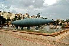
The Civil War Shelter-Museum is based on the galleries excavated out the Concepción hill (site of the Castle) to serve as air-raid shelters during the Spanish Civil War. Many naval and military attractions belong to this era, such as the Naval Museum and the world-famous Peral Submarine invented by Isaac Peral (born in Cartagena) that was launched in 1888 as one of the first U-Boats ever. It was displayed on Cartagena's harbour promenade until its move to the Naval Museum, after a full restoration.[61]
The Monument to the Heroes of Santiago de Cuba and Cavite (1923) is a war memorial erected in honour of the Spanish sailors who died in combat with the US Navy in waters off Cavite and Santiago off the Philippine and Cuban coasts.[62]
Other attractions include the Lift-Gangway near the former Bullring and the Concepción Hill, the Regional Assembly (the Parliament of the Region of Murcia) whose façade includes architectural influences from the Renaissance while maintaining a modernist air (typical in the Levant), and the Carmen Conde-Antonio Moliner Museum that reconstructs the atmosphere in which these poets from Cartagena created some of their most important works.[63]
Beaches
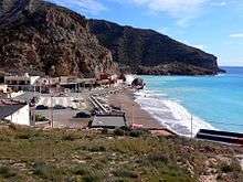
Although the city itself is only a port, within the city limits lies part of La Manga del Mar Menor (the other part belonging to the municipality of San Javier) which encompasses the Mar Menor. Cartagena also includes part of the Murcian Mediterranean Coast. Cartagena holds the distinction of being the Spanish city with the most beaches (10) certified "Q for Quality" by the ICTE (Instituto para la Calidad Turística Española). These beaches are: Cala Cortina, Islas Menores, Playa Honda beach, Mar de Cristal, Cala del Pino, Cavanna beach, Barco Perdido beach, El Galúa beach, Levante beach and La Gola beach.[64]
El Portús beach is adjacent to the naturist camping site, so nude bathing is practised on this beach.[65]
Transport
Cartagena is served by the Autopista AP-7 linking it to towns and cities further up the Mediterranean coast, and Autovía A-30 to Murcia. The Chinchilla–Cartagena railway reached Cartagena railway station in 1863 and the current station opened in 1903. It will be the future terminus of the Madrid–Levante high-speed rail network.
Sports
Probably, the most remarkable element in regards to sports is Fútbol Club Cartagena (F. C. Cartagena) team, which is in Segunda División B, the third level of the Spanish football league system. Another sport team is Futsal Cartagena, which is most in Segunda División during most seasons. A successful team is UCAM Cartagena Tenis de Mesa.[66][67]
Others sport that are played in the municipality is basketball along with Club Basket Cartagena; handball, which most noteworthy team is C.A.B. Cartagena and badminton along with UPCT Bádminton Cartagena.[68][69][70]
An international competition of aesthetic group gymnastics was held along with IFAGG (International Federation of Aesthetic Group Gymnastics) in Cartagena from 17 May to 19.[71][72]
Notable people
- Hasdrubal the Fair (c. 270 BC – 221 BC), military leader and general
- Hannibal (247 BC - 183 BC), military commander
- Liciniano de Cartagena (554-602), archbishop of the Diocese Cartaginense
- Hazim al-Qartayanni (1184-1211), poet
- Juan Fernández (1528-1599), mariner and explorer of the Pacific Ocean and Polynesia
- Sebastián Raval (1550-1604), composer
- Antonio de Escaño (1750-1814), army and naval officer
- Baltasar Hidalgo de Cisneros (1755-1829), naval officer
- Isidoro Máiquez (1768-1820), actor, painted by Francisco de Goya
- Isaac Peral (1851-1895), engineer, naval officer and designer of the Peral Submarine
- Marcos Jiménez de la Espada (1831-1898), zoologist, geographer, historian, herpetologist, explorer and writer
- Juan Luis Beigbeder y Atienza (1888-1957), military and political leader
- Luis Calandre (1890-1961), physician
- Antonio Oliver (1903-1968), poet, poeta pertaining to the Generación del 27
- Carmen Conde (1907-1996), writer
- Alfonso Pérez Sánchez (1935-2010), art historian and director of the Museo del Prado from 1983 to 1991
- Joaquín Navarro-Valls (b. 1936), doctor, journalist and writer
- Arturo Pérez-Reverte (b. 1951), novelist and journalist, member of the Real Academia Española
- Dolores Soler-Espiauba (b. 1935), novelist
- Federico Trillo (b. 1952), politician affiliated with the Partido Popular, ex-president of the Congreso de los Diputados and Spanish Ministry of Defence and current ambassador of Spain to the United Kingdom
- José Ortega Cano (b. 1953), bullfighter
- Eduardo Zaplana (b. 1956), politician affiliated with the Partido Popular
- Charris (b. 1962), painter
- José Carlos Martínez (b. 1969), dancer and choreographer
Festivals
These are the most known festivals of the municipality:[73]
- Cartagena's Holy Week, declared an item of International Tourist Interest. The main activity that is carried out during these festive days are the processions (solemn religious parades). The ones that take place in Cartagena have a special feature that consists in a specially high arrangement of the distribution and movement of the participants.[74]
- Carthaginians and Romans, declared an item of National Tourist Interest. The main festivities of the city, a colourful Carthaginian and Roman parade full of events that recall the Punic Wars and the conquest of the city by both Empires. Held over the final ten days of September.
- Cruces de Mayo: This festivity consists mainly in setting flowered Christian crosses with revere purposes.[75]
Festivities in the districts
- Patron saint festivities: Different patron saints are venerated and different festivities are held throughout the municipality. There are activities that are more or less frequent in these festivities such as little processions (festive religious parades) and romerías (religious festive acts that consist in a little procession where a statue of the Virgin or Christ is carried and end in a large festive people meeting at a isolated church).[75]
Twin towns - Sister cities
Cartagena is twinned with:
See also
- Campo de Cartagena
- Navantia Spanish Shipbuilding Industry
- Spanish Navy
- Isaac Peral Cartagena inventor of the electric submarine[78]
References
- Municipal Register of Spain 2018. National Statistics Institute.
- "Ayuntamiento de Cartagena". Ayto-cartagena.es. Retrieved 26 March 2013.
- "Callejero | Ayuntamiento de Cartagena". Ayto-cartagena.es. Archived from the original on 1 July 2012. Retrieved 26 March 2013.
- "Hasdrubal the Fair - Livius". www.livius.org.
- Qartayannat al-Halfa, Retrieved 9 September 2019
- "Historia de Cartagena - Región de Murcia Digital" (in Spanish). Retrieved 1 February 2020.
- "El auge económico de Cartagena y la revitalización del sureste español en los siglos XVI y XVII" (in Spanish). 2005. Retrieved 1 February 2020.
- "Autoridad Portuaria de Cartagena". Apc.es. Archived from the original on 8 September 2011. Retrieved 26 March 2013.
- "Ciudad Portuaria: Cartagena, ciudad de las cinco colinas. Parte I" (in Spanish). 16 November 2016. Retrieved 1 February 2020.
- "Historia de la Ciudad - Historia - Tu Ciudad - Ayuntamiento de Cartagena" (in Spanish). Retrieved 15 September 2018.
- "cartagena - CARM.es" (in Spanish). p. 11. Retrieved 1 February 2020.
- "El Clima - Atlas Global de la Región de Murcia". www.atlasdemurcia.com.
- "Archived copy" (PDF). Archived from the original (PDF) on 16 June 2015. Retrieved 8 March 2016.CS1 maint: archived copy as title (link)
- "Clima Cartagena: Temperatura, Climograma y Tabla climática para Cartagena - Climate-Data.org". es.climate-data.org.
- "Cartagena, Spain - Climate data". Weather Atlas. Retrieved 14 April 2017.
- "Archivo Municipal de Cartagena" (in Spanish). Retrieved 1 May 2020.
- "Barrios y Diputaciones I Historia I Tu Ciudad I Ayuntamiento de Cartagena" (in Spanish). Retrieved 1 May 2020.
- "El Medio Natural en Cartagena - EL MEDIO NATURAL" (in Spanish). Retrieved 5 September 2019.
- "Flora de la Comarca de Cartagena en peligro" (in Spanish). Retrieved 5 September 2019.
- "El medio natural en Cartagena - EL MEDIO NATURAL" (in Spanish). Retrieved 5 September 2019.
- García, Pepa (31 October 2017). "Los camaleones conquistan el monte". La Verdad (in Spanish). Vocento. Retrieved 14 March 2019.
- "Calblanque, Monte de las Cenizas y Peña del Águila". Web oficial turismo Región de Murcia (in Spanish). Instituto de Turismo de la Región de Murcia. Retrieved 11 September 2018.
- "Proyecto Plan de Ordenación de los recursos naturales. Sierra de la Muela, Cabo Tiñoso y Roldán". Dirección General del Medio Natural (in Spanish). Consejería de Industria y Medio Ambiente. Dirección General del Medio Natural. March 2006. p. 138. Retrieved 14 March 2019.
- "El medio natural en Cartagena - EL MEDIO NATURAL" (in Spanish). Retrieved 5 September 2019.
- "El medio natural en Cartagena - EL MEDIO NATURAL" (in Spanish). Retrieved 5 September 2019.
- "PORN_Calblanque.pdf" (PDF) (in Spanish). Retrieved 5 September 2019.
- "El Medio Natural en Cartagena - EL MEDIO NATURAL" (in Spanish). Retrieved 5 September 2019.
- "Publicación número 3564 del BORM número 131 de 08/06/2018" (in Spanish). Retrieved 5 September 2019.
- Grandal López, Alfonso (2005). Historia de Cartagena para principiantes (in Spanish). p. 33. ISBN 849566956-0.
- Grandal López, Alfonso. Historia de Cartagena para principiantes. p. 35.
- "Historia de San Antonio Abad - Prehistoria, Antigüedad y Edad Media - Región de Murcia Digital" (in Spanish). Retrieved 12 September 2018.
- "Historia de Rincón de San Ginés - Prehistoria - Región de Murcia Digital" (in Spanish). Retrieved 12 September 2018.
- Grandal López, Alfonso. Historia de Cartagena para principiantes. p. 38.
- Historia de Cartagena para principiantes. p. 40.
- Historia de Cartagena para principiantes. p. 41.
- Historia de Cartagena para principiantes. pp. 42–43.
- Historia de Cartagena para principiantes. p. 48.
- "Historia de La Aljorra - Historia de La Aljorra - Región de Murcia Digital" (in Spanish). Retrieved 12 September 2018.
- "Historia de Cartagena- Antigüedad - Región de Murcia Digital" (in Spanish). Retrieved 1 February 2020.
- "Historia de la Ciudad I Historia I Tu Ciudad I Ayuntamiento de Cartagena" (in Spanish). Retrieved 1 February 2020.
- Hammond, N.G.L. & Scullard, H.H. (Eds.) (1970). The Oxford Classical Dictionary, p. 209. Oxford: Oxford University Press. ISBN 0-19-869117-3.
- "Historia de Cartagena - Antigüedad - Región de Murcia Digital".
- "Historia de Cartagena - Edad Media Cristiana - Región de Murcia Digital" (in Spanish). Retrieved 15 September 2018.
- "1643 COMBATE DE CABO DE GATA – Melilla Medioambiente" (in Spanish). 1 February 2018. Retrieved 1 February 2020.
- "Historia de Cartagena - Siglo XIX - Región de Murcia Digital" (in Spanish). Retrieved 15 September 2018.
- "Historia de Cartagena- Siglo XX - Región de Murcia Digital" (in Spanish). Retrieved 1 February 2020.
- "Alterations to the municipalities in the Population Censuses since 1842". Instituto Nacional de Estadística (in Spanish). Retrieved 17 June 2011.
- "Urbanismo Cartagena" (in Spanish). Retrieved 1 February 2020.
- "Barrios y Diputaciones - Historia - Tu Ciudad - Ayuntamiento de Cartagena" (in Spanish). Retrieved 1 February 2020.
- "CREM - Datos Municipales Cartagena - 1. Evolución de la distribución general de la tierra" (in Spanish). Retrieved 8 February 2020.
- "CREM - Datos Municipales Cartagena - 3. Evolución de la superficie dedicada a cada grupo de cultivo" (in Spanish). Retrieved 10 June 2020.
- "Cifras de empleo municipal. 2º semestre de 2012. Municipio de Cartagena" (in Spanish). pp. 12, 18. Retrieved 10 June 2020.
- "Cifras de empleo municipal. 2º semestre de 2012. Municipio de Cartagena" (in Spanish). Retrieved 10 June 2020.
- "Cartagena Puerto de Culturas" (in Spanish). Retrieved 16 September 2018.
- "Concejalía de Turismo - Ayuntamiento de Cartagena" (in Spanish). Retrieved 14 September 2018.
- "Catedral Antigua de Santa María - Historia - Región de Murcia Digital" (in Spanish). Retrieved 14 September 2018.
- "Concejalía de Turismo - Ayuntamiento de Cartagena" (in Spanish). Retrieved 14 September 2018.
- "Casa Palacio Viuda del Molina - Región de Murcia Digital" (in Spanish). Retrieved 1 February 2020.
- "Itinerario Modernista y Ecléctico". Concejalía de Turismo (in Spanish). Ayuntamiento de Cartagena. Retrieved 14 September 2018.
- "Basílica de la Caridad". Región de Murcia Digital (in Spanish). Fundación Integra. Retrieved 14 September 2018.
- González, José Alberto (1 December 2011). "Submarino Peral: adiós Muelle, hola Museo Naval". La Verdad (in Spanish). Vocento. Retrieved 14 March 2019.
- "Itinerario Contemporáneo". Concejalía de Turismo (in Spanish). Ayuntamiento de Cartagena. Retrieved 14 September 2018.
- "Concejalía de Turismo - Ayuntamiento de Cartagena" (in Spanish). Retrieved 1 February 2020.
- "Playas". Concejalía de Turismo (in Spanish). Ayuntamiento de Cartagena. Retrieved 14 September 2018.
- Cornwell, Jane (19 August 2010). "El Portús, Spain: Easy on the naked eye". Metro. Retrieved 5 August 2016.
- "A Plásticos le llega su momento - La Opinión de Murcia" (in Spanish). 31 March 2016. Retrieved 31 January 2020.
- "UCAM CARTAGENA virtual campeón de liga Tenis de Mesa Femino" (in Spanish). 1 April 2019. Retrieved 31 January 2020.
- "El Basket de Cartagena seguirá otro año más en la Liga EBA - La Opinión de Murcia" (in Spanish). 14 July 2016. Retrieved 31 January 2020.
- "El CAB Cartagena, campeón de Segunda" (in Spanish). 23 April 2016. Retrieved 31 January 2020.
- "El UPCT Bádminton Cartagena brilla en el Campeonato Regional Absoluto" (in Spanish). 11 April 2019. Retrieved 31 January 2020.
- "20th IFAGG World Championships, Junior World Championships, IFAGG Trophy 2019, Cartagena, Spain - International Federation of Aesthetic Group Gymnastics, IFAGG". ifagg.sporttisaitti.com. Retrieved 3 February 2020.
- "Comienza en Cartagena el Campeonato del Mundo de Gimnasia Estética de Grupo, que podrá seguirse por streaming en internet" (in Spanish). Retrieved 3 February 2020.
- "Fiestas y Tradiciones - Cultura- Tu Ciudad - Ayuntamiento de Cartagena" (in Spanish). Retrieved 15 September 2018.
- "Semana Santa de Cartagena - Procesiones - Región de Murcia Digital" (in Spanish). Retrieved 2 May 2020.
- "Fiestas y Tradiciones I Información cultural I Tu Ciudad I Ayuntamiento de Cartagena" (in Spanish). Retrieved 2 May 2020.
- "Carthage". Comune-carthage (in Arabic). 2009–2014. Retrieved 14 March 2019.
- "Umbria: Towns Twinning". Comuni-Italiani.it. Prometheo. 2004. Retrieved 21 August 2013.
- Humble, Richard (1981). Underwater warfare. Chartwell Books, p. 174. ISBN 978-0-89009-424-2
Bibliography
- Kilgallon, Michael. Enemy of Belief. Fictional ebook featuring Cartagena.
External links
| Wikimedia Commons has media related to Cartagena. |
| Wikisource has the text of a 1911 Encyclopædia Britannica article about Cartagena. |
- Official Tourism Site of Murcia, Spain
- Cartagena City Hall (in Spanish)
- Viva Murcia Information and photographs for Cartagena
- Coast batteries of Cenizas and Castillitos
- Photos of Cartagena (click on English at the bottom)
- Handball Club Cartagena, Spain
| Authority control |
|
|---|