Caboolture, Queensland
Caboolture /kəˈbʊltʃər/[2] is a town and suburb in Moreton Bay Region, Queensland, Australia.[3][4] At the 2016 census, the town of Caboolture had an estimated population of 67,460.[1] It is located on the north side of the Caboolture River, which separates the town from Morayfield and Caboolture South.
| Caboolture Brisbane, Queensland | |||||||||||||||
|---|---|---|---|---|---|---|---|---|---|---|---|---|---|---|---|
 Caboolture CBD | |||||||||||||||
 Caboolture | |||||||||||||||
| Coordinates | 27°04′S 152°58′E | ||||||||||||||
| Population | 67,460 (2016 census)[1] | ||||||||||||||
| • Density | 704.2/km2 (1,823.8/sq mi) | ||||||||||||||
| Established | 1842 | ||||||||||||||
| Postcode(s) | 4510 | ||||||||||||||
| Area | 95.8 km2 (37.0 sq mi) | ||||||||||||||
| Location | 50 km (31 mi) north of Brisbane CBD | ||||||||||||||
| LGA(s) | Moreton Bay Region | ||||||||||||||
| State electorate(s) | |||||||||||||||
| Federal Division(s) | Longman | ||||||||||||||
| |||||||||||||||
Geography
Caboolture is an urban centre or satellite city approximately 44 kilometres (27 mi) north of Brisbane, the state capital of Queensland. Caboolture is considered to be the northernmost urban area of the greater Brisbane metropolitan region within South East Queensland, and it marks the end of the Brisbane suburban commuter railway service along the North Coast railway line.
The urban extent of the town of Caboolture is not formally defined but is generally regarded as including the following suburbs:
- Bellmere
- Caboolture (as a suburb)
- Caboolture South
- Morayfield (northern section, west of Bruce Highway)
- Upper Caboolture
History
Indigenous history
Duungidjawu (also known as Kabi Kabi, Cabbee, Carbi, Gabi Gabi) is an Australian Aboriginal language spoken on Duungidjawu country. The Duungidjawu language region includes the landscape within the local government boundaries of Somerset Region and Moreton Bay Region, particularly the towns of Caboolture, Kilcoy, Woodford and Moore.[5]
Gubbi Gubbi (Kabi Kabi, Cabbee, Carbi, Gabi Gabi) is an Australian Aboriginal language spoken on Gubbi Gubbi country. The Gubbi Gubbi language region includes the landscape within the local government boundaries of the Sunshine Coast Region and Gympie Region, particularly the towns of Caloundra, Noosa Heads, Gympie and extending north towards Maryborough and south to Caboolture.[6]
The Gubbi Gubbi people are the traditional custodians of the area now known as Caboolture. The name Kabultur is derived from the Yugarabul dialect meaning "place of the carpet snake".[7] The Gubbi Gubbi people harvested bush food, fresh water mussels, oysters, fish, and some game animals, moving around the land to take best advantage of seasonally-available produce.
Each year in March, the Gubbi Gubbi people would hold Bunya Festivals to feast on the plentiful and nutritious annual nuts of the Bunya Pine. These huge trees provided a food source which could sustain large numbers of people. Neighbouring clans were invited to the festivals, where singing, dancing story-telling, trading and arranging of marriages took place.
19th century
The Caboolture area was colonised by European people in 1842 when the land around the Moreton Bay penal colony was opened up to free settlers.[8]
By the mid-1860s the local pastoralists were experimenting with sugar cane and cotton. In 1867, a tiny settlement was established as a supply and trading centre for the settlers in the area and to service the needs of miners trekking from Brisbane to the goldfields near Gympie The local shire was constituted in 1879 and in 1888 the railway line from Brisbane was opened.[8]
Caboolture Post Office opened on 1 September 1869.[9]
Settlement in Caboolture was accelerated with the discovery of gold at Gympie. In 1868, the town was used as a stop-over point by the Cobb and Co coach service connecting Brisbane, Gympie and Maryborough. This function continued with the rail link established in 1888.
Recent history
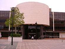
The Caboolture Library opened in 2011.[10]
As part of the 30th Anniversary of Expo 88 celebration, on 26 October 2018, artist Ken Done unveiled the restoration of his iconic signs made for the Australia pavilion at Expo 88. It had spent the intervening years in a cow paddock beside the Bruce Highway at Deception Bay. The restoration was undertaken by the Caboolture Historical Village where they will remain on display.[11]
Caboolture has the unenviable title as one of Australia's "dole" capitals.[12] It is also known for its crime along with neighbouring suburbs.[13]
Heritage listings
Caboolture has a number of heritage-listed sites, including:
- Buckle Street: Lagoon Creek Pumping Station[14]
Population and demographics

| Year | Population | Notes |
|---|---|---|
| 1933 | 1,215 | |
| 1947 | 1,423 | |
| 1954 | 1,947 | |
| 1961 | 2,466 | |
| 1966 | 2,960 | |
| 1971 | 3,830 | |
| 1976 | 5,588 | |
| 1981 | 7,934 | |
| 1986 | 11,220 | |
| 1991 | 22,178 | |
| 1996 | 30,702 | |
| 2001 | 33,230 | |
| 2006 | 37,085 | |
| 2011 | 59,052 | [15] |
| 2016 | 67,460 | [1] |
According to the 2016 census of Population, there were 67,460 people in Caboolture
- Aboriginal and Torres Strait Islander people made up 4.8% of the population.
- 75.7% of people were born in Australia. The next most common countries of birth were New Zealand 4.6%, England 3.5%, Philippines 0.9%, Taiwan 0.6% and South Korea 0.5%.
- 85.8% of people spoke only English at home. Other languages spoken at home included Mandarin 0.8%, Samoan 0.6%, Tagalog 0.4%, Korean 0.4% and Cantonese 0.3%.
- The most common responses for religion were No Religion 33.2%, Catholic 19.0% and Anglican 15.7%.[1]
Transport
Caboolture is a regional transport hub. With its connections across the Great Dividing Range via the D'Aguilar Highway, easy highway access to Brisbane and the Sunshine Coast via the Bruce Highway, and the Bribie Island Road to Bribie Island.
Caboolture railway station is the terminus for QR Citytrain's Caboolture railway line, as well as being a major stop on the North Coast railway line. Citytrain operates regular services to Brisbane, in addition to interurban services to Nambour and Gympie. The area is serviced by two bus companies, Caboolture Bus Lines and the larger Kangaroo Bus Lines.
Caboolture also contains its own airfield, which primarily services general and recreational aviation. Visiting aircraft are able to operate into the Caboolture airstrip, which is under the operational control of the Caboolture Aero Club Inc. Additionally the airport is home to a number of aviation enterprises and attractions - amongst them, the Caboolture Warplane Museum (with operational P-51 Mustang, CAC Wirraway and CAC Winjeel aircraft), skydiving club, and the Beaufort Restoration group (a group of volunteers restorating an Australian-built DAP Beaufort Mark VII Bomber).
Sport

Caboolture's senior sporting teams predominantly play in the respective Sunshine Coast competitions. The suburbs cricket club are reigning Sunshine Coast Cricket Association first division premiers. The rugby union club have rejoined the Sunshine Coast Rugby Union competition after a few years in Queensland Suburban rugby's Barber Cup.[16]
The town also has a Little Athletics club.[17]
Education
State schools
Caboolture State School is a government primary (Prep-6) school for boys and girls at 12 George Street (27.0825°S 152.9487°E). It includes a special education program.[18][19] In 2017, the school had an enrolment of 558 students with 41 teachers (37 full-time equivalent) and 39 non-teaching staff (26 full-time equivalent).[20]
Caboolture State High School is a government secondary (7-12) school for boys and girls at Lee Street (27.0841°S 152.9610°E).[18][21] It includes a special education program. In 2017, the school had an enrolment of 1248 students with 110 teachers (107 full-time equivalent) and 57 non-teaching staff (44 full-time equivalent).[20]
Caboolture East State School is a government primary (Early Childhood-6) school for boys and girls at 44 Manley Street (27.0775°S 152.9609°E). It includes a special education program and an early childhood developmental program.[18][22] In 2017, the school had an enrolment of 624 students with 54 teachers (49 full-time equivalent) and 54 non-teaching staff (34 full-time equivalent).[20]
Pumicestone State School is a government primary (Prep-6) school for boys and girls at 75 Cottrill Road (27.058°S 152.9565°E). It includes a special education program.[18][23] In 2017, the school had an enrolment of 380 students with 27 teachers (25 full-time equivalent) and 17 non-teaching staff (13 full-time equivalent).[20]
Tullawong State School is a government primary (Prep-6) school for boys and girls at 60-94 Smiths Road (27.0699°S 152.9327°E). It includes a special education program.[18][24] In 2017, the school had an enrolment of 757 students with 57 teachers (52 full-time equivalent) and 47 non-teaching staff (27 full-time equivalent).[20]
Tullawong State High School is a government secondary (7-12) school for boys and girls at Del Rosso Road (27.0705°S 152.9289°E). It includes a special education program.[18][25] In 2017, the school had an enrolment of 912 students with 86 teachers (80 full-time equivalent) and 43 non-teaching staff (33 full-time equivalent).[20]
Private schools
Alta-1 College is a private secondary (11-12) school for boys and girls at 94 Parish Road (27.0710°S 152.9415°E).[18][26] In 2017, the school had an enrolment of 32 students with 3 teachers (2 full-time equivalent) and 5 non-teaching staff (4 full-time equivalent).[20]
Australian Christian College - Moreton is a private primary and secondary (Prep-12) school for boys and girls at 34 Cottrill Road (27.0576°S 152.9525°E).[18][27] In 2017, the school had an enrolment of 1173 students with 47 teachers and 22 non-teaching staff (16 full-time equivalent).[20]
Caboolture Montessori School is a private primary (Prep-6) school for boys and girls at 200 Old Gympie Road (27.0554°S 152.9392°E).[18][28] In 2017, the school had an enrolment of 139 students with 14 teachers (12 full-time equivalent) and 24 non-teaching staff (16 full-time equivalent).[20]
Grace Lutheran College is a private secondary (7-12) facility of Grace Lutheran College at Rothwell at 129 Toohey Street (27.0743°S 152.9381°E).[18][29]
Horizons College is a private secondary (9-12) school for boys and girls at 2 King Street (27.0856°S 152.9541°E).[18][30] In 2017, the school had an enrolment of 110 students with 14 teachers (11 full-time equivalent) and 11 non-teaching staff (10 full-time equivalent).[20]
St Columban's College is a Catholic secondary (7-12) school for boys and girls at 100 McKean Street (27.0790°S 152.9627°E).[18][31] In 2017, the school had an enrolment of 1004 students with 83 teachers (79 full-time equivalent) and 67 non-teaching staff (43 full-time equivalent).[20]
St Michael's College is a private primary (Prep-6) school for boys and girls at Jan-63 The Abbey Place (27.0694°S 153.0174°E).[18][32] In 2017, the school had an enrolment of 335 students with 25 teachers (22 full-time equivalent) and 28 non-teaching staff (19 full-time equivalent).[20]
St Paul's Lutheran Primary School is a private primary (Prep-6) school for boys and girls at 55 Smith Road (27.0720°S 152.9328°E).[18][33] In 2017, the school had an enrolment of 356 students with 23 teachers (21 full-time equivalent) and 28 non-teaching staff (19 full-time equivalent).[20]
St Peter's Catholic Primary School is a Catholic primary (Prep-6) school for boys and girls at 30 Beerburrum Road (27.0803°S 152.9518°E).[18][34] In 2017, the school had an enrolment of 677 students with 42 teachers (38 full-time equivalent) and 27 non-teaching staff (18 full-time equivalent).[20]
Amenities
The Moreton Bay Regional Council operates a public library and art gallery at 4 Hasking Street.[35][36]
The Caboolture branch of the Queensland Country Women's Association meets at 10 George Street. It is one of the oldest in Queensland, having commenced in 1929.[37]
Governance
Caboolture was for most of its history the council seat of the Shire of Caboolture, however, the Shire merged into the Moreton Bay Region following statewide local government reforms in March 2008. Caboolture is divided between the electoral districts of Pumicestone and Morayfield in the Legislative Assembly of Queensland, and forms the main part of the Division of Longman in the Australian House of Representatives
Events
Caboolture hosts an annual country music festival and a ute muster each year, called the Urban Country Music Festival.[38]
Notable people
- Paul Aiton, a Papua New Guinea rugby league captain
- Glen Boss, a jockey who has won the Melbourne Cup three times
- Andrew Lofthouse, a newsreader
- Rod Pampling, a PGA Tour professional golfer
- Keith Urban, a singer who was born in New Zealand, and moved to Caboolture, aged two years
- Corey Horsburgh, a rugby league player for the Canberra Raiders. Commonly referred to as the goat of Caboolture
References
- Australian Bureau of Statistics (27 June 2017). "Caboolture (SA3)". 2016 Census QuickStats. Retrieved 3 October 2018.


- Macquarie Dictionary, Fourth Edition (2005). Melbourne, The Macquarie Library Pty Ltd. ISBN 1-876429-14-3
- "Caboolture - town (entry 5642)". Queensland Place Names. Queensland Government. Retrieved 26 June 2017.
- "Caboolture - suburb (entry 49600)". Queensland Place Names. Queensland Government. Retrieved 26 June 2017.
-

-
- South East Queensland - Place Names Archived 21 August 2006 at the Wayback Machine 2 January 2006
- History of our towns | Caboolture Shire Council Archived 16 August 2007 at the Wayback Machine
- Premier Postal History. "Post Office List". Premier Postal Auctions. Archived from the original on 15 May 2014. Retrieved 10 May 2014.
- "Public Libraries Statistical Bulletin 2016-17" (PDF). Public Libraries Connect. State Library of Queensland. November 2017. p. 14. Archived (PDF) from the original on 30 January 2018. Retrieved 30 January 2018.
- "Join us live for the unveiling of Expo 88's stacked Australia sign". ABC Radio Brisbane. 12 October 2018. Archived from the original on 15 November 2018. Retrieved 15 November 2018.
- "Queensland Suburb Ruled Australia's Dole Bludging Capita". Triple M. 13 June 2017. Archived from the original on 3 November 2019. Retrieved 3 November 2019.
- "CRIME RATES—CABOOLTURE, NARANGBA, NORTH LAKES". Vincent Security. Archived from the original on 3 November 2019. Retrieved 3 November 2019.
- "Lagoon Creek Railway Water Supply Facility and Pump Station (entry 602236)". Queensland Heritage Register. Queensland Heritage Council. Retrieved 11 July 2013.
- Australian Bureau of Statistics (31 October 2012). "Caboolture (SA3)". 2011 Census QuickStats. Retrieved 7 October 2015.
- "Gympie in Rugby A Grade 2020, Coolum get first 2A win". Around the Grounds. Sunshine Coast. 12 November 2018. Retrieved 31 December 2018.
- "Caboolture Little Athletics". Caboolture Little Athletics. Archived from the original on 13 March 2018. Retrieved 13 March 2018.
- "State and non-state school details". Queensland Government. 9 July 2018. Archived from the original on 21 November 2018. Retrieved 21 November 2018.
- "Caboolture State School". Archived from the original on 29 April 2013. Retrieved 21 November 2018.
- "ACARA School Profile 2017". Archived from the original on 22 November 2018. Retrieved 22 November 2018.
- "Caboolture State High School". Archived from the original on 24 April 2019. Retrieved 21 November 2018.
- "Caboolture East State School". Retrieved 21 November 2018.
- "Pumicestone State School". Retrieved 21 November 2018.
- "Tullawong State School". Archived from the original on 25 April 2013. Retrieved 21 November 2018.
- "Tullawong State High School". Archived from the original on 27 July 2012. Retrieved 21 November 2018.
- "Alta-1 College". Archived from the original on 6 October 2008. Retrieved 21 November 2018.
- "Australian Christian College - Moreton". Archived from the original on 13 December 2018. Retrieved 21 November 2018.
- "Caboolture Montessori School". Archived from the original on 27 December 2018. Retrieved 21 November 2018.
- "Grace Lutheran College". Archived from the original on 15 December 2018. Retrieved 21 November 2018.
- "Horizons College". Archived from the original on 29 December 2018. Retrieved 21 November 2018.
- "St Columban's College". Archived from the original on 19 August 2013. Retrieved 21 November 2018.
- "St Michael's College". Archived from the original on 17 May 2018. Retrieved 21 November 2018.
- "St Paul's Lutheran Primary School". Archived from the original on 4 November 2018. Retrieved 21 November 2018.
- "St Peter's Catholic Primary School". Archived from the original on 4 March 2016. Retrieved 21 November 2018.
- "Caboolture Library". Moreton Bay Regional Council. Archived from the original on 31 January 2018. Retrieved 30 January 2018.
- "Caboolture Regional Art Gallery". Moreton Bay Regional Council. Archived from the original on 19 May 2019. Retrieved 3 April 2020.
- "Branch Locations". Queensland Country Women's Association. Archived from the original on 26 December 2018. Retrieved 26 December 2018.
- www.urbancountry.com.au Archived 18 November 2012 at the Wayback Machine
External links
| Wikimedia Commons has media related to Caboolture, Queensland. |
| Topics |
| |
|---|---|---|
| Regions | ||
| Cities and towns | ||
| ||
| Authority control |
|
|---|