Narangba, Queensland
Narangba is a town and suburb of the Moreton Bay Region, Queensland, Australia.[2][3] It is located 34 km north of Brisbane.
| Narangba Queensland | |||||||||||||||
|---|---|---|---|---|---|---|---|---|---|---|---|---|---|---|---|
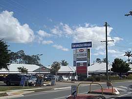 Narangba Village Shopping Centre | |||||||||||||||
 Narangba | |||||||||||||||
| Coordinates | 27.2022°S 152.9591°E | ||||||||||||||
| Population | 18,573 (2016 census)[1]> | ||||||||||||||
| • Density | 380.6/km2 (985.7/sq mi) | ||||||||||||||
| Postcode(s) | 4504 | ||||||||||||||
| Area | 48.8 km2 (18.8 sq mi) | ||||||||||||||
| Location |
| ||||||||||||||
| LGA(s) | Moreton Bay Region | ||||||||||||||
| State electorate(s) | |||||||||||||||
| Federal Division(s) | |||||||||||||||
| |||||||||||||||
This suburb has rural origins, but is being redeveloped as a residential suburb on the outskirts of the greater Brisbane metropolitan area. In the 2016 census, Narangba had a population of 18,573 people.[1]
History
The name Narangba possibly originated from an Aboriginal word meaning "small ridge", and that describes the area where the railway station with its associated township was situated.[4] Earlier, it was part of an area referred to as Stoney Creek. The railway station was first called Sideling Creek Station, later renamed as Narangba. The suburb lies within the Burpengary Creek catchment area.
An award-winning Development Control Plan[5] has resulted in major residential interest regarding the areas of Narangba and Burpengary, with infrastructure matching population growth. An industrial estate providing services required by manufacturing and general industries has taken full advantage of the shire's transport corridors, with sites on either side of the Bruce Highway.
Demographics
In the 2016 census, Narangba recorded a population of 18,573 people, 50.8% of whom are females and 49.2% of whom are males.[1] The median age of the Narangba population was 32 years, 6 years below the national median of 38.[1] 78.2% of people living in Narangba were born in Australia. The other top responses for country of birth were England 5.7%, New Zealand 5.1%, South Africa 1.1%, Philippines 0.5%, Scotland 0.5%.[1] 91.7% of people spoke only English at home; the next most common languages were 0.5% Afrikaans, 0.3% Hindi, 0.3% Filipino, 0.2% German, 0.2% Italian, 0.2%.[1]
| Year | Population | Notes |
|---|---|---|
| 1911 | 58 | [6] |
| 1961 | 457 | [6] |
| 1991 | 992 | [6] |
| 2006 | 12,997 | [6] |
| 2011 | 16,223 | [6] |
| 2016 | 18,573 | [1] |
Climate
The climate in Narangba is a humid subtropical climate (Köppen climate classification: Cfa). It consists of hot, humid and wet summers and mild, mainly dry winters.
Precipitation in the warmer months is usually from thunderstorms, of which many can be severe. It can also come from remnants of cyclones sweeping down the east coast. In the winter months, precipitation comes from cold fronts or an Australian east coast low (also known as an ECL).
Community
The local newspapers are Our Narangba Magazine, the Caboolture Shire Herald and the Caboolture News. Other regional and national newspapers such as The Courier-Mail and The Australian are also available.
Shopping and dining
A basic community shopping village is located on Main Street within the original retail precinct of Narangba opposite the train station. The master planned estate of Forest Ridge boasts a modern shopping precinct at the intersection of Young Road and Golden Wattle Drive, this complex consists of a Woolworths, bakery, a 24hr gym, Red Rooster and the Narangba Valley Tavern among other retail stores.
With the development of the neighbouring master planned estate of Narangba Heights, there is growing speculation of an IGA or equivalent to be built at the intersection of Oakey Flat Road and Raynbird Road although this development is yet to be formally announced.
Parks
There are several parks and community open spaces in Narangba spanning many kilometers in every direction. Most create a pleasant link between neighbouring streets and children's playgrounds however in the case of the highly sought after Forest Ridge precinct of Creekside, the parks meander along the tranquil Burpengary Creek which is home to many unique Australian birds and animals, and has been identified as a naturally occurring sub-tropical environment and ecosystem. The green space surrounding the creek includes many native palms, large stag-horns and tree ferns.
Narangba has many sporting facilities, notably there are two baseball/softball pitches and three soccer fields off Harris Avenue,[7] as well as two rugby fields as a part of Duncombe Park.[8] Additionally, there is a basketball half court, a dog park, and a small skate park off Harris Avenue.[7]
Schools
- Narangba State School[9] The school opened on 21 January 1910.[10]
- Jinibara State School[11] The school was opened on 29 January 1996.[10]
- Narangba Valley State School[12] The school was opened on 1 January 2005.[10]
- Narangba Valley State High School[13] The school was opened on 1 January 2000.[10]
A new Catholic primary and secondary school is expected to open in 2025 initially offering Prep to Year 3 and Year 7 schooling.[14]
Transport
Narangba railway station provides regular Queensland Rail City network services to Brisbane and Ipswich, as well as Caboolture and the Sunshine Coast.
The 663 local loop bus service provides transport throughout the suburb connecting it to train services. The 668 service runs from Narangba railway station to the nearby suburb of North Lakes.
Being near the Bruce Highway, Narangba is easily accessible to both the Sunshine Coast and Brisbane averaging 40min by car for either destination.
In 2014 Queensland Rail Translink completed works on the recently refurbished Narangba train station creating a state of the art facility consisting of multiple platforms and secure car parks. Narangba train station now forms a staging point for inbound and outbound express trains which cater to the growing executive class who call Narangba home and make the commute into the Brisbane CBD on a daily basis.[15]
References
- Australian Bureau of Statistics (27 June 2017). "Narangba (SSC)". 2016 Census QuickStats. Retrieved 20 October 2018.

- "Narangba - town (entry 23848)". Queensland Place Names. Queensland Government. Retrieved 13 April 2017.
- "Narangba - suburb (entry 49811)". Queensland Place Names. Queensland Government. Retrieved 13 April 2017.
- Moreton Bay Regional Council. "Narangba". Archived from the original on 6 April 2012. Retrieved 8 December 2011.
- "Archived copy". Archived from the original on 16 August 2007. Retrieved 19 June 2007.CS1 maint: archived copy as title (link) Accessed 03/02/08
- "Narangba". Centre for the Government of Queensland. Archived from the original on 12 September 2017. Retrieved 12 September 2017.
- Google (12 September 2017). "Harris Ave" (Map). Google Maps. Google. Retrieved 12 September 2017.
- Google (12 September 2017). "Duncombe Park" (Map). Google Maps. Google. Retrieved 12 September 2017.
- "Narangba SS". Archived from the original on 2 February 2017. Retrieved 29 January 2017.
- "Opening and closing dates of Queensland Schools". Queensland Government. Retrieved 18 April 2019.
- "Jinibara SS". Archived from the original on 2 February 2017. Retrieved 29 January 2017.
- "Narangba Valley SS". Archived from the original on 2 February 2017. Retrieved 29 January 2017.
- "Narangba Valley SHS". Archived from the original on 4 February 2017. Retrieved 29 January 2017.
- "New Schools". Brisbane Catholic Education. Retrieved 4 December 2019.
- "Narangba upgrade on its way". Archived from the original on 12 September 2017. Retrieved 12 September 2017.