Burpengary, Queensland
Burpengary is a town and suburb in the Moreton Bay Region, Queensland, Australia.[2][3] It is 35 kilometres (22 mi) from the Brisbane CBD.
| Burpengary Moreton Bay Region, Queensland | |||||||||||||||
|---|---|---|---|---|---|---|---|---|---|---|---|---|---|---|---|
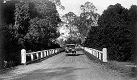 Austin motor vehicle crossing a bridge on the North Coast Road at Burpengary, 1934 | |||||||||||||||
 Burpengary | |||||||||||||||
| Coordinates | 27°09′16″S 152°58′22″E | ||||||||||||||
| Population | 14,022 (2016 census)[1] | ||||||||||||||
| Postcode(s) | 4505 | ||||||||||||||
| Location | 35 km (22 mi) from Brisbane GPO | ||||||||||||||
| LGA(s) | Moreton Bay Region | ||||||||||||||
| State electorate(s) | |||||||||||||||
| Federal Division(s) | Longman | ||||||||||||||
| |||||||||||||||
Burpengary is one of Moreton Bay region's fastest growing residential areas.[4] Major retailers in Burpengary include ALDI, Woolworths Limited, Coles Supermarkets and Kmart Australia.[5]
Geography
The locality is bounded to the east by the Bruce Highway, to the west by Oakey Flat Road, to the north-west by the North Coast railway line, and to the south-west by Burpengary Creek and the North Coast railway line.[6]
Burpengary Creek is the suburb's main waterway.[6]
History
The name is derived from the Aboriginal word burpengar, meaning the "place of the green wattle".[7]
When Europeans settled in Burpengary in the 1870s, the industry was mainly timber-cutting.
Burpengary State School was established in 1876.[8]
The town of Burpengary was initially founded as a large truckstop due to its strategic location on the North Coast Road (now the Bruce Highway) from Brisbane to the North Coast (now the Sunshine Coast). Burpengary is still home to a functional truck weigh-bridge.
St Eugene College (Burpengary's first secondary school) opened in 1989.[9]
Burpengary Library opened in 1994 and had a major refurbishment in 2016.[10]
Burpengary Meadows State School opened in 2007.[11]
Burpengary State Secondary College opened in 2015, offering years 7 and 8 initially.[12]
Redwood College opened in 2018 for distance education only, but on completion of its campus, expects to enrol on-campus students from 2020.[13]
Amenities
Burpengary is also home to the Caboolture Regional Aquatic Centre which houses a 50m Olympic pool, a 25m warm up pool, aqua aerobics, tennis, beach volleyball, gymnasium, cafe, barbecues and landscaped settings and enclosed children's play areas. A new centre in the area is the AFL fields, where the Brisbane Lions played three Australian Football League pre-season competition matches.
The Moreton Bay Regional Council operates a public library at 121 Station Road.[14]
The Burpengary Group of the Queensland Country Women's Association meets at CREEC Facility on 150 Rowley Road.[15]
Demographics
Burpengary has been a predominantly blue-collar suburb with a significant proportion of the population directly employed in a labouring or trade-related jobs.
However, with expanding planned communities, easy access to the M1 and council approving plans for mini city initiatives, more and more families are moving to the locality including those in the professions. This is fuelling economic growth with the expansion of the shopping precinct, local services and increasing pressure on the local transport infrastructure since 2005.
In the 2016 census, the population of Burpengary was 14,022, with 51% females and 49% males.[1]
The median age of the Burpengary population was 37 years of age, 1 year below the Australian median. Children aged under 15 years made up 20.7% of the population and people aged 65 years and over made up 13.6% of the population.[1]
78.6% of people living in Burpengary were born in Australia. The other top responses for country of birth were England 4.7%, New Zealand 4.2%, South Africa 0.7%, Philippines 0.7%, and Scotland 0.6%.[1]
90.7% of people spoke only English at home; the next most popular languages were Samoan (0.4%), Mandarin (0.3%), Tagalog (0.3%), Dutch (0.3%), and Afrikaans (0.2%).[1]
Education
Burpengary State School is a government primary (Prep-6) school for boys and girls at 35 Station Road (27.1577°S 152.9590°E).[16][17] In 2017, the school had an enrolment of 995 students with 69 teachers (63 full-time equivalent) and 36 non-teaching staff (24 full-time equivalent).[18] The school includes an intensive English language program and a special education program.[16]
St Eugene College is a Catholic primary and secondary (Prep-12) school for boys and girls at 138 Station Road (27.1525°S 152.9689°E).[16][19] In 2017, the school had an enrolment of 1053 students with 78 teachers (74 full-time equivalent) and 51 non-teaching staff (35 full-time equivalent).[18]
Burpengary Meadows State School is a government primary (Prep-6) school for boys and girls at 153 Rowley Road (27.1598°S 152.9382°E).[16][20] In 2017, the school had an enrolment of 625 students with 47 teachers (37 full-time equivalent) and 28 non-teaching staff (17 full-time equivalent).[18] The school includes a special education program.[16]
Burpengary State Secondary College is a government secondary (7-12) school for boys and girls at 196 Pitt Road (27.1706°S 152.9773°E).[16][21] In 2017, the school had an enrolment of 685 students with 54 teachers (53 full-time equivalent) and 25 non-teaching staff (17 full-time equivalent).[18] The school includes a special education program.[16]
Redwood College is a private primary and secondary (Prep-10) school at 6 Gleeson Road (27.1379°S 152.9661°E).[16][13] It offers a distance education program and, after construction of its campus, expects to accept on-campus enrolments from 2020.[13]
Transport
Burpengary railway station provides access to regular Queensland Rail City network services to Brisbane and Ipswich, as well as Caboolture and the Sunshine Coast. Burpengary is linked regionally by Kangaroo Bus Lines which operate services primarily to Redcliffe and Caboolture.
Notable residents
- Loretta Marron, health advocate and CEO of Friends of Science in Medicine.
References
- Australian Bureau of Statistics (27 June 2017). "Burpengary (State Suburb)". 2016 Census QuickStats. Retrieved 12 July 2017.

- "Burpengary - population centre in the Moreton Bay Region (entry 39163)". Queensland Place Names. Queensland Government. Retrieved 30 May 2014.
- "Burpengary - locality in the Moreton Bay Region (entry 46997)". Queensland Place Names. Queensland Government. Retrieved 30 May 2014.
- "Caboolture township history - Moreton Bay Regional Council". Archived from the original on 26 March 2018. Retrieved 5 August 2015.
- LJ Hooker. "Burpengary Plaza". Retrieved 26 March 2018.
- "Queensland Globe". State of Queensland. Retrieved 5 May 2019.
- Moreton Bay Regional Council. "Burpengary". Retrieved 8 December 2011.
- "Our school". Burpengary State School. Retrieved 22 October 2017.
- Queensland Family History Society (2010), Queensland schools past and present (Version 1.01 ed.), Queensland Family History Society, ISBN 978-1-921171-26-0
- "Public Libraries Statistical Bulletin 2016–17" (PDF). Public Libraries Connect. State Library of Queensland. November 2017. p. 14. Archived (PDF) from the original on 30 January 2018. Retrieved 30 January 2018.
- "Our school". Burpengary Meadows. Retrieved 22 October 2017.
- "Principal's welcome". Burpengary State Secondary College. Retrieved 22 October 2017.
- "Redwood College". Retrieved 21 November 2018.
- "Burpengary Library". Moreton Bay Regional Council. Retrieved 30 January 2018.
- "Branch Locations". Queensland Country Women's Association. Retrieved 26 December 2018.
- "State and non-state school details". Queensland Government. 9 July 2018. Archived from the original on 21 November 2018. Retrieved 21 November 2018.
- "Burpengary State School". Retrieved 21 November 2018.
- "ACARA School Profile 2017". Archived from the original on 22 November 2018. Retrieved 22 November 2018.
- "St Eugene College". Retrieved 21 November 2018.
- "Burpengary Meadows State School". Retrieved 21 November 2018.
- "Burpengary State Secondary College". Retrieved 21 November 2018.
Further reading
- Down the track 120 years : a living history of the Burpengary State School, Burpengary State School>, 1996