Bukit Panjang
Bukit Panjang, often abbreviated as Bt Panjang or simply BP, is a planning area and residential town located in the West Region of Singapore. The planning area is bounded by Bukit Batok to the west, Choa Chu Kang to the northwest, Sungei Kadut to the north, the Central Water Catchment to the east and Bukit Timah to the south. Bukit Panjang New Town is located at the northern portion of the planning area. Bukit Panjang has an average elevation of 36m/118 ft and a portion of this town is situated on a low-lying elongated hill.[4]

Bukit Panjang | |
|---|---|
| Other transcription(s) | |
| • English | Long Hill |
| • Chinese | 武吉班让 |
| • Malay | Bukit Panjang |
| • Tamil | பக்கிட் பஞ்சாங் |
.jpg) .jpg) 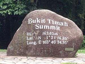  From top left to right: HDB flats in Bukit Panjang, Senja-Cashew Community Club with HDB flats in the background, Summit of Bukit Timah Hill, Zhenghua Community Club | |

Location of Bukit Panjang in Singapore | |
.svg.png) Bukit Panjang  Bukit Panjang Bukit Panjang (Asia) .svg.png) Bukit Panjang Bukit Panjang (Earth) | |
| Coordinates: 1°22′51.00″N 103°45′45.00″E | |
| Country | |
| Region | West Region
|
| CDC | |
| Town council |
|
| Constituencies | |
| Government | |
| • Mayor | North West CDC
|
| • Members of Parliament | Bukit Panjang SMC
Holland-Bukit Timah GRC |
| Area | |
| • Total | 8.99 km2 (3.47 sq mi) |
| • Residential | 2.19 km2 (0.85 sq mi) |
| Population | |
| • Total | 139,280 |
| • Density | 15,000/km2 (40,000/sq mi) |
| Demonym(s) | Official
Colloquial
|
| Ethnic groups | |
| • Chinese | 103,280 |
| • Malays | 22,230 |
| • Indians | 10,300 |
| • Others | 3,210 |
| Postal districts | 21, 23 |
| Dwelling units | 34,463 |
| Projected ultimate | 44,000 |
Etymology
Bukit in Malay means "hill" and Panjang means "long". Therefore, Bukit Panjang literally means Long Hill which gets its name from the long range of high hills which ends in Bukit Timah to the south.
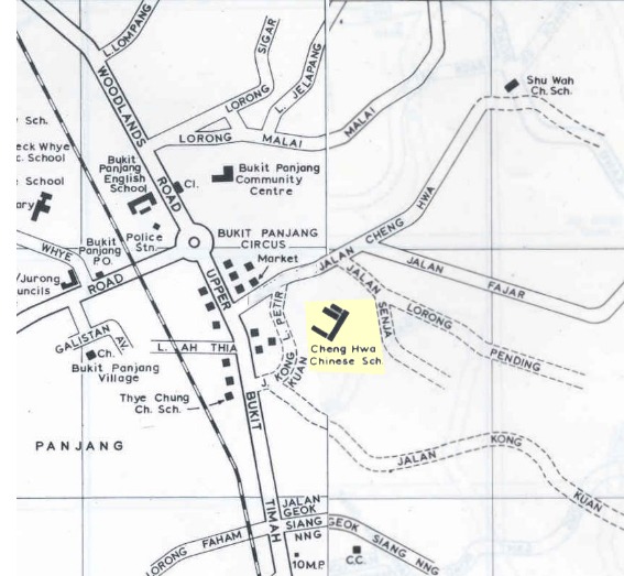
At the height of the movement to change place names in Singapore to Mandarin ones using Hanyu Pinyin romanization, the new town to be built in the area was initially known as Zhenghua, after the Pinyinised version of "Cheng Hwa", which was derived from the old road, Jalan Cheng Hwa.[5] The trading of old dialect names which have gained common currency for unfamiliar, Mandarin ones were not well received by the public, and Bukit Panjang was quickly reinstated. However, the name Zhenghua is preserved in the name of the flyover between Bukit Panjang Road and the Bukit Timah Expressway as well as the Zhenghua Park.
Most of the roads in this town are named after old village tracks from the 1960s, such as Petir, Pending, Fajar and Senja, which used to ply the area.[6]
Climate
| Climate data for Bukit Panjang (34m) (2011–present) | |||||||||||||
|---|---|---|---|---|---|---|---|---|---|---|---|---|---|
| Month | Jan | Feb | Mar | Apr | May | Jun | Jul | Aug | Sep | Oct | Nov | Dec | Year |
| Record high °C (°F) | 34.1 (93.4) |
35.7 (96.3) |
36.1 (97.0) |
35.8 (96.4) |
35.9 (96.6) |
35.4 (95.7) |
35.6 (96.1) |
35.2 (95.4) |
35.6 (96.1) |
35.8 (96.4) |
35.0 (95.0) |
34.0 (93.2) |
36.1 (97.0) |
| Average high °C (°F) | 30.4 (86.7) |
31.2 (88.2) |
32.7 (90.9) |
33.9 (93.0) |
33.2 (91.8) |
32.8 (91.0) |
32.7 (90.9) |
33.5 (92.3) |
32.5 (90.5) |
32.7 (90.9) |
31.6 (88.9) |
30.7 (87.3) |
32.3 (90.2) |
| Average low °C (°F) | 25.9 (78.6) |
26.9 (80.4) |
27.7 (81.9) |
28.4 (83.1) |
28.6 (83.5) |
28.3 (82.9) |
27.7 (81.9) |
27.3 (81.1) |
27.1 (80.8) |
27.2 (81.0) |
26.6 (79.9) |
26.3 (79.3) |
27.3 (81.2) |
| Record low °C (°F) | 19.9 (67.8) |
21.3 (70.3) |
23.7 (74.7) |
22.9 (73.2) |
22.4 (72.3) |
21.9 (71.4) |
21.5 (70.7) |
21.3 (70.3) |
20.9 (69.6) |
20.7 (69.3) |
20.4 (68.7) |
20.2 (68.4) |
19.9 (67.8) |
| Average rainfall mm (inches) | 194 (7.6) |
88 (3.5) |
137 (5.4) |
152 (6.0) |
166 (6.5) |
138 (5.4) |
118 (4.6) |
143 (5.6) |
159 (6.3) |
168 (6.6) |
193 (7.6) |
201 (7.9) |
1,857 (73) |
History
Before its redevelopment as a suburban town in western Singapore, Kampong Bukit Panjang was a village that used to exist in the area. The development of the town and advanced earthworks began in 1981. Public housing flats rose up by 1985, but only Blocks 1xx and 2xx were built so far. Blocks 4xx was up and running by 1989, followed by 5xx and 6xx in 1995.
Administration
The Bukit Panjang area comes under the administrative lead of the Holland-Bukit Panjang Town Council, which oversees the management and maintenance of the many apartments (HDB flats) and commercial units in Bukit Panjang.
Housing, amenities, and attractions
Bukit Panjang is a quieter town compared to some of the older housing estates such as Toa Payoh, Ang Mo Kio and other more publicly discussed towns due to its lower population, but it has seen major housing development in recent years.[7]
The town consists of a mixture of old and new blocks of flats as well as condominiums. To date, there are three community centers (CC), namely Bukit Panjang Community Centre, Zhenghua Community Centre, and Senja-Cashew Community Club, which serve the entertainment, recreational, and educational needs of residents.
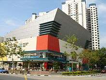
Bukit Panjang Plaza is one of the well-known malls in Bukit Panjang. It is located at the heart of the town and is located close to the LRT and MRT stations as well as the Bukit Panjang Bus Interchange. Located on Jelebu Road, the mall has been expanded twice throughout its existence to include more shops in the building. The mall is owned by CapitaRetail which is another retail-based REIT by CapitaLand. The mall houses the Bukit Panjang Community Library as well as a NTUC FairPrice Finest supermarket.
In addition to Bukit Panjang Plaza, there are five other commercial buildings equipped with food courts, supermarkets, and other basic shops to meet the basic necessities of the residents. These include Junction 10 located along Woodlands Road, Hillion located along Bukit Panjang Road, Fajar Shopping Centre located along Fajar Road, Greenridge Shopping Centre located along Jelapang Road, and the Bangkit Town Centre located along Bangkit Road.
Opened in 2017, Hillion Mall is the latest addition to the shopping malls in Bukit Panjang.[8] Hillion Mall is directly connected to the Bukit Panjang MRT Station (DT1) on the Downtown Line via an underpass. It houses the Bukit Panjang Bus Interchange as well.
Within the neighbourhood consists of two hawker centres; the Bukit Panjang Hawker Centre and the Senja Hawker Centre which is currently under construction.[9]
In 2020, an upcoming healthcare facility located along Senja Road is expected to house the Bukit Panjang Polyclinic and the Senja Care Home.[10]
The neighbourhood has two parks, the Bukit Panjang Park and Zhenghua Park. Bukit Panjang Park is located right across from Bukit Panjang Plaza and wraps around a man-made pond. Zhenghua Park consists of a fitness area, gazebos, playgrounds, and a 2.5-kilometre cycling and jogging track that runs alongside the Bukit Timah Expressway. The parks interconnect via a park connector which is also a track for cycling and jogging. At the edge of the man-made pond lies the Senja-Cashew Community Club that houses sporting and community facilities. The community club has an Olympic-sized swimming pool, a children's pool, badminton court, tennis courts, street soccer courts as well as various function rooms.
Community centres
- Zhenghua Community Centre
- Bukit Panjang Community Centre
- Senja-Cashew Community Club
Education
As of 2017, this area has a total of six primary schools and five secondary schools.[11]
Transport
Road
Bukit Panjang is adjacent to two of Singapore's major highways, the Bukit Timah Expressway (BKE) and Kranji Expressway (KJE), and is a quick gateway to and from other towns. As such, many drivers coming from the western parts of Singapore make use of Bukit Panjang's major roads as one of the ways to access the BKE, and, subsequently, the KJE. There is a slip road branching off of Senja Road, connecting to the KJE. This slip road will be upgraded to a vehicular interchange by 2022.[12]
Bukit Panjang also has a ring road running through the neighbourhoods, the Bukit Panjang Ring Road, which acts as a feeder to the main arterial roads in the town.
Bus
The public bus system is predominantly run by SMRT Buses. Of the SMRT buses based in Bukit Panjang, some are intra-town "feeder-service" buses that serve the various neighbourhoods, some are used to ferry passengers into the Light Rail Transit system, and the rest are long-distance services that serve as a mode of transport to other towns and to the city centre.
Rail
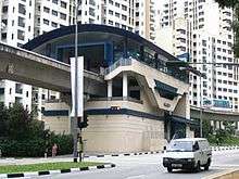
The driverless and fully automated Bukit Panjang LRT Line was completed in 1999 at a cost of S$285 million.[13] The rail line was intended to serve the growing town and act as a replacement to the many buses employed through the town, especially during rush hours.
Several petitions were presented by the residents of Bukit Panjang protesting the decision by SMRT to replace the buses in Bukit Panjang with the LRT system. Some of the complaints were related to the fact that people preferred the previous bus system that covered most parts of the Bukit Panjang neighbourhoods such as bus service 190 and 972. The previous bus system was viewed as more efficient because it had many bus stops within walking distance; the LRT system has only 13 stations that are spaced hundreds of meters apart.
The new Bukit Panjang MRT Station on the Downtown Line opened in 2015, which provides Bukit Panjang residents with direct train access to the Downtown Core. It is located at the Bukit Panjang Integrated Transport Hub, which also comprises the Bus Interchange. It is directly connected to Hillon Mall.
Politics
Bukit Panjang is politically divided into three constituencies. The area of Bukit Panjang is in the Bukit Panjang Single Member Constituency whose Member of Parliament is Teo Ho Pin. He is also the mayor for Northwest Community Development Council. The other two constituencies are enclosed in the Holland-Bukit Timah Group Representation Constituency. Senja, Segar, and Jelapang are located in Zhenghua constituency of Holland-Bukit Timah GRC whose Member of Parliament is Liang Eng Hwa. Petir and Gangsa areas belong to the Cashew division of Holland-Bukit Timah GRC with its Member of Parliament being the Foreign Affairs Minister Dr. Vivian Balakrishnan.
References
- Victor R Savage, Brenda S A Yeoh (2003), Toponymics - A Study of Singapore Street Names, Eastern Universities Press, ISBN 981-210-205-1
Footnotes
- "Bukit Panjang (Planning Area, Singapore) - Population Statistics, Charts, Map and Location". www.citypopulation.de. Retrieved 10 April 2018.
- HDB Key Statistics FY 2014/2015 Archived 4 March 2016 at the Wayback Machine
- "Statistics Singapore - Geographic Distribution - 2018 Latest Data". Retrieved 11 February 2019.
- elevationmap.net. "Bukit Panjang New Town Singapore on the Elevation Map. Topographic Map of Bukit Panjang New Town Singapore". elevationmap.net. Retrieved 10 April 2018.
- "Jalan Cheng Hwa".
- http://hm.onemap.sg/1969/1969%20(44).jpg
- "May 2016 Sales Launch- A Flat for Every Budget and Need". My Nice Home. Retrieved 27 February 2020.
- "www.iproperty.com.sg/news/10954/Hillion-Mall-opens-with-great-fanfare-in-Bukit-Panjang". www.iproperty.com.sg. Archived from the original on 13 March 2017. Retrieved 13 March 2017.
- "New Bukit Panjang hawker centre design unveiled; construction to begin this year: NEA". CNA. Retrieved 27 February 2020.
- "New Bukit Panjang polyclinic to help ease strain". AsiaOne. 14 March 2015. Retrieved 27 February 2020.
- "School Information Service (SIS)". sis.moe.gov.sg. Retrieved 10 April 2018.
- "LTA | Upcoming Projects | Road & Commuter Facilities | Senja/KJE Interchange". www.lta.gov.sg. Retrieved 27 February 2020.
- "Built at a cost of $285 million, Bukit Panjang LRT may be scrapped – The Independent News". Retrieved 27 February 2020.
.jpg)