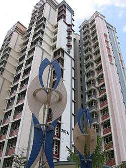
Buangkok
Buangkok is a neighbourhood located in north eastern Singapore. Whilst its boundaries are vague, the neighbourhood is roughly spread across the Trafalgar [1] and Compassvale subzones of the Hougang and Sengkang Planning Areas respectively, as designated by the URA.[2]
Buangkok | |
|---|---|
| Name transcription(s) | |
| • Chinese | 万国 |
| • Pinyin | Wànguó |
| • Hokkien POJ | Bān-kok |
| • Malay | Buangkok |
| • Tamil | புவாங்கோக் |
| Country | Singapore |
Etymology
The namesake road Lorong Buangkok was named Buangkok, meaning "united countries", after the rubber plantation company Singapore United Rubber Plantations Limited's Chinese name "Multi Nations" (万国) in Teochew.[3] In 1967, a track off Lorong Buangkok was named Lorong Buangkok Kechil.
History
Chinese farmers settled on the land in this vicinity in the early twentieth century. The land belonged partly to the state and partly to Singapore United Rubber Plantation Limited.
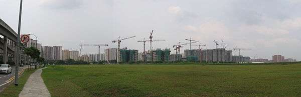
When Sengkang was developed in the late 1990s, a large section of Lorong Buangkok was removed for the development of the new town. Today, Lorong Buangkok is truncated into two sections — one located at the west end of Buangkok with its entrance near Yio Chu Kang Road, and the other much shorter section located within Sengkang near Punggol Road.
Buangkok was once filled and overcrowded by kampongs and villages. These were cleared between 2005 and 2009. The last kampong, Kampong Lorong Buangkok is the only remaining village and is conserved.
Buangkok Drive is a road that was completed in the second half of 1999 from Buangkok Green to Punggol Road, as the road shortens the travel drive from Ang Mo Kio Avenue 5 to Punggol Road.[4] The second section was opened all the way to Upper Serangoon Road on December 2001 together with the extension of Upper Serangoon Road all the way to Punggol East which was opened in 2002. Buangkok East Drive was subsequently opened on 22 March 2009, all the way to the Tampines Road. Yet another Buangkok Drive extension, from Buangkok Green to Buangkok Link started construction in 2017, and was opened on 25 August 2019. The final extension from Buangkok Link to Yio Chu Kang Road has also started construction, and will be completed at an unknown date in the near future.
Transportation
Buangkok MRT station (NE15) on the North East line of the Singapore MRT serves the residents of Buangkok. It was opened on 15 January 2006. The station is served by bus services 27, 43, 43e, 43M and 102. In addition, bus services 101 and 329 enters the western part of Buangkok town, with bus services 43, 43M, 88, 109, 156, 159, 161, 325, 575, 660, 672 and 729 passing by. Bus service 329 was introduced on 9 July 2017.[5]
References
- "Singapore's Hougang Planning Area". Key Location. Retrieved 2017-11-18.
- "SingStat - Planning Areas/Subzones in Singapore (Year 2016)" (PDF). SingStat. Archived from the original (PDF) on 2017-09-08. Retrieved 2017-08-17.
- Ng Yew Peng (28 September 2017). What's In The Name? How The Streets And Villages In Singapore Got Their Names. World Scientific. p. 293. ISBN 978-981-322-147-5.
- Buangkok Green and Buangkok Drive were completed in the second half of 1999. They shorten the drive from the Central Expressway near Ang Mo Kio Avenue 5 to Punggol Road: Karamjit Kaur (21 December 1999). "New roads cut down travel time". The Straits Times. p. 40.
- "Welcome to SBS Transit". www.sbstransit.com.sg. Retrieved 2017-11-18.
References
- Victor R Savage, Brenda S A Yeoh (2003), Toponymics - A Study of Singapore Street Names, Eastern Universities Press, ISBN 981-210-205-1
| Wikimedia Commons has media related to Buangkok. |
| |||||||