Alton, Missouri
Alton is the county seat[6] of Oregon County, Missouri, United States. The population was 871 at the 2010 census.
Alton, Missouri | |
|---|---|
 Location of Alton, Missouri | |
| Coordinates: 36°41′38″N 91°23′57″W | |
| Country | United States |
| State | Missouri |
| County | Oregon |
| Incorporated | 1929[1] |
| Area | |
| • Total | 1.58 sq mi (4.10 km2) |
| • Land | 1.57 sq mi (4.06 km2) |
| • Water | 0.01 sq mi (0.04 km2) |
| Elevation | 781 ft (238 m) |
| Population | |
| • Total | 871 |
| • Density | 534.74/sq mi (206.49/km2) |
| Time zone | UTC-6 (Central (CST)) |
| • Summer (DST) | UTC-5 (CDT) |
| ZIP code | 65606 |
| Area code(s) | 417 |
| FIPS code | 29-00964[4] |
| GNIS feature ID | 0713252[5] |
History
Alton was platted in 1859.[7] The city was named after Alton, Illinois.[8][9] A post office has been in operation in Alton since 1860.[10] Alton was incorporated as a city in 1929.[1]
Greer Mill was listed on the National Register of Historic Places in 2005.[11]
Geography
Alton is located at 36°41′38″N 91°23′57″W (36.693920, -91.399076).[12] According to the United States Census Bureau, the city has a total area of 1.59 square miles (4.12 km2), of which 1.57 square miles (4.07 km2) is land and 0.02 square miles (0.05 km2) is water.[13]
Demographics
| Historical population | |||
|---|---|---|---|
| Census | Pop. | %± | |
| 1870 | 76 | — | |
| 1880 | 127 | 67.1% | |
| 1930 | 439 | — | |
| 1940 | 576 | 31.2% | |
| 1950 | 571 | −0.9% | |
| 1960 | 677 | 18.6% | |
| 1970 | 715 | 5.6% | |
| 1980 | 721 | 0.8% | |
| 1990 | 692 | −4.0% | |
| 2000 | 668 | −3.5% | |
| 2010 | 871 | 30.4% | |
| Est. 2018 | 838 | [14] | −3.8% |
| U.S. Decennial Census[15] | |||
2010 census
As of the census[3] of 2010, there were 871 people, 352 households, and 213 families living in the city. The population density was 554.8 inhabitants per square mile (214.2/km2). There were 406 housing units at an average density of 258.6 per square mile (99.8/km2). The racial makeup of the city was 95.64% White, 0.46% Black or African American, 0.69% Native American, and 3.21% from two or more races. Hispanic or Latino people of any race were 1.38% of the population.
There were 352 households, of which 32.7% had children under the age of 18 living with them, 39.8% were married couples living together, 16.2% had a female householder with no husband present, 4.5% had a male householder with no wife present, and 39.5% were non-families. 35.5% of all households were made up of individuals, and 23% had someone living alone who was 65 years of age or older. The average household size was 2.34 and the average family size was 2.99.
The median age in the city was 39.2 years. 28.7% of residents were under the age of 18; 6.3% were between the ages of 18 and 24; 22.2% were from 25 to 44; 16.9% were from 45 to 64; and 25.6% were 65 years of age or older. The gender makeup of the city was 45.7% male and 54.3% female.
2000 census
As of the census[4] of 2000, there were 668 people, 321 households, and 188 families living in the city. The population density was 797.2 people per square mile (307.0/km2). There were 364 housing units at an average density of 434.4 per square mile (167.3/km2). The racial makeup of the city was 97.01% White, 0.30% African American, 1.95% Native American, and 0.75% from two or more races. Hispanic or Latino people of any race were 0.60% of the population.
There were 321 households, out of which 24.0% had children under the age of 18 living with them, 45.2% were married couples living together, 11.2% had a female householder with no husband present, and 41.4% were non-families. 38.6% of all households were made up of individuals, and 26.8% had someone living alone who was 65 years of age or older. The average household size was 2.07 and the average family size was 2.70.
In the city, the population was spread out, with 20.1% under the age of 18, 7.3% from 18 to 24, 23.2% from 25 to 44, 22.3% from 45 to 64, and 27.1% who were 65 years of age or older. The median age was 45 years. For every 100 females there were 82.5 males. For every 100 females age 18 and over, there were 78.6 males.
The median income for a household in the city was $16,667, and the median income for a family was $21,667. Males had a median income of $21,184 versus $13,929 for females. The per capita income for the city was $10,071. About 18.0% of families and 27.4% of the population were below the poverty line, including 28.1% of those under age 18 and 33.6% of those age 65 or over.
Education
Alton R-IV School District operates Alton Elementary School and Alton High School.[16]
The town has a lending library, the Alton Branch Library.[17]
See also
References
- Hellmann, Paul T. (14 February 2006). Historical Gazetteer of the United States. Routledge. p. 609. ISBN 1-135-94859-3.
- "2017 U.S. Gazetteer Files". United States Census Bureau. Retrieved Jan 10, 2019.
- "U.S. Census website". United States Census Bureau. Retrieved 2012-07-08.
- "U.S. Census website". United States Census Bureau. Retrieved 2008-01-31.
- "US Board on Geographic Names". United States Geological Survey. 2007-10-25. Retrieved 2008-01-31.
- "Find a County". National Association of Counties. Archived from the original on 2011-05-31. Retrieved 2011-06-07.
- "Oregon County Place Names, 1928–1945". The State Historical Society of Missouri. Archived from the original on June 24, 2016. Retrieved November 24, 2016.
- Earngey, Bill (1995). Missouri Roadsides: The Traveler's Companion. University of Missouri Press. p. 5.
- Eaton, David Wolfe (1917). How Missouri Counties, Towns and Streams Were Named. The State Historical Society of Missouri. p. 337.
- "Oregon County". Jim Forte Postal History. Retrieved 4 April 2015.
- "National Register Information System". National Register of Historic Places. National Park Service. July 9, 2010.
- "US Gazetteer files: 2010, 2000, and 1990". United States Census Bureau. 2011-02-12. Retrieved 2011-04-23.
- "US Gazetteer files 2010". United States Census Bureau. Archived from the original on 2012-01-25. Retrieved 2012-07-08.
- "Population and Housing Unit Estimates". Retrieved February 25, 2020.
- "Census of Population and Housing". Census.gov. Retrieved June 4, 2015.
- "Alton R-IV School District". GreatSchools. Retrieved 17 March 2018.
- "Missouri Public Libraries". PublicLibraries.com. Archived from the original on 10 June 2017. Retrieved 17 March 2018.
External links

- Historic maps of Alton in the Sanborn Maps of Missouri Collection at the University of Missouri
Municipalities and communities of Oregon County, Missouri, United States | ||
|---|---|---|
| Cities | 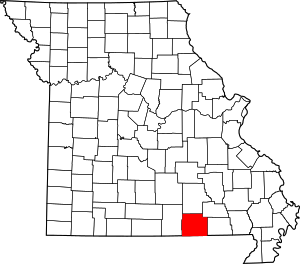 Map of Missouri highlighting Oregon County | |
| Townships |
| |
| CDP | ||
| Other unincorporated communities | ||
| Ghost towns | ||
| Authority control |
|
|---|