Trenton, Missouri
Trenton is a city in Grundy County, Missouri, United States. The population was 6,001 at the 2010 census. It is the county seat of Grundy County.[6] The city used to be the world's largest producer of vienna sausages (at its biggest employer, the ConAgra Grocery Foods plant, now owned by Nestlé).[7]
Trenton, Missouri | |
|---|---|
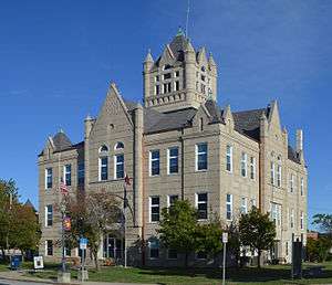 Grundy County Courthouse | |
| Nickname(s): City of friendly citizens | |
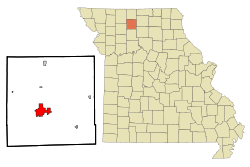 Location of Trenton, Missouri | |
 U.S. Census Map | |
| Coordinates: 40°4′44″N 93°37′00″W[1] | |
| Country | United States |
| State | Missouri |
| County | Grundy |
| Area | |
| • Total | 6.74 sq mi (17.46 km2) |
| • Land | 6.45 sq mi (16.71 km2) |
| • Water | 0.29 sq mi (0.75 km2) |
| Elevation | 840 ft (260 m) |
| Population | |
| • Total | 6,001 |
| • Estimate (2018)[4] | 5,803 |
| • Density | 890/sq mi (340/km2) |
| Time zone | UTC-6 (Central (CST)) |
| • Summer (DST) | UTC-5 (CDT) |
| ZIP code | 64683 |
| Area code(s) | 660 |
| FIPS code | 29-73816[5] |
| GNIS feature ID | 0727769[1] |
| Website | City of Trenton |
History
The Crowder State Park Vehicle Bridge, Jewett Norris Library, Plaza Hotel, St. Philip's Episcopal Church, Trenton High School, and WPA Stock Barn and Pavilion are listed on the National Register of Historic Places.[8]
The Utopian Socialist Ruskin College Movement
In 1869, the Chicago, Rock Island and Pacific Railroad arrived in Trenton. In 1890 Avalon College, which had been founded in Avalon, Missouri by the United Brethren in 1869, moved to Trenton because of proximity to the railroad.
Due to financial difficulties, the college nearly closed again. In 1900 George McAnelly Miller started to turn the school around. He was soon joined by Walter Vrooman who had just returned from Oxford, England where he established Ruskin Hall, a university called the "College for the People" based on the Utopian Socialist writings of John Ruskin. Avalon College was renamed Ruskin College after Vrooman donated 1,500 acres (6.1 km2) to it.
The college directly loaned money to the students and they could work at the school's canning, farming and novelty wood working businesses. The college admitted women (unlike the Oxford school).[9][10]
Vrooman then proceeded to attempt to buy the major businesses in the town buying three grocery stores, a hardware store, drug store—paying for it all in cash via the Western Cooperative Association. The New York Times on April 14, 1902 headlined its article on the development "Buying a Town Outright." According to the cooperative arrangement, members of the coop who spent at least $300 in one of its stores would receive a dividend at the end of the year.
The Ruskin experiment collapsed in 1903 when town residents resisted the Utopian business model and Vrooman's wife divorced him saying that he had squandered $250,000 of her money. Miller moved the college to the Chicago suburb of Glen Ellyn, Illinois in 1903 where it consolidated 12 different colleges and had an enrollment of 2,500 with 8,000 correspondence students. Friction quickly arose there also and the main school burned after being struck by lightning.[11]
Miller moved the college again in 1906 to Ruskin, Florida where 550 acres (2.2 km2) of land around Trenton was swapped for 12,000 acres (49 km2). Many of the Florida campus buildings burned in 1918 and when Miller died in 1919, the College ceased to exist.[12]
In 1925, Trenton Junior College was established (which is now North Central Missouri College). Through expansion projects and support from numerous people, North Central Missouri College has developed into a major agricultural and nursing educational institution for the state of Missouri. Recent construction additions have added to the size of the main campus, and a current project will establish a satellite agricultural location directly south of Trenton.
Superfund sites
Trenton has two hazardous waste dump sites.[13] One is on the property of Modine Manufacturing, a plant that makes automobile radiators. Modine has produced a variety of acid, lead, and copper-bearing waste products which in previous decades were buried on site and also at a public dump a mile north east of the plant.
Government
- Mayor: Linda Crooks
- First Ward Council Members : Glen Briggs (2019-2021) & Lou Fisher (2018-2020)
- Second Ward Council Members: Brad Chumbley (2018-2020) & Danny Brewer (2019-2021)
- Third Ward Council Members: David Mlika (2018-2020) & Cathie Smith (2019-2021)
- Fourth Ward Council Members: John Dolan (2019-2021) & Larry Crawford (2018-2020)
Geography
The city is on the Thompson River floodplain between the Thompson River on the west and its Muddy Creek tributary on the east. U.S. Route 65 passes the east side of the city and Missouri Route 6 passes through the south side. Chillicothe is nineteen miles to the south.[14]
According to the United States Census Bureau, the city has a total area of 6.74 square miles (17.46 km2), of which 6.45 square miles (16.71 km2) is land and 0.29 square miles (0.75 km2) is water.[2]
Demographics
| Historical population | |||
|---|---|---|---|
| Census | Pop. | %± | |
| 1860 | 617 | — | |
| 1870 | 920 | 49.1% | |
| 1880 | 3,312 | 260.0% | |
| 1890 | 5,039 | 52.1% | |
| 1900 | 5,396 | 7.1% | |
| 1910 | 5,656 | 4.8% | |
| 1920 | 6,951 | 22.9% | |
| 1930 | 6,992 | 0.6% | |
| 1940 | 7,046 | 0.8% | |
| 1950 | 6,157 | −12.6% | |
| 1960 | 6,262 | 1.7% | |
| 1970 | 6,063 | −3.2% | |
| 1980 | 6,811 | 12.3% | |
| 1990 | 6,129 | −10.0% | |
| 2000 | 6,216 | 1.4% | |
| 2010 | 6,001 | −3.5% | |
| Est. 2018 | 5,803 | [4] | −3.3% |
| U.S. Decennial Census[15] | |||
2010 census
As of the census[3] of 2010, there were 6,001 people, 2,559 households, and 1,467 families residing in the city. The population density was 930.4 inhabitants per square mile (359.2/km2). There were 2,960 housing units at an average density of 458.9 per square mile (177.2/km2). The racial makeup of the city was 96.0% White, 0.8% African American, 0.5% Native American, 0.5% Asian, 0.9% from other races, and 1.1% from two or more races. Hispanic or Latino of any race were 2.4% of the population.
There were 2,559 households of which 26.5% had children under the age of 18 living with them, 43.0% were married couples living together, 9.9% had a female householder with no husband present, 4.4% had a male householder with no wife present, and 42.7% were non-families. 37.9% of all households were made up of individuals and 19.5% had someone living alone who was 65 years of age or older. The average household size was 2.21 and the average family size was 2.89.
The median age in the city was 41.6 years. 22.6% of residents were under the age of 18; 10.2% were between the ages of 18 and 24; 20.7% were from 25 to 44; 23.6% were from 45 to 64; and 22.8% were 65 years of age or older. The gender makeup of the city was 45.7% male and 54.3% female.
2000 census
As of the census of 2000,[5] there were 6,216 people, 2,673 households, and 1,641 families residing in the city. The population density was 1,065.5 people per square mile (411.7/km²). There were 3,059 housing units at an average density of 524.3 per square mile (202.6/km²). The racial makeup of the city was 97.20% White, 0.56% African American, 0.40% Native American, 0.21% Asian, 0.02% Pacific Islander, 0.74% from other races, and 0.87% from two or more races. Hispanic or Latino of any race were 2.14% of the population.
There were 2,673 households out of which 25.6% had children under the age of 18 living with them, 49.0% were married couples living together, 9.4% had a female householder with no husband present, and 38.6% were non-families. 35.2% of all households were made up of individuals and 19.6% had someone living alone who was 65 years of age or older. The average household size was 2.19 and the average family size was 2.81.
In the city the population was spread out with 22.0% under the age of 18, 9.1% from 18 to 24, 23.0% from 25 to 44, 22.2% from 45 to 64, and 23.7% who were 65 years of age or older. The median age was 42 years. For every 100 females, there were 83.7 males. For every 100 females age 18 and over, there were 80.4 males.
The median income for a household in the city was $25,733, and the median income for a family was $33,317. Males had a median income of $26,959 versus $16,505 for females. The per capita income for the city was $15,834. About 12.7% of families and 17.1% of the population were below the poverty line, including 23.2% of those under age 18 and 14.6% of those age 65 or over.
Education
Public education in Trenton is administered by Trenton R-IX School District.[16]
Trenton has a public library, the Grundy County-Jewett Norris Library.[17]
Notable people
- Roy Gardner, 1920s bank robber
- John Hack, war hero
- Yank Lawson, Dixieland trumpet player
- Gregg Miller, inventor and author
- J. M. Whorton, politician
See also
References
- U.S. Geological Survey Geographic Names Information System: Trenton, Missouri
- "US Gazetteer files 2010". United States Census Bureau. Archived from the original on 2012-01-25. Retrieved 2012-07-08.
- "U.S. Census website". United States Census Bureau. Retrieved 2012-07-08.
- "Population and Housing Unit Estimates". Retrieved September 8, 2019.
- "U.S. Census website". United States Census Bureau. Retrieved 2008-01-31.
- "Find a County". National Association of Counties. Retrieved 2011-06-07.
- Major Employers - trentonmo.com - Retrieved February 19, 2008. Archived December 28, 2014, at the Wayback Machine
- "National Register Information System". National Register of Historic Places. National Park Service. July 9, 2010.
- Ruskin College Material at the State Historical Society of Missouri
- The Arena - Benjamin Orange Flower, Harry Houdini Collection (Library of Congress) - Google Boeken
- Ruskin, Florida gothere.com.
- Founding of Ruskin, Florida - ruskinhistory.org - Retrieved October 12, 2007.
- Missouri Superfund Sites Archived 2012-09-06 at Archive.today. cqs.com - Retrieved February 27, 2008.
- Missouri Atlas & Gazetteer, DeLorme, 1st ed., 1998, p. 21, ISBN 0899332242
- "Census of Population and Housing". Census.gov. Retrieved June 4, 2015.
- "Homepage". Trenton R-Ix School District. Retrieved 5 June 2019.
- "Missouri Public Libraries". PublicLibraries.com. Archived from the original on 10 June 2017. Retrieved 5 June 2019.
External links
| Wikisource has the text of a 1911 Encyclopædia Britannica article about Trenton, Missouri. |
- City of Trenton
- Trenton Chamber of Commerce
- Historic maps of Trenton in the Sanborn Maps of Missouri Collection at the University of Missouri
- http://www.marxisthistory.org/history/usa/groups/ruskin/1901/0601-appeal-ruskincollege.pdf
Municipalities and communities of Grundy County, Missouri, United States | ||
|---|---|---|
| Cities |  Map of Missouri highlighting Grundy County | |
| Village | ||
| Townships | ||
| CDPs | ||
| Unincorparated communities | ||
| Footnotes | ‡This populated place also has portions in an adjacent county or counties | |
| Authority control |
|
|---|