Akat Amnuai District
Akat Amnuai (Thai: อากาศอำนวย, pronounced [ʔāː.kàːt ʔām.nūa̯j]) is a district (amphoe) of Sakon Nakhon Province, northeast Thailand.
Akat Amnuai อากาศอำนวย | |
|---|---|
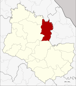 District location in Sakon Nakhon Province | |
| Coordinates: 17°35′48″N 103°58′30″E | |
| Country | Thailand |
| Province | Sakon Nakhon |
| Seat | Akat Amnuai |
| Area | |
| • Total | 585.0 km2 (225.9 sq mi) |
| Population (2005) | |
| • Total | 67,328 |
| • Density | 115.1/km2 (298/sq mi) |
| Time zone | UTC+7 (ICT) |
| Postal code | 47170 |
| Geocode | 4711 |
History
The minor district (king amphoe) Akat Amnuai was created on 15 May 1963, when the four tambons Akat, Wa Yai, Phon Phaeng, and Phon Ngam were split off from Wanon Niwat District.[1] On 27 July 1965 it was upgraded to a full district.[2]
Geography
Neighboring districts are (from the north clockwise) Seka of Bueng Kan Province, Na Thom, Si Songkhram, and Na Wa of Nakhon Phanom Province, and Phanna Nikhom, Wanon Niwat, and Kham Ta Kla of Sakon Nakhon Province.
Administration
The district is divided into eight sub-districts (tambons), which are further subdivided into 92 villages (mubans). The township (thesaban tambon) Akat Amnuai covers parts of tambon Akat. There are a further eight tambon administrative organizations.
| No. | Name | Thai name | Villages | Pop. | |
|---|---|---|---|---|---|
| 1. | Akat | อากาศ | 18 | 16,206 | |
| 2. | Phon Phaeng | โพนแพง | 12 | 9,121 | |
| 3. | Wa Yai | วาใหญ่ | 14 | 8,858 | |
| 4. | Phon Ngam | โพนงาม | 12 | 8,014 | |
| 5. | Tha Kon | ท่าก้อน | 8 | 5,436 | |
| 6. | Na Hi | นาฮี | 6 | 4,944 | |
| 7. | Ba Wa | บะหว้า | 12 | 6,303 | |
| 8. | Samakkhi Phatthana | สามัคคีพัฒนา | 10 | 8,446 |
References
- ประกาศกระทรวงมหาดไทย เรื่อง แบ่งท้องที่การปกครองอำเภอนรนิวาส ตั้งเป็นกิ่งอำเภอ (PDF). Royal Gazette (in Thai). 80 (44 ง): 1373. May 14, 1963.
- พระราชกฤษฎีกาตั้งอำเภอศรีสวัสดิ์ อำเภอสังขละบุรี อำเภอท่าคันโท อำเภอดอกคำใต้ อำเภอแม่ใจ อำเภอจุน อำเภอขามทะเลสอ อำเภอไพศาลี อำเภอท่าวังผา อำเภอบ้านกรวด อำเภอเด่นชัย อำเภอปทุมรัตน์ อำเภอกะเปอร์ อำเภออากาศอำนวย อำเภอดอนเจดีย์ อำเภอจอมพระ และอำเภอสามโก้ พ.ศ. ๒๕๐๘ (PDF). Royal Gazette (in Thai). 81 (49 ก): 565–569. July 27, 1965.