Waritchaphum District
Waritchaphum (Thai: วาริชภูมิ, pronounced [wāː.rít.t͡ɕʰā.pʰūːm]) is a district (amphoe) in the province of Sakon Nakhon, Thailand.
Waritchaphum วาริชภูมิ | |
|---|---|
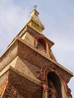 Wat Phra That Si Mongkhon | |
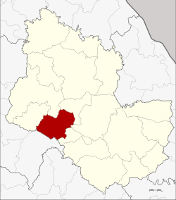 District location in Sakon Nakhon Province | |
| Coordinates: 17°17′36″N 103°38′12″E | |
| Country | Thailand |
| Province | Sakon Nakhon |
| Seat | Waritchaphum |
| Area | |
| • Total | 476.125 km2 (183.833 sq mi) |
| Population (2005) | |
| • Total | 51,067 |
| • Density | 107.3/km2 (278/sq mi) |
| Time zone | UTC+7 (ICT) |
| Postal code | 47150 |
| Geocode | 4706 |
Geography
Neighboring districts are (from the north clockwise) Sawang Daen Din, Phang Khon, Nikhom Nam Un, Wang Sam Mo of Udon Thani Province, and Song Dao.
History
The minor district (king amphoe) was established on 1 April 1926 as a subordinate of Phanna Nikhom District, consisting of the tambons Waritchaphum and Pla Lo split off from Phanna Nikhom District and Kham Bo and Nong Lat from Ban Han (now Sawang Daen Din) District.[1] It was upgraded to a full district on 10 March 1953.[2]
Administration
The district is divided into five sub-districts (tambons), which are further subdivided into 71 villages (mubans). Waritchaphum is the only township (thesaban tambon) of the district, covering parts of tambon Waritchaphum. There are a further five tambon administrative organizations (TAO).
| No. | Name | Thai name | Villages | Pop. | |
|---|---|---|---|---|---|
| 1. | Waritchaphum | วาริชภูมิ | 20 | 13,870 | |
| 2. | Pla Lo | ปลาโหล | 16 | 11,910 | |
| 3. | Nong Lat | หนองลาด | 11 | 7,505 | |
| 4. | Kham Bo | คำบ่อ | 18 | 13,378 | |
| 5. | Kho Khiao | ค้อเขียว | 6 | 4,404 |
References
- ประกาศ เรื่อง ตั้งกิ่งอำเภอในมณฑลอุดร (PDF). Royal Gazette (in Thai). 41 (0 ก): 268. January 24, 1926.
- พระราชกฤษฎีกาจัดตั้งอำเภอจักราช อำเภอสัตตหีบ อำเภอศรีสงคราม อำเภอชะอวด อำเภอหนองแซง อำเภอภาชี อำเภอเขาไชยสน อำเภอชุมพลบุรี อำเภอวาริชภูมิ อำเภอสบปราบ และอำเภอสุไหงโกลก พ.ศ. ๒๔๙๖ (PDF). Royal Gazette (in Thai). 70 (17 ก): 368–371. March 10, 1953.