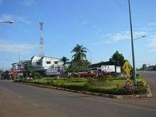
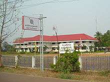
Na Wa District
Na Wa (Thai: นาหว้า, pronounced [nāː wâː]) is a district (amphoe) in Nakhon Phanom Province, northeast Thailand.
Na Wa นาหว้า | |
|---|---|
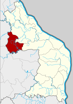 District location in Nakhon Phanom Province | |
| Coordinates: 17°29′22″N 104°6′5″E | |
| Country | Thailand |
| Province | Nakhon Phanom |
| Seat | Na Wa |
| Area | |
| • Total | 523.2 km2 (202.0 sq mi) |
| Population (2005) | |
| • Total | 44,661 |
| • Density | 85.4/km2 (221/sq mi) |
| Time zone | UTC+7 (ICT) |
| Postal code | 48180 |
| Geocode | 4809 |
Geography
Neighboring districts are (from the northeast clockwise): Si Songkhram, Phon Sawan, and in Sakon Nakhon Province the districts Kusuman, Mueang Sakon Nakhon, Phanna Nikhom, and Akat Amnuai.
The main rivers are the Un and Yam.
History
The population of the district is made up of five tribes: Phu Thai, Saek, Yau, Kalueng, and Thai Isan. The Yau form the largest group. They came from Luang Prabang in modern-day Laos in the 16th century. Others immigrated from Ubon Ratchathani Province.[1]
The district was established on 16 August 1971 as a minor district (king amphoe) by splitting off the three tambons, Na Wa, Na Ngua, and Ban Siao, from Si Songkhram District.[2] On 22 March 1979 it was elevated to full district status.[3][4] Three further sub-districts were created, Nakhun Yai in 1978,[5] Lao Phatthana in 1979,[6] and Tha Ruea in 1987.[7]
The township Na Wa was created in 1963 as a sanitary district (sukhaphiban).[8] Like all sanitary districts it was upgraded to a township (thesaban tambon) in May 1999.
Symbols
The district slogan is "Phra That temple of unity, beautiful silk cloth, making Thai handicrafts".
The district name Na Wa means 'fields of Wa trees' (Syzygium cumini), which were very common in the area in the past.
Administration
Na Wa is divided into six sub-districts (tambons), which are further subdivided into 68 villages (mubans). Na Wa itself is a sub-district municipality (thesaban tambon) and covers part of tambon Na Wa. Each of the six tambons is administered by a tambon administrative organization (TAO).
| No. | Name | Thai name | Villages | Pop. | |
|---|---|---|---|---|---|
| 1. | Na Wa | นาหว้า | 15 | 13391 | |
| 2. | Na Ngua | นางัว | 13 | 5123 | |
| 3. | Ban Siao | บ้านเสียว | 10 | 6377 | |
| 4. | Na Khun Yai | นาคูณใหญ่ | 7 | 4565 | |
| 5. | Lao Phatthana | เหล่าพัฒนา | 15 | 9639 | |
| 6. | Tha Ruea | ท่าเรือ | 8 | 5566 |
References
- amphoe.com translated by siammission.com
- ประกาศกระทรวงมหาดไทย เรื่อง แบ่งท้องที่อำเภอศรีสงคราม จังหวัดนครพนม ตั้งเป็นกิ่งอำเภอนาหว้า (PDF). Royal Gazette (in Thai). 88 (87 ง): 2229. August 17, 1971.
- "District information from the Udompat school website". Archived from the original on 2005-04-15. Retrieved 2006-06-19.
- พระราชกฤษฎีกาตั้งอำเภอหนองกุงศรี อำเภอไทรงาม อำเภอบ้านฝาง อำเภออุบลรัตน์ อำเภอเวียงชัย อำเภอดอยเต่า อำเภอนิคมคำสร้อย อำเภอนาหว้า อำเภอเสิงสาง อำเภอศรีสาคร อำเภอบึงสามพัน อำเภอนาดูน อำเภอค้อวัง อำเภอโพธิ์ชัย อำเภอเมืองสรวง อำเภอปลวกแดง อำเภอยางชุมน้อย อำเภอกาบเชิง อำเภอสุวรรณคูหา และอำเภอกุดข้าวปุ้น พ.ศ. ๒๕๒๒ (PDF). Royal Gazette (in Thai). 96 (42 ก Special): 19–24. March 25, 1979.
- ประกาศกระทรวงมหาดไทย เรื่อง ตั้งและเปลี่ยนแปลงเขตตำบลในท้องที่อำเภอบ้านแพง กิ่งอำเภอนาหว้า อำเภอศรีสงคราม และอำเภอนาแก จังหวัดนครพนม (PDF). Royal Gazette (in Thai). 95 (62 ง): 1728–1733. 1978-06-13.
- ประกาศกระทรวงมหาดไทย เรื่อง ตั้งและเปลี่ยนแปลงเขตตำบลในท้องที่อำเภอมุกดาหาร อำเภอคำชะอี อำเภอนาหว้า จังหวัดนครพนม (PDF). Royal Gazette (in Thai). 96 (171 ง): 3353. 1979-10-02.
- ประกาศกระทรวงมหาดไทย เรื่อง ตั้งและเปลี่ยนแปลงเขตตำบลในท้องที่อำเภอนาหว้า และกิ่งอำเภอโพนสวรรค์ จังหวัดนครพนม (PDF). Royal Gazette (in Thai). 104 (168 ง): 6005–6011. 1987-08-25.
- ประกาศกระทรวงมหาดไทย เรื่อง จัดตั้งสุขาภิบาลนาหว้า อำเภอศรีสงคราม จังหวัดนครพนม (PDF). Royal Gazette (in Thai). 80 (121 ง): 2748–2750. December 24, 1963.
External links
| Wikimedia Commons has media related to Na Wa District. |