Sawang Daen Din District
Sawang Daen Din (Thai: สว่างแดนดิน, pronounced [sā.wàːŋ dɛ̄ːn dīn]) is a district (amphoe) in the western part of Sakon Nakhon Province, northeast Thailand.
Sawang Daen Din สว่างแดนดิน | |
|---|---|
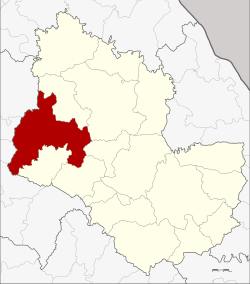 District location in Sakon Nakhon Province | |
| Coordinates: 17°28′30″N 103°27′30″E | |
| Country | Thailand |
| Province | Sakon Nakhon |
| Seat | Sawang Daen Din |
| Tambon | 16 |
| Muban | 189 |
| Area | |
| • Total | 970.0 km2 (374.5 sq mi) |
| Population (2015) | |
| • Total | 150,786 |
| • Density | 151.4/km2 (392/sq mi) |
| Time zone | UTC+7 (ICT) |
| Postal code | 47110 |
| Geocode | 4712 |
Geography
Neighboring districts are (from the north clockwise) Charoen Sin, Wanon Niwat, Phang Khon, Waritchaphum, and Song Dao of Sakon Nakhon Province, Chai Wan, Nong Han, Thung Fon, and Ban Dung of Udon Thani Province.
History
The district dates back to Mueang Sawang Daen Din, which was converted into an amphoe during the Thesaphiban administrative reforms around 1900.
In 1939 it was renamed Sawang Daen Din.[1]
Administration
Central administration
Sawang Daen Din is divided into 16 sub-districts (tambons), which are further subdivided into 189 administrative villages (mubans).
| No. | Name | Thai | Villages | Pop.[2] |
|---|---|---|---|---|
| 1. | Sawang Daen Din | สว่างแดนดิน | 27 | 30,273 |
| 3. | Kham Sa-at | คำสะอาด | 14 | 10,933 |
| 4. | Ban Tai | บ้านต้าย | 7 | 6,451 |
| 6. | Bong Nuea | บงเหนือ | 12 | 10,759 |
| 7. | Phon Sung | โพนสูง | 9 | 6,088 |
| 8. | Khok Si | โคกสี | 14 | 11,392 |
| 10. | Nong Luang | หนองหลวง | 12 | 8,225 |
| 11. | Bong Tai | บงใต้ | 15 | 10,087 |
| 12. | Kho Tai | ค้อใต้ | 10 | 6,782 |
| 13. | Phan Na | พันนา | 12 | 6,893 |
| 14. | Waeng | แวง | 11 | 10,632 |
| 15. | Sai Mun | ทรายมูล | 8 | 7,069 |
| 16. | Tan Kon | ตาลโกน | 11 | 6,056 |
| 17. | Tan Noeng | ตาลเนิ้ง | 9 | 4,941 |
| 20. | That Thong | ธาตุทอง | 8 | 5,875 |
| 21. | Ban Thon | บ้านถ่อน | 10 | 8,330 |
Missing numbers are tambon which now form Charoen Sin District.
Local administration
There are seven sub-district municipalities (thesaban tambons) in the district:
- Don Khueang (Thai: เทศบาลตำบลดอนเขือง) consisting of parts of sub-district Waeng.
- Sawang Daen Din (Thai: เทศบาลตำบลสว่างแดนดิน) consisting of parts of sub-district Sawang Daen Din.
- Bong Tai (Thai: เทศบาลตำบลบงใต้) consisting of sub-district Bong Tai.
- Ban Tai (Thai: เทศบาลตำบลบ้านต้าย) consisting of sub-district Ban Tai.
- Khok Si (Thai: เทศบาลตำบลโคกสี) consisting of sub-district Khok Si.
- Nong Luang (Thai: เทศบาลตำบลหนองหลวง) consisting of sub-district Nong Luang.
- Phan Na (Thai: เทศบาลตำบลพันนา) consisting of sub-district Phan Na.
There are 11 subdistrict administrative organizations (SAO) in the district:
- Sawang Daen Din (Thai: องค์การบริหารส่วนตำบลสว่างแดนดิน) consisting of parts of sub-district Sawang Daen Din.
- Kham Sa-at (Thai: องค์การบริหารส่วนตำบลคำสะอาด) consisting of sub-district Kham Sa-at.
- Bong Nuea (Thai: องค์การบริหารส่วนตำบลบงเหนือ) consisting of sub-district Bong Nuea.
- Phon Sung (Thai: องค์การบริหารส่วนตำบลโพนสูง) consisting of sub-district Phon Sung.
- Kho Tai (Thai: องค์การบริหารส่วนตำบลค้อใต้) consisting of sub-district Kho Tai.
- Waeng (Thai: องค์การบริหารส่วนตำบลแวง) consisting of parts of the sub-district Waeng.
- Sai Mun (Thai: องค์การบริหารส่วนตำบลทรายมูล) consisting of sub-district Sai Mun.
- Tan Kon (Thai: องค์การบริหารส่วนตำบลตาลโกน) consisting of sub-district Tan Kon.
- Tan Noeng (Thai: องค์การบริหารส่วนตำบลตาลเนิ้ง) consisting of sub-district Tan Noeng.
- That Thong (Thai: องค์การบริหารส่วนตำบลธาตุทอง) consisting of sub-district That Thong.
- Ban Thon (Thai: องค์การบริหารส่วนตำบลบ้านถ่อน) consisting of sub-district Ban Thon.
References
- พระราชกฤษฎีกาเปลี่ยนนามอำเภอ กิ่งอำเภอ และตำบลบางแห่ง พุทธศักราช ๒๔๘๒ (PDF). Royal Gazette (in Thai). 56 (0 ก): 354–364. April 17, 1939.
- "Population statistics 2015" (in Thai). Department of Provincial Administration. Retrieved 2016-06-11.