Årdal
Årdal is a municipality in Vestland county, Norway. It is located at the end of the Årdalsfjorden in the traditional district of Sogn. The village of Årdalstangen is the administrative center of the municipality. The other main village is Øvre Årdal. The municipality of Årdal was created in 1863 when it was separated from the municipality of Lærdal.
Årdal kommune | |
|---|---|
 Øvre Årdal in early-June 2008 | |
 Coat of arms  Vestland within Norway | |
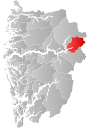 Årdal within Vestland | |
| Coordinates: 61°17′29″N 07°47′53″E | |
| Country | Norway |
| County | Vestland |
| District | Sogn |
| Established | 1863 |
| Administrative centre | Årdalstangen |
| Government | |
| • Mayor (2020) | Hilmar Høl (Ap) |
| Area | |
| • Total | 976.58 km2 (377.06 sq mi) |
| • Land | 930.06 km2 (359.10 sq mi) |
| • Water | 46.53 km2 (17.97 sq mi) 4.8% |
| Area rank | 119 in Norway |
| Population (2020) | |
| • Total | 5,193 |
| • Rank | 176 in Norway |
| • Density | 5.6/km2 (15/sq mi) |
| • Change (10 years) | -7.8% |
| Demonym(s) | Årdøl[1] |
| Time zone | UTC+01:00 (CET) |
| • Summer (DST) | UTC+02:00 (CEST) |
| ISO 3166 code | NO-4643 |
| Official language form | Nynorsk[2] |
| Website | ardal |
Årdal is a modern industrial community, with ties to the old society of farming and fishing. It is surrounded by dramatic nature with high mountains and waterfalls. The climate is rather mild and with less rain than normal in the west part of Norway. Årdal is a good starting point to explore the wild nature of Jotunheimen National Park, and with summer and winter activities within its boundaries. The Vettisfossen waterfall (highest in Norway) is located within the municipality.[3]
The 977-square-kilometre (377 sq mi) municipality is the 119th largest by area out of the 356 municipalities in Norway. Årdal is the 176th most populous municipality in Norway with a population of 5,193. The municipality's population density is 5.6 inhabitants per square kilometre (15/sq mi) and its population has decreased by 7.8% over the previous 10-year period.[4][5]
In 2016, the chief of police for Vestlandet formally suggested a reconfiguration of police districts and stations. He proposed that the police station in Årdal be closed.[6]
Etymology and coat of arms
The Old Norse form of the name was Árdalr. The first element is the genitive case of á which means "river" (referring to the Utla river) and the last element is dalr which means "valley" or "dale". Until 1921, the name was written Aardal.[7]
The coat of arms were granted on 9 August 1957. They are red with yellow zig-zag lines. The local economy at the time was mainly based on heavy industry, which needs a lot of electricity. The zig-zag lines in the arms symbolize both the electrical power and the industries. The colors were chosen randomly.[8]
History
Lærdal was established as a municipality on 1 January 1838 (see formannskapsdistrikt). The original municipality was identical to the Lærdal parish (prestegjeld) including the sub-parish (sokn) of Aardal. In 1863, the sub-parish of Aardal (population: 1,791) was separated from Lærdal and became a municipality of its own. The spelling was later changed to Årdal.
During the 1960s, there were many municipal mergers across Norway due to the work of the Schei Committee. On 1 January 1964, the Muggeteigen, Luggenes, and Bergmål farms (population: 11) were transferred from Årdal to Lærdal.[9][10]
Establishment of center for asylum seekers
From 1 August 2013 to 1 September it received 151 asylum seekers.[11] (The municipal council had beforehand said no to establishing a center for asylum seekers, but the fylkesmannen resolved otherwise.[11]) On 4 November 2013, one of the residents of the center was found—with a knife in his hand—on the bus from Årdal to Oslo, together with one dead bus driver and two dead passengers. The incident is known as the Triple murder on the Valdres Express,[12] and only one male[13]—the asylum seeker—is a police suspect. Earlier on the same day, for the first time one of the center's asylum seekers was removed (by police) in order to be deported from Norway.[14] (After the deaths, media said that Norway has no requirement for screening the mental health of asylum seekers—unlike requirements in Netherlands.)
Government
All municipalities in Norway, including Årdal, are responsible for primary education (through 10th grade), outpatient health services, senior citizen services, unemployment and other social services, zoning, economic development, and municipal roads. The municipality is governed by a municipal council of elected representatives, which in turn elect a mayor.[15] The municipality falls under the Sogn og Fjordane District Court and the Gulating Court of Appeal.
Municipal council
The municipal council (Kommunestyre) of Årdal is made up of 21 representatives that are elected to four year terms. The party breakdown of the council is as follows:
| Party Name (in Nynorsk) | Number of representatives | |
|---|---|---|
| Labour Party (Arbeidarpartiet) | 11 | |
| Conservative Party (Høgre) | 1 | |
| Red Party (Raudt) | 1 | |
| Centre Party (Senterpartiet) | 8 | |
| Total number of members: | 21 | |
| Party Name (in Nynorsk) | Number of representatives | |
|---|---|---|
| Labour Party (Arbeidarpartiet) | 10 | |
| Green Party (Miljøpartiet Dei Grøne) | 1 | |
| Conservative Party (Høgre) | 1 | |
| Centre Party (Senterpartiet) | 8 | |
| Liberal Party (Venstre) | 1 | |
| Total number of members: | 21 | |
| Party Name (in Nynorsk) | Number of representatives | |
|---|---|---|
| Labour Party (Arbeidarpartiet) | 16 | |
| Progress Party (Framstegspartiet) | 1 | |
| Conservative Party (Høgre) | 1 | |
| Centre Party (Senterpartiet) | 3 | |
| Total number of members: | 21 | |
| Party Name (in Nynorsk) | Number of representatives | |
|---|---|---|
| Labour Party (Arbeidarpartiet) | 16 | |
| Progress Party (Framstegspartiet) | 1 | |
| Conservative Party (Høgre) | 1 | |
| Centre Party (Senterpartiet) | 2 | |
| Socialist Left Party (Sosialistisk Venstreparti) | 1 | |
| Total number of members: | 21 | |
| Party Name (in Nynorsk) | Number of representatives | |
|---|---|---|
| Labour Party (Arbeidarpartiet) | 15 | |
| Progress Party (Framstegspartiet) | 2 | |
| Centre Party (Senterpartiet) | 2 | |
| Socialist Left Party (Sosialistisk Venstreparti) | 2 | |
| Total number of members: | 21 | |
| Party Name (in Nynorsk) | Number of representatives | |
|---|---|---|
| Labour Party (Arbeidarpartiet) | 21 | |
| Joint list of the Centre Party (Senterpartiet), Christian Democratic Party (Kristeleg Folkeparti), and Liberal Party (Venstre) | 8 | |
| Total number of members: | 29 | |
| Party Name (in Nynorsk) | Number of representatives | |
|---|---|---|
| Labour Party (Arbeidarpartiet) | 21 | |
| Conservative Party (Høgre) | 2 | |
| Socialist Left Party (Sosialistisk Venstreparti) | 3 | |
| Joint list of the Centre Party (Senterpartiet) and the Christian Democratic Party (Kristeleg Folkeparti) | 3 | |
| Total number of members: | 29 | |
| Party Name (in Nynorsk) | Number of representatives | |
|---|---|---|
| Labour Party (Arbeidarpartiet) | 20 | |
| Conservative Party (Høgre) | 2 | |
| Socialist Left Party (Sosialistisk Venstreparti) | 4 | |
| Joint list of the Centre Party (Senterpartiet) and the Christian Democratic Party (Kristeleg Folkeparti) | 3 | |
| Total number of members: | 29 | |
| Party Name (in Nynorsk) | Number of representatives | |
|---|---|---|
| Labour Party (Arbeidarpartiet) | 22 | |
| Conservative Party (Høgre) | 3 | |
| Socialist Left Party (Sosialistisk Venstreparti) | 3 | |
| Joint list of the Centre Party (Senterpartiet) and the Christian Democratic Party (Kristeleg Folkeparti) | 1 | |
| Total number of members: | 29 | |
| Party Name (in Nynorsk) | Number of representatives | |
|---|---|---|
| Labour Party (Arbeidarpartiet) | 22 | |
| Conservative Party (Høgre) | 3 | |
| Christian Democratic Party (Kristeleg Folkeparti) | 1 | |
| Socialist Left Party (Sosialistisk Venstreparti) | 1 | |
| Joint list of the Liberal People's Party (Liberale Folkepartiet), Centre Party (Senterpartiet), and Liberal Party (Venstre) | 2 | |
| Total number of members: | 29 | |
| Party Name (in Nynorsk) | Number of representatives | |
|---|---|---|
| Labour Party (Arbeidarpartiet) | 21 | |
| Conservative Party (Høgre) | 3 | |
| Christian Democratic Party (Kristeleg Folkeparti) | 1 | |
| Socialist Left Party (Sosialistisk Venstreparti) | 2 | |
| Joint list of the Liberal People's Party (Liberale Folkepartiet), Centre Party (Senterpartiet), and Liberal Party (Venstre) | 2 | |
| Total number of members: | 29 | |
| Party Name (in Nynorsk) | Number of representatives | |
|---|---|---|
| Labour Party (Arbeidarpartiet) | 21 | |
| Conservative Party (Høgre) | 1 | |
| Socialist Left Party (Sosialistisk Venstreparti) | 2 | |
| Joint list of the Centre Party (Senterpartiet), Christian Democratic Party (Kristeleg Folkeparti), New People's Party (Nye Folkepartiet), and Liberal Party (Venstre) | 5 | |
| Total number of members: | 29 | |
| Party Name (in Nynorsk) | Number of representatives | |
|---|---|---|
| Labour Party (Arbeidarpartiet) | 22 | |
| Conservative Party (Høgre) | 2 | |
| Christian Democratic Party (Kristeleg Folkeparti) | 1 | |
| Liberal Party (Venstre) | 4 | |
| Total number of members: | 29 | |
| Party Name (in Nynorsk) | Number of representatives | |
|---|---|---|
| Labour Party (Arbeidarpartiet) | 21 | |
| Liberal Party (Venstre) | 4 | |
| Joint List(s) of Non-Socialist Parties (Borgarlege Felleslister) | 2 | |
| Local List(s) (Lokale lister) | 2 | |
| Total number of members: | 29 | |
| Party Name (in Nynorsk) | Number of representatives | |
|---|---|---|
| Labour Party (Arbeidarpartiet) | 22 | |
| Liberal Party (Venstre) | 4 | |
| Joint List(s) of Non-Socialist Parties (Borgarlege Felleslister) | 3 | |
| Total number of members: | 29 | |
| Party Name (in Nynorsk) | Number of representatives | |
|---|---|---|
| Labour Party (Arbeidarpartiet) | 15 | |
| Joint List(s) of Non-Socialist Parties (Borgarlege Felleslister) | 4 | |
| Local List(s) (Lokale lister) | 2 | |
| Total number of members: | 21 | |
| Party Name (in Nynorsk) | Number of representatives | |
|---|---|---|
| Labour Party (Arbeidarpartiet) | 9 | |
| Joint List(s) of Non-Socialist Parties (Borgarlege Felleslister) | 5 | |
| Local List(s) (Lokale lister) | 7 | |
| Total number of members: | 21 | |
| Party Name (in Nynorsk) | Number of representatives | |
|---|---|---|
| Labour Party (Arbeidarpartiet) | 15 | |
| Communist Party (Kommunistiske Parti) | 1 | |
| Joint List(s) of Non-Socialist Parties (Borgarlege Felleslister) | 4 | |
| Total number of members: | 20 | |
| Party Name (in Nynorsk) | Number of representatives | |
|---|---|---|
| Labour Party (Arbeidarpartiet) | 11 | |
| Communist Party (Kommunistiske Parti) | 1 | |
| Joint List(s) of Non-Socialist Parties (Borgarlege Felleslister) | 4 | |
| Total number of members: | 16 | |
| Party Name (in Nynorsk) | Number of representatives | |
|---|---|---|
| Labour Party (Arbeidarpartiet) | 11 | |
| Joint List(s) of Non-Socialist Parties (Borgarlege Felleslister) | 3 | |
| Local List(s) (Lokale lister) | 2 | |
| Total number of members: | 16 | |
| Party Name (in Nynorsk) | Number of representatives | |
|---|---|---|
| Labour Party (Arbeidarpartiet) | 10 | |
| Joint List(s) of Non-Socialist Parties (Borgarlege Felleslister) | 6 | |
| Total number of members: | 16 | |
Mayor
The mayor (ordførar) of a municipality in Norway is a representative of the majority party of the municipal council who is elected to lead the council. The mayors of Årdal (incomplete list):
- 2019–present: Hilmar Høl (Ap)
- 2002-2019: Arild Ingar Lægreid (Ap)
- 1995-2002: Oddbjørn Einan (Ap)
- 1984-1995: Jo Ragnar Sønstlien (Ap)
Geography

The municipality is situated at the inner part of the Årdalsfjorden, one of the beginning branches of the Sognefjorden and is a gateway to the mountain areas called Jotunheimen and Hurrungane, including the mountains Falketind, Store Austanbotntind, and Store Skagastølstind.
There are two urban areas in Årdal: Årdalstangen and Øvre Årdal, with a total population of approximately 5,700. There are also smaller village areas throughout the municipality: Naddvik (Vikadalen), Nundalen, Indre Offerdal, Ytre Offerdal, Seimsdalen, Fardalen, Avdalen, Utladalen, Vetti, and Vettismorki.[3]
Årdal is bordered to the north and west by the municipality of Luster, to the east by Vang (in Oppland county), and to the south by Lærdal.
Industry
Årdal became a symbol of modern Norway after World War II. In the course of a few years, Årdal was transformed from a scarcely populated rural community into a small town situated around the aluminium plant Årdal og Sunndal Verk. Construction of the aluminium plant at Årdal started in 1941. The purpose was to build a large aluminium industry as a part of the German war effort. The Norwegian State confiscated the unfinished plant in Årdal in 1945 at the end of the war. The plant was finished by the government and production started in 1948.
At Årdal, the aluminium factory produced semi-finished aluminium that went on to be transformed into various products in other factories. During the early years most of the aluminium was exported. The car and airplane industries were big aluminium consumers. Some finished products were made in Norway, such as Høyang kitchen equipment, kettles, and pans.
In 1986, Årdal og Sunndal Verk was merged with Norsk Hydro under the name Hydro Aluminium AS.[34]
Churches
The Church of Norway has two parishes (sokn) within the municipality of Årdal. It is part of the Sogn prosti (deanery) in the Diocese of Bjørgvin.
| Parish (sokn) | Church name | Location of the church | Year built |
|---|---|---|---|
| Nedre Årdal | Årdal Church | Årdalstangen | 1867 |
| Øvre Årdal | Farnes Church | Øvre Årdal | 1970 |
Attractions
Utladalen
The Vettisfossen waterfall was given protected status in 1924. With a free fall of 275 metres (902 ft), it is the highest waterfall in Northern Europe.
The Vetti Gard og Turiststasjon, a farm rich in tradition dating from around 1120, is set in dramatic natural surroundings. The farm has been involved in tourism ever since the early 19th century and now serves as a café and tourist information office in the summer. The Vettismorki mountain farm is located nearby.
The Utladalen Landscape Protection Area (314 square kilometres or 121 square miles) was established in conjunction with the Jotunheimen National Park. It comprises large parts of the Utladalen valley and adjoining side valleys. The area contains several old farms and mountain pasture farmsteads of historical interest.
Utladalen Naturhus is a nature center situated at Skåri, an old farm. Farming here ceased in the early 1970s. In 1996 work commenced on the restoration of the old cultural landscape, and the Utladalen Naturhus center was opened in May 1998. Run by the Utladalen Naturhus foundation, the aim of the centre is to inform visitors about the natural and cultural history of Utladalen and Western Jotunheimen. The centre also includes the Slingsby Museum.[3]
Avdalen Gård (Farm)

The Avdalen farm is scenically situated on the mountainside above the beautiful Avdalen waterfall in the Utladalen valley. The land was cleared for farming in the 16th century. Abandoned in more recent times, the farm has now been restored to provide restaurant, accommodation and meeting facilities. The mill house can be seen in operation milling grain.[3]
Jotunheimen National Park
The Jotunheimen National Park, established in 1980, covers an area of approximately 1,145 square kilometres (442 sq mi) and comprises the Hurrungane, Fannaråki, and the Rauddalstind og Mjølkedalstind peaks. Jotunheimen is a popular area for hiking in summer and skiing in winter, and the Hurrungane massif is very popular with climbers.[3]
Indre Offerdal Museum
This old fjord-side settlement of Indre Offerdal "right down by the shore" is packed with interesting history about Årdal. Ten buildings, including a mill, sawmill, a shoreside warehouse, and farm buildings dating from the 19th century, provide insight into the beginnings of the extensive industrialization of this local community.[3]
Scenic Views
- Mountain Road from Årdal-Turtagrø: In the summer, this road from Øvre Årdal to Turtagrø links Årdal to the Sognefjell mountain road.[3]
- Folkevegen road from Hjelle-Vetti: From Vetti you can walk to Europe's highest waterfall (275 metres or 902 feet high). The road/path passes four waterfalls.[3]
Historical society
The group called Årdal Sogelag concerns itself with local history.
Transportation
One of the bus lines which stops there, is the Valdres Express which has an end stop in Oslo.
References
- "Navn på steder og personer: Innbyggjarnamn" (in Norwegian). Språkrådet.
- "Forskrift om målvedtak i kommunar og fylkeskommunar" (in Norwegian). Lovdata.no.
- "Welcome to Årdal". Årdal Kommune. 5 July 2004. Archived from the original on 2 January 2008. Retrieved 24 June 2008.
- Statistisk sentralbyrå (2020). "Table: 06913: Population 1 January and population changes during the calendar year (M)" (in Norwegian).
- Statistisk sentralbyrå (2020). "09280: Area of land and fresh water (km²) (M)" (in Norwegian).
- Fjelltveit, Ingvild; Raunholm, Per Vidar (20 December 2016). "Foreslår å legge ned 17 lensmannskontor i Vest politidistrikt". NRK Hordaland (in Norwegian). Retrieved 20 October 2017.
- Rygh, Oluf (1919). Norske gaardnavne: Nordre Bergenhus amt (in Norwegian) (12 ed.). Kristiania, Norge: W. C. Fabritius & sønners bogtrikkeri. p. 53.
- "Civic heraldry of Norway - Norske Kommunevåpen". Heraldry of the World. Retrieved 22 October 2017.
- Jukvam, Dag (1999). "Historisk oversikt over endringer i kommune- og fylkesinndelingen" (PDF) (in Norwegian). Statistics Norway.
- Natvik, Oddvar (9 February 2005). "Some historical data on the 26 Kommunes". Archived from the original on 13 June 2008. Retrieved 24 June 2008.
- "Mottaksleder: – Alle har et ansvar for å hjelpe mennesker på flukt" [Leader of the center: - Everyone has a responsibility to help people on the run] (in Norwegian). NRK. 12 September 2013.
- Trippeldrapssikta blir avhøyrt torsdag Archived 4 March 2016 at the Wayback Machine
- - Trippeldrapssiktet nektet avhør Archived 4 March 2016 at the Wayback Machine
- Politiet må setje ned evalueringsutval etter bussdrapene Archived 4 January 2016 at the Wayback Machine
- Hansen, Tore, ed. (12 May 2016). "kommunestyre". Store norske leksikon (in Norwegian). Kunnskapsforlaget. Retrieved 6 April 2019.
- "Tall for Norge: Kommunestyrevalg 2019 - Vestland". Valg Direktoratet. Retrieved 29 October 2019.
- "Table: 04813: Members of the local councils, by party/electoral list at the Municipal Council election (M)" (in Norwegian). Statistics Norway.
- "Tall for Norge: Kommunestyrevalg 2011 - Sogn og Fjordane". Valg Direktoratet. Retrieved 29 October 2019.
- "Kommunestyrevalget 1995" (PDF) (in Norwegian). Oslo-Kongsvinger: Statistisk sentralbyrå. 1996. Retrieved 18 February 2020.
- "Kommunestyrevalget 1991" (PDF) (in Norwegian). Oslo-Kongsvinger: Statistisk sentralbyrå. 1993. Retrieved 18 February 2020.
- "Kommunestyrevalget 1987" (PDF) (in Norwegian). Oslo-Kongsvinger: Statistisk sentralbyrå. 1988. Retrieved 18 February 2020.
- "Kommunestyrevalget 1983" (PDF) (in Norwegian). Oslo-Kongsvinger: Statistisk sentralbyrå. 1984. Retrieved 18 February 2020.
- "Kommunestyrevalget 1979" (PDF) (in Norwegian). Oslo: Statistisk sentralbyrå. 1979. Retrieved 18 February 2020.
- "Kommunevalgene 1975" (PDF) (in Norwegian). Oslo: Statistisk sentralbyrå. 1977. Retrieved 1 May 2020.
- "Kommunevalgene 1972" (PDF) (in Norwegian). Oslo: Statistisk sentralbyrå. 1973. Retrieved 1 May 2020.
- "Kommunevalgene 1967" (PDF) (in Norwegian). Oslo: Statistisk sentralbyrå. 1967. Retrieved 1 May 2020.
- "Kommunevalgene 1963" (PDF) (in Norwegian). Oslo: Statistisk sentralbyrå. 1964. Retrieved 1 May 2020.
- "Kommunevalgene og Ordførervalgene 1959" (PDF) (in Norwegian). Oslo: Statistisk sentralbyrå. 1960. Retrieved 1 May 2020.
- "Kommunevalgene og Ordførervalgene 1955" (PDF) (in Norwegian). Oslo: Statistisk sentralbyrå. 1957. Retrieved 1 May 2020.
- "Kommunevalgene og Ordførervalgene 1951" (PDF) (in Norwegian). Oslo: Statistisk sentralbyrå. 1952. Retrieved 1 May 2020.
- "Kommunevalgene og Ordførervalgene 1947" (PDF) (in Norwegian). Oslo: Statistisk sentralbyrå. 1948. Retrieved 1 May 2020.
- "Kommunevalgene og Ordførervalgene 1945" (PDF) (in Norwegian). Oslo: Statistisk sentralbyrå. 1947. Retrieved 1 May 2020.
- "Kommunevalgene og Ordførervalgene 1937" (PDF) (in Norwegian). Oslo: Statistisk sentralbyrå. 1938. Retrieved 1 May 2020.
- Karlsen, Anne Marit. "Årdal Aluminium plant". Retrieved 24 June 2008.
External links
- Municipal fact sheet from Statistics Norway (in Norwegian)
- Årdal kommune (in Norwegian)
- Årdalsportalen (in Norwegian)
- Tindevegen (in Norwegian)
- Opplev Utladalen (in Norwegian)
- Årdal Sogelag—a historical society (in Norwegian)
- Avdalen farm in Utladalen (in Norwegian)
 |
|  | |||
| Authority control |
|
|---|