Yucatan, Missouri
| Yucatan, Missouri | |
|---|---|
| Unincorporated community | |
 Yucatan, Missouri | |
| Coordinates: 38°51′16″N 91°45′02″W / 38.85444°N 91.75056°WCoordinates: 38°51′16″N 91°45′02″W / 38.85444°N 91.75056°W | |
| Country | United States |
| State | Missouri |
| County | Callaway |
| Elevation[1] | 817 ft (249 m) |
| Time zone | UTC-6 (Central (CST)) |
| • Summer (DST) | UTC-5 (CDT) |
| Area code(s) | 573 |
| GNIS feature ID | 741377[1] |
Yucatan is an unincorporated community in eastern Callaway County, Missouri, United States.[1] The community is on Missouri Route D about four miles south of I-70. Lake Lochaweeno is about two miles to the southwest.[2]
A post office called Yucatan was established in 1892, and remained in operation until 1908.[3] The community was named after the nearby Yucatan Baptist Church.[4]
Notes
- 1 2 3 "Yucatan, Missouri". Geographic Names Information System. United States Geological Survey.
- ↑ Missouri Atlas & Gazetteer, DeLorme, 1998, First edition, p. 38, ISBN 0-89933-224-2
- ↑ "Post Offices". Jim Forte Postal History. Retrieved 7 September 2016.
- ↑ "Callaway County Place Names, 1928–1945 (archived)". The State Historical Society of Missouri. Retrieved 7 September 2016.
Municipalities and communities of Callaway County, Missouri, United States | ||
|---|---|---|
| Cities | 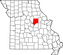 | |
| Village | ||
| Townships | ||
| Unincorporated communities | ||
| Ghost towns | ||
| Footnotes | ‡This populated place also has portions in an adjacent county or counties | |
This article is issued from
Wikipedia.
The text is licensed under Creative Commons - Attribution - Sharealike.
Additional terms may apply for the media files.