Guthrie Township, Callaway County, Missouri
| Guthrie Township | |
|---|---|
| Township | |
 | |
| Coordinates: 38°46′03″N 092°07′18″W / 38.76750°N 92.12167°WCoordinates: 38°46′03″N 092°07′18″W / 38.76750°N 92.12167°W | |
| Country | United States |
| State | Missouri |
| County | Callaway |
| Area | |
| • Total | 19.65 sq mi (50.9 km2) |
| • Land | 19.61 sq mi (50.78 km2) |
| • Water | 0.05 sq mi (0.12 km2) 0.24% |
| Elevation[1] | 761 ft (232 m) |
| Population (2010) | |
| • Total | 604 |
| • Density | 31/sq mi (12/km2) |
| FIPS code | 29-29800[2] |
| GNIS feature ID | 0766378 |
Guthrie Township is one of eighteen townships in Callaway County, Missouri, USA. As of the 2010 census, its population was 604.[3]
Guthrie Township was created sometime between 1876 and 1897 from what was before then approximately the southern one-third of Round Prairie Township (reduced in size thereafter). You can see this by comparing historical county maps linked in in the bibliography at the bottom of the article on Callaway County. Further research should reveal the exact date of creation of Guthrie township. This is critical to determining exact locations in historical and genealogical research.
Guthrie Township has the name of a local family.[4]
Geography
Guthrie Township covers an area of 19.65 square miles (50.9 km2) and while containing no incorporated settlements, it does include the unincorporated community of Guthrie (named Bigbee at time of its establishment). The stream of Dry Fork runs through this township, where the removal of the Chicago & Alton Railroad tracks and station affected the community substantially, and the community was absorbed largely into the economy of nearby New Bloomfield in neighboring Cedar Township.
References
- ↑ "US Board on Geographic Names". United States Geological Survey. 2007-10-25. Retrieved 2008-01-31.
- ↑ "American FactFinder". United States Census Bureau. Retrieved 2008-01-31.
- ↑ "Race, Hispanic or Latino, Age, and Housing Occupancy: 2010 Census Redistricting Data (Public Law 94-171) Summary File (QT-PL), Guthrie township, Callaway County, Missouri". U.S. Census Bureau, American FactFinder 2. Retrieved October 31, 2011.
- ↑ "Callaway County Place Names, 1928–1945 (archived)". The State Historical Society of Missouri. Archived from the original on 24 June 2016. Retrieved 7 September 2016.
External links
Municipalities and communities of Callaway County, Missouri, United States | ||
|---|---|---|
| Cities | 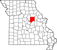 | |
| Village | ||
| Townships | ||
| Unincorporated communities | ||
| Ghost towns | ||
| Footnotes | ‡This populated place also has portions in an adjacent county or counties | |