Cote Sans Dessein Township, Callaway County, Missouri
| Cote Sans Dessein Township | |
|---|---|
| Township | |
 | |
| Coordinates: 38°38′18″N 092°00′07″W / 38.63833°N 92.00194°WCoordinates: 38°38′18″N 092°00′07″W / 38.63833°N 92.00194°W | |
| Country | United States |
| State | Missouri |
| County | Callaway |
| Area | |
| • Total | 48.82 sq mi (126.43 km2) |
| • Land | 47.29 sq mi (122.49 km2) |
| • Water | 1.52 sq mi (3.95 km2) 3.12% |
| Elevation[1] | 551 ft (168 m) |
| Population (2010) | |
| • Total | 1,122 |
| • Density | 23/sq mi (8.9/km2) |
| FIPS code | 29-16642[2] |
| GNIS feature ID | 0766376 |
Cote Sans Dessein Township is one of eighteen townships in Callaway County, Missouri, USA. As of the 2010 census, its population was 1,122.[3]
Geography
Cote Sans Dessein Township covers an area of 48.82 square miles (126.4 km2) and contains no incorporated settlements as of 2018, but does include the unincorporated community of Tebbetts and the historic settlement of Effie. It contains six cemeteries: Farmer, High Hill, Middle River, Riverview, Thorp and Williams and The streams of Cason Branch, Gallons Creek, Muddy Creek, Rivaux Creek, Rocky Branch and Sand Springs Branch.
The township's eastern boundary is formed by the Missouri River tributary of Middle River, and the Missouri River tributary of Little Auxvasse Creek also flows through the township.
A detailed historic map of Callaway County townships in 1930 can be found at http://cdm16795.contentdm.oclc.org/cdm/ref/collection/moplatbooks/id/656 . This is useful for historical and genealogical research. Maps and text descriptions of Callaway townships prior to that date can be found under the article for Callaway County, Missouri.
History
Cote Sans Dessein Township was established in 1821, and named after the community of Cote Sans Dessein, Missouri.[4] The township included nearly all of western Callaway County at the time of its establishment, but within only a few months was lessened in size by the creation of new townships up and down western Callaway (per the Missouri State Library's "History of Callaway County" published in 1884, which gives text descriptions of the boundaries).
References
- ↑ "US Board on Geographic Names". United States Geological Survey. 2007-10-25. Retrieved 2008-01-31.
- ↑ "American FactFinder". United States Census Bureau. Archived from the original on 2013-09-11. Retrieved 2008-01-31.
- ↑ "Race, Hispanic or Latino, Age, and Housing Occupancy: 2010 Census Redistricting Data (Public Law 94-171) Summary File (QT-PL), Cote Sans Dessein township, Callaway County, Missouri". U.S. Census Bureau, American FactFinder 2. Archived from the original on September 11, 2013. Retrieved October 31, 2011.
- ↑ "Callaway County Place Names, 1928–1945 (archived)". The State Historical Society of Missouri. Archived from the original on 24 June 2016. Retrieved 7 September 2016.
- USGS Geographic Names Information System (GNIS)
- [http://www.kchsoc.org/tebbetts.html Tebbetts Area Page.
- Missouri State Library: "History of Callaway County". (St Louis, National Historical Company, 1884).
External links
Municipalities and communities of Callaway County, Missouri, United States | ||
|---|---|---|
| Cities | 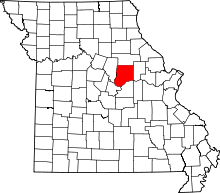 | |
| Village | ||
| Townships | ||
| Unincorporated communities | ||
| Ghost towns | ||
| Footnotes | ‡This populated place also has portions in an adjacent county or counties | |