Madhogarh Fort, Haryana
| Madhogarh Fort | |
|---|---|
|
Native name Hindi: माधोगढ़ का किला | |
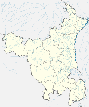
 Location of Madhogarh Fort in Haryana  Madhogarh Fort, Haryana (India) | |
| Location | Madhogarh, Haryana, Haryana, India |
| Coordinates | 28°17′52″N 76°1′59″E / 28.29778°N 76.03306°E |
| Built | first half of 18th century |
| Built for | Madho Singh I |
| Architectural style(s) | Hindu |
| Governing body | Archaeological Survey of India |
Madhogarh Fort is located on top of Madhogarh Hill in the Aravalli mountain range, near Madhogarh village, in the Mahendragarh district of Haryana state in India.[1] It is located 12 kilometres (7.5 mi) from Mahendragarh.
History
Rao Shekha, a Shekhawat rajput (sub-branch of Kachwaha or Kushwaha), was the founder of Shekhawati, who originally divided Shekhawati into 33 Thikana (also called a Pargana), each styled as Thakur with at least a 'kuccha' mud fort, some of which were fortified further with stone. After him, additional thikanas were granted to the descendants of subsequent generations.[2][3]
- Loharu Thikana, Loharu was founded as 33rd Thikana in the year 1588 A.D by the Thakur Narhar Das, a decedent of Rao Shekha.
- Mahendragarh Thikana, was granted by Maharaja Mukund Singh of Shekhawati in 1868 to Kunwar Sheonath Singh I, the son of Maharaja Raj Singh II.
- Tosham Thikana, It was granted as a thikana by Shekhawati ruler Maharaja Mukund Singh in 1870 to Kunwar Abhaya Singh.
- Madhogarh Thikana and fort were founded by Madho Singh I in the first half of the 18th century, when he placed the area under the control of Balwant Singh. The fort is named after Madho Singh I; "Madhogarh" literally means "the fort of Madho". Around 1755, this area passed from the Rajputs to the Maratha Empire under Maharaja Khande Rao Holkar of Indore when he attacked the independent Mughal chieftain Ismail Beg, Ismail Beg escaped to Madhogarh and established a post near Madhogarh fort. Khande Rao Holkar attacked Madhogargh fort and captured it on 16 February 1792. Ismail Beg escaped and attacked Kanud when the ruling wife of already deceased Nawab Najaf Quli Khan had died. Khande Rao Holkar then attacked Kanud and captured Ismail Beg, imprisoned him at Agra Fort and put him to death on 1794. Maratha Maharaj Mahadaji Shinde (Scindia) of Gwalior had conquered Rania, Fatehabad and Sirsa from Bhatti Rajput Muslims. Haryana came under Maratha Empire. Mahad ji divided Haryana in four territories: Delhi (Mughal emperor Shah Alam II, his family and areas surrounding Delhi), Panipat (Karnal, Sonepat, Kurukshetra and Ambala), Hisar (Hisar, Sirsa, Fatehabad, parts of Rohtak), Mewat (Gurugram, Rewari, Narnaul, Mahendragarh). Daulat Rao Scindia ceded Haryana on 30 December 1803 under the Treaty of Surji-Anjangaon to British East India Company's Company rule in India.[1]
Architecture
The fort is one of only a few hill forts in Haryana. The architecture is of Hindu Rajput origin.
It has two portions: an upper section on top of the hill, with a ruined main structure, and a smaller section just below the top of the hill. The fort is surrounded by a high and thick wall around the hill with several bastions. Below the sections of the fort, there is a water tank that still stands. The upper complex has a few chambers that appear to be connected to the water tank.
Future development
The Government of Haryana plans to develop an integrated tourist resort incorporating the Madhogarh fort.[4][5][6]
See also
References
- 1 2 "Gazetteer of Mahandragarh 1988" (PDF). Haryana Revenue Department. Retrieved 12 Nov 2014.
- ↑ Loharu State The Imperial Gazetteer of India, 1909, v. 16, p. 169.
- ↑ The State of Loharu Indian States: A Biographical, Historical, and Administrative Survey, by Somerset Playne, R. V. Solomon, J. W. Bond, Arnold Wright. Asian Educational Services, 2006. ISBN 81-206-1965-X. Page 691.
- ↑ Haryana to develop new tourist spots
- ↑ Convention facilities to be set up
- ↑ Haryana govt to give a boost to tourism