Radaur
| Radaur | |
|---|---|
| township | |
 Radaur Location in Haryana, India  Radaur Radaur (India) | |
| Coordinates: 30°02′N 77°09′E / 30.03°N 77.15°ECoordinates: 30°02′N 77°09′E / 30.03°N 77.15°E | |
| Country |
|
| State | Haryana |
| District | Yamunanagar |
| Elevation | 260 m (850 ft) |
| Population (2011) | |
| • Total | 13,690 |
| Languages | |
| • Official | Hindi |
| Time zone | UTC+5:30 (IST) |
| Telephone code | 01732 |
| ISO 3166 code | IN-HR |
| Vehicle registration | HR 92 |
| Website |
haryana |
Radaur is a town in Yamunanagar district in the Indian state of Haryana.
Geography
Radaur is located on the Kurukshetra to Saharanpur highway and is close to some major cities of Haryana such as , Kurukshetra, Yamuna Nagar, Shahbad , Ladwa and Karnal . It is one of best village in Haryana having all facilities of a good city. Rural pollution-free and green habitat of Radaur at a Distance of 18 km from Yamuna Nagar and 28 km from Kurukshetra. It is on the bank of Western Yamuna Canal. Few Famous places in Radaur are: Grain Market,JMIT college, Government hospital ,Shiv colony , Ganja colony, Geeta colony , Choota bans , Saini medical hall ,MLN college , Aadarsh diary , Khema juice wala, Royal health club etc type of castes living in Radaur: Baniya, Saini, Punjabi , Dalit , Jaat , Kamboj , SC /ST etc
Demographics
As of 2011 India census,[1] Radaur had a population of 14,690. Males constitute 53% of the population and females 47%. Radaur has an average literacy rate of 72%, higher than the national average of 59.5%: male literacy is 90%, and female literacy is 67%. In Radaur, 12% of the population is under 6 years of age. Radaur is very old town . There are lots of old houses in town, which was built before partition of India.
Colleges
The town hosts a Degree college (Mukand Lal National College) and Engineering College Seth Jai Parkash Mukand Lal Institute of Engineering and Technology, JMIETI, Vertex polytechnic, Global Research Institute of Management and Technology, Asian Institute of Engineering, Balaji Institute of polytechnic. Five more B.Ed. Colleges are there in the town.
Schools
Govt. Senior Secondary School, Mukand Lal National Senior Secondary School, Swaraj Shishu Neekatan, DAV Public School, Hari Om Shiv OM Public School, Indian Public senior secondary School, Doon Public School, Like Public School Raj Rajeshwari Public School
References
- ↑ "Census of India 2011: Data from the 2011 Census, including cities, villages and towns (Provisional)". Census Commission of India. Archived from the original on 2004-06-16. Retrieved 2008-11-01.
Yamunanagar district topics | ||
|---|---|---|
| Geography | 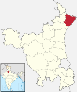 | |
| Cities and towns | ||
| Transport | ||
| Lok Sabha constituencies | ||
| Colleges and Schools | ||
| Industries | ||