Yamatsuri, Fukushima
| Yamatsuri 矢祭町 | |||
|---|---|---|---|
| Town | |||
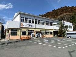 Yamatsuri Town Hall | |||
| |||
|
Location of Yamatsuri in Fukushima Prefecture | |||
 Yamatsuri | |||
| Coordinates: 36°52′16.8″N 140°25′29″E / 36.871333°N 140.42472°ECoordinates: 36°52′16.8″N 140°25′29″E / 36.871333°N 140.42472°E | |||
| Country | Japan | ||
| Region | Tōhoku | ||
| Prefecture | Fukushima | ||
| District | Higashishirakawa | ||
| Government | |||
| • Mayor | Makoto Kobari | ||
| Area | |||
| • Total | 118.27 km2 (45.66 sq mi) | ||
| Population (May 2018) | |||
| • Total | 5,859 | ||
| • Density | 50/km2 (130/sq mi) | ||
| Time zone | UTC+9 (Japan Standard Time) | ||
| - Tree | Japanese Red Pine | ||
| - Flower | Azalea | ||
| - Bird | Oriental turtle dove | ||
| Phone number | 0247-46-3131 | ||
| Address | 66 Tatemoto, Higashitate, Yamatsuri-machi, Higashishirakawa-gun, Fukushima-ken 963-5118 | ||
| Website | Official website | ||
Yamatsuri (矢祭町 Yamatsuri-machi) is a town located in Fukushima Prefecture, Japan. As of 1 May 2018, the town had an estimated population of 5,859 in 2057 households [1], and a population density of 50.0 persons per km². The total area of the town was 118.27 square kilometres (45.7 sq mi).
Geography
Yamatsuri is located in the southernmost portion of Fukushima prefecture, bordering on Ibaraki Prefecture to the south. Yamatsuri has a humid climate (Köppen climate classification Cfa). The average annual temperature in Yamatsuri is 11.7 °C (53.1 °F). The average annual rainfall is 1,428 mm (56.2 in) with September as the wettest month.The temperatures are highest on average in August, at around 25.3 °C (77.5 °F), and lowest in Yamatsuri, at around −0.9 °C (30.4 °F).[2]
- Mountains: Yamatsuriyama (382.7m), Yamizosan (1021.8m)
- Rivers: Kuji River, Yamatsurigawa
Neighboring municipalities
- Fukushima Prefecture
- Ibaraki Prefecture
Demographics
Per Japanese census data,[3] , the population of Yamatsuri has been declining over the past 40 years.
| Census Year | Population |
|---|---|
| 1970 | 9,211 |
| 1980 | 8,074 |
| 1990 | 7,596 |
| 2000 | 7,062 |
| 2010 | 6,348 |
History
The area of present-day Yamatsuri was part of ancient Mutsu Province. The area formed part of the holdings of Tanagura Domain, in the early Edo period, but mostly became tenryō territory under direct control of the Tokugawa Shogunate after 1729. After the Meiji Restoration, it was organized as part of Higashishirakawa District within the Nakadōri region of Iwaki Province. The villages of Toyosato, Takagi and Ishii were created with the establishment of the modern municipalities system on April 1, 1889. On March 31, 1955 Toyosato and a portion of the village of Takagi merged to form the village of Yamatsuri. It was elevated to town status on January 1, 1963.
Economy
The economy of Yamamtsuri is primarily agricultural.
Education
Yamatsuri has one public elementary school and one public junior high school operated by the town government. The town does not have a high school.
Transportation
Railway
Highway
International relations
External links
![]()
- Official website (in Japanese)