Hitachiōta, Ibaraki
| Hitachiōta 常陸太田市 | |||
|---|---|---|---|
| City | |||
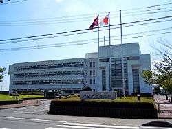 Hitachiōta city hall | |||
| |||
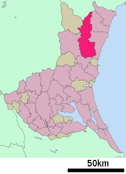 Location of Hitachiōta in Ibaraki Prefecture | |||
 Hitachiōta | |||
| Coordinates: 36°32′17.8″N 140°31′51.3″E / 36.538278°N 140.530917°ECoordinates: 36°32′17.8″N 140°31′51.3″E / 36.538278°N 140.530917°E | |||
| Country | Japan | ||
| Region | Kantō | ||
| Prefecture | Ibaraki Prefecture | ||
| Area | |||
| • Total | 371.99 km2 (143.63 sq mi) | ||
| Population (June 2018) | |||
| • Total | 49,987 | ||
| • Density | 134/km2 (350/sq mi) | ||
| Time zone | UTC+9 (Japan Standard Time) | ||
| - Tree | Zelkova serrata | ||
| - Flower | Kerria japonica | ||
| - Bird | Alcedo atthis | ||
| Phone number | 0294-72-3111 | ||
| Address | 3690 Kanai-chō, Hitachiōta-shi, Ibaraki-ken 313-8611 | ||
| Website | http://www.city.hitachiota.ibaraki.jp/ | ||


Hitachiōta (常陸太田市 Hitachiōta-shi) is a city located in Ibaraki Prefecture, Japan. As of June 2018, the city had an estimated population of 49,987, and a population density of 134 persons per km². Its total area is 371.99 square kilometres (143.63 sq mi).
Geography
Hitachiōta is located in northeastern Ibaraki Prefecture, bordered by Fukushima Prefecture to the north.
Surrounding municipalities
History
The town of Ota was established with the creation of the municipalities system on April 1, 1889. It was raised to city status on July 15, 1954. On December 1, 2004, the town of Kanasagō, and the villages of Satomi and Suifu (all from Kuji District) were merged into Hitachiōta, more than tripling its size and increasing its population by about 20,000.
Education
Hitachiōta has 14 elementary schools, eight middle schools, and three high schools.
Transportation
Railway
Highway
- Jōban Expressway – Hitachi-minamiōta IC
- Japan National Route 293
- Japan National Route 349
- Japan National Route 461
Local attractions
- Bontenyama Kofun cluster
- site of Ota Castle
- Kawanakago onsen
Notable people from Hitachiōta
- Miyuki Akiyama – professional volleyball player
- Hiroshi Kajiyama – politician
External links
![]()
- Official Website (in Japanese)
| Special cities | ||
|---|---|---|
| Cities | ||
| Districts | ||