Ya'bad
| Ya'bad | |
|---|---|
| Other transcription(s) | |
| • Arabic | يعبد |
| • Also spelled | Yabad (official) |
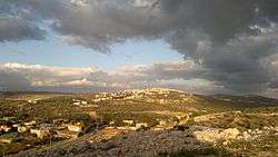 Skyline of Ya'bad, Palestine | |
 Ya'bad Location of Ya'bad within Palestine | |
| Coordinates: 32°26′48″N 35°10′13″E / 32.44667°N 35.17028°ECoordinates: 32°26′48″N 35°10′13″E / 32.44667°N 35.17028°E | |
| Palestine grid | 166/205 |
| Governorate | Jenin |
| Government | |
| • Type | Municipality |
| • Head of Municipality | Samer Abu Baker |
| Area | |
| • Jurisdiction | 21,622 dunams (21.6 km2 or 8.3 sq mi) |
| Population (2007)[1] | |
| • Jurisdiction | 13,640 |
| Name meaning | Yabid, p.n.[2] |
Ya'bad (Arabic: يعبد; Hebrew: יעבד) is a Palestinian town in the northern West Bank, 20 kilometers west of Jenin in the Jenin Governorate. It is a major agricultural town with most of its land covered with olive groves and grain fields. According to the Palestinian Central Bureau of Statistics, the town had a population of 13,640 in 2007.[1] Its mayor is Samer Abu Baker who was elected in 2005.[3] The Israeli settlement of Mevo Dotan is built on Ya'bad's land.[4]
History
Pottery sherds from the Persian, Hellenistic, early Roman, Byzantine, early Muslim and the Medieval eras have been found here.[5]
In 1105, Abd el-Ghani en-Nabulsi, a Moslem traveler, passed by Ya'bad and noted it as “a village between Jenin and Arrabeh”.[6]
Ottoman era
In 1596 Ya'bad appeared in the Ottoman tax registers as being in the nahiya of Jabal Sami in the liwa of Nablus. It had a population of 62 households, all Muslim. They paid a tax rate of 33,3% on agricultural products, including wheat, barley, summer crops, occasional revenues, goats and beehives, and a press for olives or grapes; a total of 18,085 Akçe. Half of the revenue went to a waqf dedicated to Halil ar-Rahman.[7] In the 17th-18th centuries, Ya'bad was well known for producing the best cheese in Samaria. Politically it was ruled by the Qadri clan allied with the powerful Abd al-Hadi clan.[8] In 1838, it was noted as a Muslim village, Ya'bud, located in the esh–Sha'rawiyeh esh–Shurkiyeh District.[9]
In 1870 French explorer Victor Guérin noted Ya'bad situated "on a hill",[10] while in the Palestine Exploration Fund's Survey of Western Palestine (1882), Yabid was described as "a good-sized stone village, with some Christian families and two factions of Moslems, called respectively the 'Abd el Hady and the Beni Tokan, living in separate quarters. The village stands on a ridge, with a well to the south and a small separate quarter on the east, in which is a small Mukam."[11]
British Mandate era
In the 1922 census of Palestine, conducted by the British Mandate authorities, Yabid had a population of 1,733, all Muslims,[12] increasing in the 1931 census to a population of 2,383, still all Muslim, in 418 occupied houses.[13]
In 1935 the prominent Arab resistance leader Izz ad-Din al-Qassam and a few of his men were killed in a cave near Ya'bad by British forces.[14]
In the 1945 statistics the population of Ya'bad (including Khirbat el Khuljan, Khirbat et Tarim, Khirbat Tura ash Sharqiya, Nazlat Sheik Zeid and Khirbat Umm Rihan) was 3,480, all Muslims,[15] with 37,805 dunams of land, according to an official land and population survey.[16] 6,035 dunams were used for plantations and irrigable land, 9,955 dunams for cereals,[17] while 92 dunams were built-up (urban) land.[18]
Jordanian era
After the 1948 Arab-Israeli War, Ya'bad came under Jordani rule.
The Jordanian census of 1961 found 4,709 inhabitants in Ya'bad.[19]
Post-1967
After the 1967 Six-Day War, Ya'bad has been under Israeli occupation along with the rest of the West Bank. The population of Ya'bad in the 1967 census conducted by Israel was 4,857, of whom 581 originated from the Israeli territory.[20]
A major charcoal mine is located near Ya'bad and most of its workers come from the town.[21] Since the establishment of "closed-off areas" and the construction of the West Bank Barrier in the northern West Bank, Ya'bad and surrounding cities and towns have seen an increase in unemployment which reached to 88% in 2006. The annual average income has dropped "dramatically" by one-third according to the World Bank.[21]
See also
References
- 1 2 2007 Locality Population Statistics. Palestinian Central Bureau of Statistics (PCBS).
- ↑ Palmer, 1881, p. 156
- ↑ Yabad municipality inaugurates new town hall
- ↑ Israeli Settlers Attack Taxi Driver, Shut Down Main Road near Jenin, December 31, 2015 (WAFA)
- ↑ Zertal, 2004, p. 109
- ↑ Cited in Zertal, 2004, p. 108
- ↑ Hütteroth and Abdulfattah, 1977, p. 128
- ↑ Doumani, Beshara. (1995). The Hinterland of Nablus
- ↑ Robinson and Smith, 1841, vol. 3, 2nd appendix, p. 129
- ↑ Guérin, 1875, p. 223
- ↑ Conder and Kitchener, 1882, SWP II, p. 47
- ↑ Barron, 1923, Table IX, Sub-district of Jenin, p. 30
- ↑ Mills, 1932, p. 71
- ↑ Segev, 2013, pp. 360 -362
- ↑ Government of Palestine, Department of Statistics, 1945, p. 17
- ↑ Government of Palestine, Department of Statistics. Village Statistics, April, 1945. Quoted in Hadawi, 1970, p. 55
- ↑ Government of Palestine, Department of Statistics. Village Statistics, April, 1945. Quoted in Hadawi, 1970, p. 100
- ↑ Government of Palestine, Department of Statistics. Village Statistics, April, 1945. Quoted in Hadawi, 1970, p. 150
- ↑ Government of Jordan, 1964, p. 13
- ↑ Perlmann, Joel (November 2011 – February 2012). "The 1967 Census of the West Bank and Gaza Strip: A Digitized Version" (PDF). Levy Economics Institute. Retrieved 25 January 2018.
- 1 2 Palestinians struggle in dire straits Martin Asser BBC News
Bibliography
- Barron, J. B., ed. (1923). Palestine: Report and General Abstracts of the Census of 1922. Government of Palestine.
- Conder, C.R.; Kitchener, H.H. (1882). The Survey of Western Palestine: Memoirs of the Topography, Orography, Hydrography, and Archaeology. 2. London: Committee of the Palestine Exploration Fund.
- Doumani, B. (1995). Rediscovering Palestine: Merchants and Peasants in Jabal Nablus. University of California Press.
- Government of Jordan, Department of Statistics (1964). First Census of Population and Housing. Volume I: Final Tables; General Characteristics of the Population (PDF).
- Government of Palestine, Department of Statistics (1945). Village Statistics, April, 1945.
- Guérin, V. (1875). Description Géographique Historique et Archéologique de la Palestine (in French). 2: Samarie, pt. 2. Paris: L'Imprimerie Nationale.
- Hadawi, S. (1970). Village Statistics of 1945: A Classification of Land and Area ownership in Palestine. Palestine Liberation Organization Research Center.
- Hütteroth, Wolf-Dieter; Abdulfattah, Kamal (1977). Historical Geography of Palestine, Transjordan and Southern Syria in the Late 16th Century. Erlanger Geographische Arbeiten, Sonderband 5. Erlangen, Germany: Vorstand der Fränkischen Geographischen Gesellschaft. ISBN 3-920405-41-2.
- Mills, E., ed. (1932). Census of Palestine 1931. Population of Villages, Towns and Administrative Areas. Jerusalem: Government of Palestine.
- Palmer, E.H. (1881). The Survey of Western Palestine: Arabic and English Name Lists Collected During the Survey by Lieutenants Conder and Kitchener, R. E. Transliterated and Explained by E.H. Palmer. Committee of the Palestine Exploration Fund.
- Robinson, E.; Smith, E. (1841). Biblical Researches in Palestine, Mount Sinai and Arabia Petraea: A Journal of Travels in the year 1838. 3. Boston: Crocker & Brewster.
- Segev, T. (2013). One Palestine Complete: Jews and Arabs Under the British Mandate. London: Macmillan. ISBN 1466843500.
- Zertal, A. (2004). The Manasseh Hill Country Survey. 1. Boston: BRILL. ISBN 9004137564.
External links
- Welcome To Ya'bad
- Yabad, Welcome to Palestine
- Survey of Western Palestine, Map 8: IAA, Wikimedia commons
- The Israeli Checkpoints in the Northern Districts of the West Bank 24, August, 2003, POICA
- Hundreds of dunums confiscated for bypass road construction 07, May, 2007, POICA
- Confiscating a Truck in Ya'bad Village - Jenin Governorate 06, November, 2011, POICA
| Cities |  | |
|---|---|---|
| Municipalities |
| |
| Villages |
| |