Winfarthing
| Winfarthing | |
|---|---|
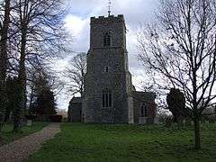 Church of Saint Mary the Virgin, Winfarthing | |
 Winfarthing Winfarthing shown within Norfolk | |
| Area | 10.80 km2 (4.17 sq mi) |
| Population | 503 (2011) |
| • Density | 47/km2 (120/sq mi) |
| OS grid reference | TM108857 |
| Civil parish |
|
| District | |
| Shire county | |
| Region | |
| Country | England |
| Sovereign state | United Kingdom |
| Post town | DISS |
| Postcode district | IP22 |
| Police | Norfolk |
| Fire | Norfolk |
| Ambulance | East of England |
| EU Parliament | East of England |
Winfarthing is a village and civil parish in the English county of Norfolk. It is located 6 km north of the town of Diss, 20 km east of the town of Thetford, and 30 km south of the city of Norwich.[1]
The civil parish has an area of 10.8 km2 (4.2 sq mi) and in the 2001 census had a population of 403 in 162 households, the population increasing to 503 at the 2011 Census.[2] For the purposes of local government, the parish falls within the district of South Norfolk.[3]
The village is a prime example of a linear village, being strung out along the B1077 road between Diss and Attleborough for around 2 km/1.25m. It is home to the Fighting Cocks public house, All Saints Church of England Primary School and St Mary's church. Until the early 1990s it had a small Royal Mail Post Office and shop. There is still a red post box at the site of the old Post Office with regular collections. Farming is the primary local business, with several dairy, arable and pig farms in the surrounding area.
King Henry VIII is known to have visited the area, and there was a large oak tree in the village at that time that was standing until the late 20th century.
History
The parish was a demesne of the King until c. 1189 the reign of Henry II, when it was sold off to a private land owner. In 1600, there were 189 communicants, and by 1739, there were 50 dwelling-houses, and about 260 inhabitants in total, at which point the parish was valued for tax purposes at £924 (£132000 today).[4]
References
- ↑ Ordnance Survey (1999). OS Explorer Map 230 - Diss & Harleston. ISBN 0-319-21862-7.
- ↑ "Civil Parish population 2011". Retrieved 5 September 2015.
- ↑ Office for National Statistics & Norfolk County Council (2001). Census population and household counts for unparished urban areas and all parishes Archived 2017-02-11 at the Wayback Machine.. Retrieved December 2, 2005.
- ↑ Blomefield, Francis (c. 1736). History of Norfolk. 1. London (published c. 1806).
- Winfarthing parish data, South Norfolk Council. Retrieved 20 June 2009.
External links
| Wikimedia Commons has media related to Winfarthing. |
- Diss Express - village's local newspaper website
- Map sources for Winfarthing.
- Information from Genuki Norfolk on Winfarthing.