Bressingham
| Bressingham | |
|---|---|
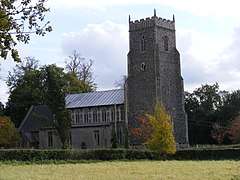 St John the Baptist, Bressingham | |
 Bressingham Bressingham shown within Norfolk | |
| Area | 15.77 km2 (6.09 sq mi) |
| Population | 882 (2011) |
| • Density | 56/km2 (150/sq mi) |
| OS grid reference | TM0780 |
| Civil parish |
|
| District | |
| Shire county | |
| Region | |
| Country | England |
| Sovereign state | United Kingdom |
| Post town | DISS |
| Postcode district | IP22 2 |
| Police | Norfolk |
| Fire | Norfolk |
| Ambulance | East of England |
| EU Parliament | East of England |
Bressingham is a village and civil parish in the English county of Norfolk. It covers an area of 15.77 km2 (6.09 sq mi) and had a population of 751 in 305 households as of the 2001 census,[1] the population increasing to 882 at the 2011 Census.[2] For the purposes of local government, it falls within the district of South Norfolk.
History
This town of Bressingham was given by Osulph le Sire, and the lady Laverine, or Leofrine, his wife, to the abbey of St. Edmund's in Bury in about 963. By the time of Edward the Confessor, the abbey owned slightly more than half the town; the rest being owned by Almar, the Bishop of Elmham. Almar's part was also a manor, and held in William the Conqueror's time by Roger Bigod, 1st Earl of Norfolk. The town was then two miles long, and a mile and a half broad, it extended at that time into Shimpling, Fersfield, Shelfhanger, and Roydon.[3]
Governance
Bressingham forms a part of the electoral ward called Bressingham and Burston. The population of this ward at the 2011 Census was 2,810.[4]
Notes
- ↑ Census population and household counts for unparished urban areas and all parishes. Office for National Statistics & Norfolk County Council (2001). Retrieved 20 June 2009.
- ↑
Bressingham is divided into five major districts.
- The Tourism Sector, the area including and surrounding the A1066. Includes Bressingham Steam Museum and Gardens and Blooms Garden Centre.
- Residential District, consisting of School Road, High Road and Bressingham Road.
- Slum District, The area along the Southern end of Darrow Lane
- The Styx. The rest of Bressingham, including a high density of farms
- Autonomous Region of Fersfield. The village of Fersfield which is part of Bressingham.
- ↑ Blomefield, Francis (c. 1736). History of Norfolk. 1. London (published c. 1806).
- ↑ "Bressingham and Burston ward population 2011". Retrieved 5 September 2015.
External links
![]()