Flordon
| Flordon | |
|---|---|
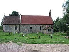 St Michael's church, Flordon | |
 Flordon Flordon shown within Norfolk | |
| Area | 3.74 km2 (1.44 sq mi) |
| Population | 281 (2011) |
| • Density | 75/km2 (190/sq mi) |
| OS grid reference | TM189969 |
| Civil parish |
|
| District | |
| Shire county | |
| Region | |
| Country | England |
| Sovereign state | United Kingdom |
| Post town | NORWICH |
| Postcode district | NR15 |
| Police | Norfolk |
| Fire | Norfolk |
| Ambulance | East of England |
| EU Parliament | East of England |
Flordon is both a civil parish and a village in Norfolk, England.
Parish data
The parish of Flordon covers an area of 3.74 km2 (1.44 sq mi) and had a population of 263 in 110 households at the 2001 census,[1] the population increasing to 281 at the 2011 Census.[2] This is not an especially significant increase from the 1881 census at which time 178 people were living there.
Village data
The village borders, in the north from west to east, Wreningham, Bracon Ash and Newton Flotman. In the south, it borders Hapton and Tasburgh. The village contains, amongst other things, protected common land on which can be found a spring and rare plants Flordon Hall is also in the vicinity.
Until 1920, Flordon had a mill on the river Tas It also had a station on the Great Eastern Main Line. Taswood Lakes lie just to the east of the village.
A mile east of Flordon is Rainthorpe Hall a Grade I listed Elizabethan manor house, owned at one time by Frederick Walpole, MP for North Norfolk.[3]
Businesses
Tas Valley Mushrooms Ltd, ABS (Anglia boiler services) Redwings horse sanctuary /(hapton )
Neighbours
Nearby villages include Hapton, Newton Flotman, Mulbarton, and Tasburgh and Long Stratton.
Notes
- ↑ "parish information". South Norfolk Council. 1 January 2010. Archived from the original on 22 November 2008. Retrieved 20 June 2009.
- ↑ "Parish population 2011". Retrieved 8 September 2015.
- ↑ "Rainthorpe Hall at PrimeLocation property website".
External links
| Wikimedia Commons has media related to Flordon. |