Barford, Norfolk
| Barford | |
|---|---|
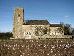 St Botolph's Church, Barford | |
 Barford Barford shown within Norfolk | |
| Area | 4.38 km2 (1.69 sq mi) |
| Population | 547 (2011) |
| • Density | 125/km2 (320/sq mi) |
| OS grid reference | TG115075 |
| Civil parish |
|
| District | |
| Shire county | |
| Region | |
| Country | England |
| Sovereign state | United Kingdom |
| Post town | NORWICH |
| Postcode district | NR9 |
| Police | Norfolk |
| Fire | Norfolk |
| Ambulance | East of England |
| EU Parliament | East of England |
Barford is a village and civil parish in the English county of Norfolk, situated some 4 miles (6 km) north of Wymondham and 8 miles (13 km) west of Norwich.
The civil parish has an area of 4.38 km2 and in the 2001 census had a population of 508 in 201 households, the population increasing to 547 at the 2011 census.[1] For the purposes of local government, the parish falls within the district of South Norfolk.
References
- ↑ "Civil Parish population 2011". Retrieved 7 September 2015.
- ^ Ordnance Survey (1999). OS Explorer Map 237 - Norwich. ISBN 0-319-21868-6.
- ^ Office for National Statistics & Norfolk County Council (2001). Census population and household counts for unparished urban areas and all parishes. Retrieved December 2, 2005.
External links

- Information from Genuki Norfolk on Barford
- Barford in the Domesday Book
This article is issued from
Wikipedia.
The text is licensed under Creative Commons - Attribution - Sharealike.
Additional terms may apply for the media files.