Wilsden
| Wilsden | |
|---|---|
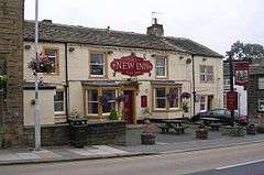 The New Inn - Main Street, Wilsden | |
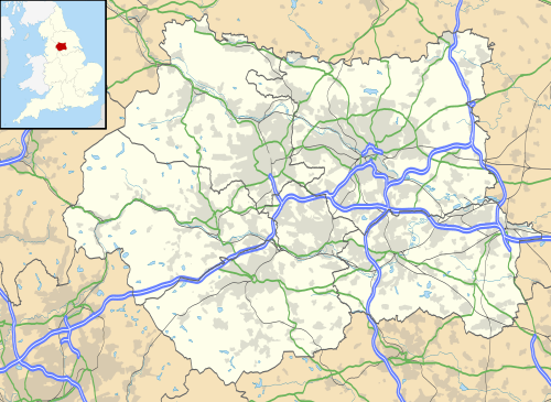 Wilsden Wilsden shown within West Yorkshire | |
| Population | 4,807 (2011 census)[1] |
| Civil parish |
|
| Metropolitan borough | |
| Metropolitan county | |
| Region | |
| Country | England |
| Sovereign state | United Kingdom |
| Post town | Bradford |
| Postcode district | BD |
| Dialling code | 01274 |
| Police | West Yorkshire |
| Fire | West Yorkshire |
| Ambulance | Yorkshire |
| EU Parliament | Yorkshire and the Humber |
| UK Parliament | |
Wilsden is a village and civil parish in west Bradford, in West Yorkshire, England. Wilsden is 6 miles (9.7 km) west of Bradford[2] and is close to the Aire Valley and the nearby villages of Denholme, Cullingworth, Harden, Cottingley and Allerton. Wilsden re-acquired civil parish status in 2004. The 2001 census revealed a population of 3,697,[3][4] increasing to 4,807 at the 2011 Census.[1]
History
Wilsden is recorded as being 'Wealhas-den', which has been suggested as meaning the place or the land of the Welshmen. This is an Anglo-Saxon term as it was believed when they arrived in the Aire Valley, Wilsden was one of the places that the native people retreated to.[5] The village is mentioned in the Domesday Book as belonging to Gamalbarn and was part of the manor known as Allerton-cum-Wilsden.[6][7] A map of 1818, shows Wilsden Hill, Wilsden and Lingbob as being three separate and distinct hamlets. Industrialisation led to the building of mills in the village, the first of which, Albion Mill, was built in 1810 with a further seven following in the same century. Albion Mill was demolished after it suffered a serious fire in 1990.[8]
The church of St Matthew was built in Wilsden in 1826 and was identical to the Church of St Paul in Shipley. The church was demolished in 1962 and ten years later, a modern St Matthew's church was built in a different location in the village.[9][10]
In 1886, a railway station was opened on the Queensbury to Keighley line that ran to the west of the village. The station was actually in the hamlet of Harecroft, 2 miles (3.2 km) away, and was closed down in May 1955 to passengers and November 1963 to goods.[11] The 616 and 619 bus services connect the village with Harden, Bingley and Eldwick to the north and with Allerton and Bradford to the south.[12][13] The main road that runs north/south through the village is an unclassified road but connects at the southern end with the B6144 road towards Cullingworth and Bradford, and at the northern end goes through Harden to connect with the B6429 towards Bingley.[14]
Wilsden has many businesses such as Wilsden Autos, Suite Centre, a Co-op and a post office.[15]
The village occupies the high ground to the west of the Aire Valley and is surrounded by upland pastures, enclosed areas, wooded valleys and gritstone moorland.[16]
The Ling Bob public house was built to the south of the village in 1836[17] and was originally known as the Brown Cow Inn. It was situated in the hamlet of Ling Bob, which was separate from the village of Wilsden at that time, however, the locals all knew the pub as the Ling Bob, so the name stuck.[18]
Wilsden Village Hall
Wilsden village hall holds lots of groups like scouting groups, walking group, a weekly auction, a pre-school and others.[19]
Administratively, it is part of the Bingley Rural ward of the City of Bradford and part of the Shipley constituency.[20]
Notable people
- Alfred Fowler, Astronomer was born in the village[21]
References
- 1 2 UK Census (2011). "Local Area Report – Wilsden Parish (1170210967)". Nomis. Office for National Statistics. Retrieved 1 October 2018.
- ↑ "About Wilsden & Harecroft". Wilsden Parish Council. Retrieved 9 October 2016.
- ↑ "Census 2001 : Urban Areas : Table KS01 : Usual Resident Population". Office for National Statistics. Archived from the original on 16 August 2009. Retrieved 26 August 2009.
- ↑ http://www.wilsdenparishcouncil.gov.uk/about.php
- ↑ Speight, Harry (1898). Chronicles and stories of old Bingley A full account of the history, antiquities, natural productions, scenery, customs and folklore of the ancient town and parish of Bingley, in the West Riding of Yorkshire. London: Eliott Stock. pp. 62–70. OCLC 620352036.
- ↑ Powell-Smith, Anna. "Wilsden | Domesday Book". opendomesday.org. Retrieved 1 October 2018.
- ↑ James, John (1841). The History and Topgraphy of Bradford. London: Longman, Brown, Green and Longmans. p. 365. OCLC 18077389.
- ↑ WCAA 2004, pp. 8–10.
- ↑ "History of St Matthew's". www.stmatthewswilsden.org.uk. Retrieved 1 October 2018.
- ↑ WCAA 2004, p. 24.
- ↑ Armour, Chris. "Wilsden". Disused Stations. Retrieved 9 October 2016.
- ↑ "616 - Bradford - Eldwick – First Bradford – Bus Times". bustimes.org. Retrieved 1 October 2018.
- ↑ "619 - Bradford - Eldwick – First Bradford – Bus Times". bustimes.org. Retrieved 1 October 2018.
- ↑ "288" (Map). Bradford & Huddersfield. 1:25,000. Explorer. Ordnance Survey. 2015. ISBN 9780319244852.
- ↑ "Wilsden Co-op re-opens after revamp". Bradford Telegraph and Argus. 7 October 2009. Retrieved 1 October 2018.
- ↑ "Landscape Character Supplementary Planning Document Volume 9: Wilsden" (PDF). bradford.gov.uk. Bradford Council. October 2008. p. 1. Retrieved 1 October 2018.
- ↑ Barnett, David (31 January 2011). "The story of the woman with a special gift". Telegraph and Argus. Retrieved 9 October 2016.
- ↑ Hansen, Astrid (2001). Wilsden. Wilsden: Astrid Hansen. p. 37. OCLC 876778579.
- ↑ "Regular Events". www.wilsdenvillagehall.com. Retrieved 8 September 2011.
- ↑ "Wilsden and Harecroft Parish Plan Spring 2010" (PDF). wilsdenparishcouncil.gov.uk. p. 2. Retrieved 1 October 2018.
- ↑ Shand, Neil (6 March 2018). "Lasting tribute to 'remarkable' astronomer who is now ' almost forgotten'". Bradford Telegraph and Argus. Retrieved 1 October 2018.
Sources
- Wilsden Conservation Area Appraisal (PDF) (Report). Bradford: Bradford City Council. March 2004. Retrieved 1 October 2018.
External links
| Wikimedia Commons has media related to Wilsden. |
- Wilsden
- Wilsden at Curlie (based on DMOZ)
- Webcam located in Wilsden.