Lumbfoot
| Lumbfoot | |
|---|---|
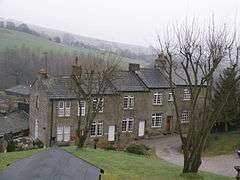 Cottages at Lumbfoot (2008) | |
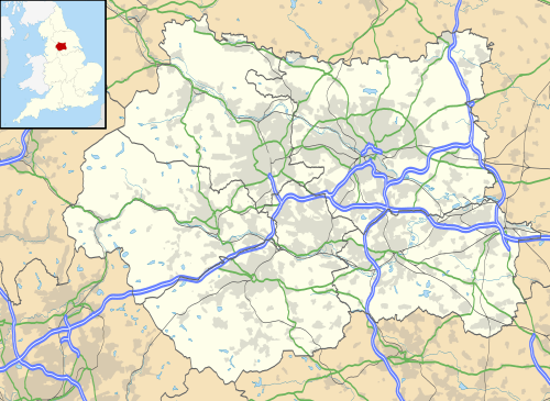 Lumbfoot Lumbfoot shown within West Yorkshire | |
| OS grid reference | SE016375 |
| • London | 180 mi (290 km) SSE |
| Civil parish |
|
| Metropolitan borough | |
| Metropolitan county | |
| Region | |
| Country | England |
| Sovereign state | United Kingdom |
| Post town | KEIGHLEY |
| Postcode district | BD22 |
| Police | West Yorkshire |
| Fire | West Yorkshire |
| Ambulance | Yorkshire |
| EU Parliament | Yorkshire and the Humber |
| UK Parliament | |
Lumbfoot is a hamlet in the Haworth, Cross Roads and Stanbury civil parish, and the City of Bradford metropolitan district, England.[1] It is situated approximately 1 mile (1.6 km) from Haworth and less than half a mile north-east from Stanbury. The hamlet is Historically part of the West Riding of Yorkshire. Lumbfoot overlooks a number of fields and a small brook, and contains 15 households and a farm. There is no public road; access is by a private road for vehicles, and a public footpath.
Lumbfoot has its own newspaper, "The Lumbfoot Clarion", which reports on local news and events.
History
Lumbfoot Mill, built on the floor of a valley, was originally water powered but adopted steam power in c. 1900. The mill has since been largely demolished but a 15-foot stump of the chimney and the engine house still remain, and there is evidence of the pit that housed the original waterwheel among the ruins. A row of cottages at Lumbfoot, which today are modernised, were constructed between 1840 and 1852 to house mill workers.
Declaration of independence
In 1989 Lumbfoot declared independence from the UK following a dispute between residents of Lumbfoot and residents of the nearby village of Stanbury. Lumbfoot residents erected a road barrier and signs declaring independence, and used two stone outbuildings (former privies) as a 'douane' and a 'gendarmerie'. This declaration of independence was reported in the county newspaper, the Yorkshire Post.
As part of the independence declaration, Lumbfoot was twinned with Lhasa, Tibet. The hamlet's signpost reads "Lumbfoot, twinned with Lhasa, Tibet" and indicates the number of residents – human, dogs (muttleys) and cats (moggies). Current residents actively maintain a policy of independence.
Gallery
 Lumbfoot Mill about 1900, from an old postcard
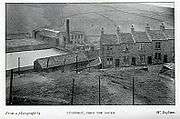 Lumbfoot cottages about 1900, from an old postcard
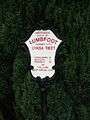 Sign at Lumbfoot showing population