Williamsbridge, Bronx
| Williamsbridge | |
|---|---|
| Neighborhood of the Bronx | |
|
Location in New York City | |
| Coordinates: 40°52′37″N 73°51′58″W / 40.877°N 73.866°WCoordinates: 40°52′37″N 73°51′58″W / 40.877°N 73.866°W | |
| Country |
|
| State |
|
| City |
|
| Borough |
|
| Community District | Bronx 12[1] |
| Area[2] | |
| • Total | 3.11 km2 (1.202 sq mi) |
| Population (2010 United States Census)[3] | |
| • Total | 61,321 |
| • Density | 20,000/km2 (51,000/sq mi) |
| Economics | |
| Ethnicity | |
| • African-American | 67.5% |
| • Hispanic and Latino American | 25.6% |
| • White | 2.8% |
| • Asian | 1.6% |
| • Others | 2.5% |
| ZIP codes | 10466, 10467, 10469 |
| Area code | 718, 347, 929, and 917 |
| Website |
www |
Williamsbridge is a neighborhood geographically located in the north central Bronx borough of New York City in the United States. The neighborhood is part of Bronx Community Board 12. Its boundaries, starting from the north and moving clockwise are: East 222nd Street to the north, Boston Road to the east, East Gun Hill Road to the south, and the Bronx River to the west. White Plains Road is the primary thoroughfare through Williamsbridge. ZIP codes include 10466, 10467, and 10469. The area is patrolled by the 47th Precinct located at 4111 Laconia Avenue. New York City Housing Authority (NYCHA) property in the area is patrolled by P.S.A. 8 at 2794 Randall Avenue in the Throggs Neck section of the Bronx.
Demographics
The neighborhood was historically heavily Jewish and Italian-American. It became predominantly African American in the 1970s, and since the 1980s, has received an influx of Caribbean and West Indian immigrants, particularly from Jamaica. Currently, the neighborhood is predominate native-born people of Caribbean descent.
Based on data from the 2010 United States Census, the population of Williamsbridge was 61,321, an increase of 3,901 (6.8%) from the 57,420 counted in 2000. Covering an area of 833.25 acres (337.20 ha), the neighborhood had a population density of 73.6 inhabitants per acre (47,100/sq mi; 18,200/km2).[3]
The racial makeup of the neighborhood was 2.8% (1,690) White, 67.5% (41,380) African American, 0.4% (237) Native American, 1.6% (961) Asian, 0.0% (13) Pacific Islander, 0.6% (396) from other races, and 1.6% (956) from two or more races. Hispanic or Latino of any race were 25.6% (15,688) of the population.[4]
Land use and terrain
Williamsbridge is characterized by multi-family homes and moderate size multi-unit buildings. Majority of residences are private and owner-occupied two and three stories homes. The total land area is roughly a mile and a half. The area is low-lying and flat.
Beth Abraham Hospital[5] is located on Allerton and Barker Avenues. P.S. 96 - Richard Rodgers School[6] is located at Olinville Avenue and Waring Avenue.
Parks
The Seventh Draft District World War I Monument located at East 219th Street and Bronx Blvd. and the park that surrounds it, has undergone a renaissance as of late. In addition to the Department of Parks cleaning up the area in 2008, there has been an annual Memorial Day service at the monument itself since 2009.[7]
History
According to the New York City Parks Department Williamsbridge was named for 18th Century farmer John Williams, who had a farm on the east bank of the Bronx River in the vicinity of Gun Hill Road and White Plains Road, and was credited with building the first bridge over the Bronx River.[8] It incorporated as a village on November 23, 1888.[9]
Olinville is a disused neighborhood name for the area around Olinville Avenue in Williamsbridge. It is mostly situated around White Plains Road between Allerton Avenue and Gun Hill Road.
The New York City Department of City Planning has proposed zoning map changes for 36 blocks in the Williamsbridge/Olinville area. The proposed zoning would preserve the area’s lower density residential character and promote new development in keeping with the scale of the surrounding neighborhood. In addition, the DCP is proposing a zoning text amendment establishing a new citywide R5A district to address the unique detached housing stock found within this neighborhood.[10]
The area’s development patterns, although varied, are characterized by distinct enclaves of detached, semi-detached, and attached residential buildings, as well as a smaller number of mid and high-rise apartment buildings. However, the height and density of existing housing is generally lower than is permitted under the current zoning. Clusters of one- and two-family homes are prevalent in many parts of Williamsbridge and few buildings are higher than 70 feet, even in the more densely developed portions of the neighborhood. The proposed rezonings aim to address this zoning mismatch by ensuring that new development is of a density and scale compatible with the low-rise/low-density character of this community.[10]
Transportation
The following MTA Regional Bus Operations bus routes serve Williamsbridge:[11]
- Bx8: to Locust Point (via Williamsbridge Road)
- Bx28: to Co-op City or Fordham Center (via Gun Hill Road)
- Bx30: to Co-op City or Norwood – 205th Street (via Boston Road)
- Bx38: to Bay Plaza Shopping Center or Norwood – 205th Street (via Gun Hill Road)
- Bx39: to Wakefield or Clason Point (via White Plains Road)
- Bx41 SBS: to The Hub (via Webster Avenue)
- BxM11: express bus to Midtown Manhattan
The following New York City Subway stations serve Williamsbridge:[12]
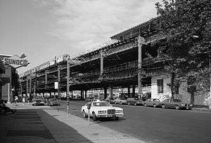
- Gun Hill Road (2 and 5 trains)
- 219th Street (2 and 5 trains)
The Metro-North Railroad also stops at Williams Bridge station at Gun Hill Road and Webster Avenue, served by the Harlem Line.
References
- ↑ "NYC Planning | Community Profiles". communityprofiles.planning.nyc.gov. New York City Department of City Planning. Retrieved 25 February 2018.
- ↑ "Williamsbridge neighborhood in New York". Retrieved November 2, 2017.
- 1 2 Table PL-P5 NTA: Total Population and Persons Per Acre - New York City Neighborhood Tabulation Areas*, 2010, Population Division - New York City Department of City Planning, February 2012. Accessed June 16, 2016.
- ↑ Table PL-P3A NTA: Total Population by Mutually Exclusive Race and Hispanic Origin - New York City Neighborhood Tabulation Areas*, 2010, Population Division - New York City Department of City Planning, March 29, 2011. Accessed June 14, 2016.
- ↑ http://www.bethabe.org/index1.html
- ↑ "Welcome - P.S. 096 Richard Rodgers - X096 - New York City Department of Education". schools.nyc.gov.
- ↑ Hayes, Maggie (June 23, 2011). "Bronx man keeps neighborhood history alive in effort to preserve community". New York Daily News. p. 36. Retrieved 2011-06-23.
- ↑ "Williamsbridge Oval Highlights : NYC Parks". www.nycgovparks.org.
- ↑ Senate, New York (State) Legislature (4 January 2018). "Documents of the Senate of the State of New York" – via Google Books.
- 1 2 Olinville Rezoning - Approved, New York City Department of City Planning. Accessed March 12, 2008.
- ↑ "Bronx Bus Map" (PDF). Metropolitan Transportation Authority. September 2017. Retrieved April 24, 2018.
- ↑ "Subway Map" (PDF). Metropolitan Transportation Authority. January 18, 2018. Retrieved January 18, 2018.
External links
| South Bronx |  | |
|---|---|---|
| West Bronx | ||
| East Bronx | ||
| Related areas |
| |