Country Club, Bronx
| Country Club | |
|---|---|
| Neighborhood of the Bronx | |
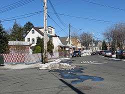 Griswold & Research Avenues in Country Club | |
|
Location in New York City | |
| Coordinates: 40°50′20″N 73°49′12″W / 40.839°N 73.82°WCoordinates: 40°50′20″N 73°49′12″W / 40.839°N 73.82°W | |
| Country |
|
| State |
|
| City |
|
| Borough |
|
| Community District | Bronx 10[1] |
| Area[2] | |
| • Total | 0.54 km2 (0.208 sq mi) |
| Population (2011)[2] | |
| • Total | 3,548 (estimated) |
| Economics | |
| • Median income | $89,826 |
| ZIP codes | 10465 |
| Area code | 718, 347, 929, and 917 |
Country Club is a mixed-income neighborhood located in the East Bronx in New York City; it shares the 10465 ZIP code with Throggs Neck. Country Club is east of Pelham Bay; and it contains a large Italian-American population.[3]
The neighborhood's boundaries are Middletown Road and Watt Avenue to the north, Eastchester Bay to the east, Layton Avenue to the south, and New England Thruway to the west.[3] This area is policed by the 45th Precinct of the New York City Police Department.[4] Pelham Bay Park (including Orchard Beach), the largest public park in New York City, is located just north of Country Club, which itself is approximately two miles from City Island in Eastchester Bay.
Transportation
Since there are no alternate side parking regulations in this residential area, many residents drive. There are two New York City Subway stations relatively nearby: Pelham Bay Park and Buhre Avenue, both on the 6 and <6> trains, are located to the northwest in the Pelham Bay neighborhood.[5] Surface transportation is provided by the Bx24 local bus.[6] Additionally, the community is the home of the Evers Marina and Seaplane Base on the west bank of Eastchester Bay at Outlook Point.[7][8]
Education
Country Club has a private primary educational institution within its borders, Villa Maria Academy, operated by the Congregation of Notre Dame of Montreal.[9] The zoned public school, PS 71, is in nearby Pelham Bay in the New York City Department of Education's District 8.[10]
Demographics
Country Club has a population of around 3,548 people. It is a predominantly white neighborhood with around 89% of the population of Country Club being non-Hispanic white, while approximately 8% are of Hispanic ancestry and the remaining 3% a mix of Black and Asian.[2][11]
References
- ↑ "NYC Planning | Community Profiles". communityprofiles.planning.nyc.gov. New York City Department of City Planning. Retrieved 3 March 2018.
- 1 2 3 "Country Club neighborhood in New York". Retrieved 17 October 2015.
- 1 2 Vandam, Jeff (2010-04-02). "Country Club, the Bronx: Passed Down to Generations". The New York Times. ISSN 0362-4331. Retrieved 2017-01-08.
- ↑ 45th Precinct Official Website
- ↑ "Subway Map" (PDF). Metropolitan Transportation Authority. January 18, 2018. Retrieved January 18, 2018.
- ↑ MTA Regional Bus Operations. "Bx24 bus schedule" (PDF).
- ↑ Evers Marina and Seaplane Base
- ↑ Evers Seaplane Base - 6N6 (AirNav.com)
- ↑ "Villa Maria Academy Official Website". Retrieved 17 October 2015.
- ↑ "Welcome to PS 71 - P.S. 071 Rose E. Scala - X071 - New York City Department of Education". schools.nyc.gov. Retrieved 2017-01-08.
- ↑ "Bronx Community District 10" (PDF). Archived from the original (PDF) on 4 March 2016. Retrieved 17 October 2015.
| South Bronx |  | |
|---|---|---|
| West Bronx | ||
| East Bronx | ||
| Related areas |
| |