Vindication Island
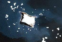 NASA Terra image of Vindication Island | |
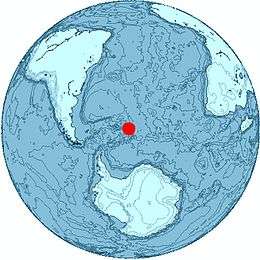 Location of Vindication Island | |
| Geography | |
|---|---|
| Coordinates | 57°06′S 26°47′W / 57.100°S 26.783°W |
| Area | 3 km2 (1.2 sq mi) |
| Length | 2.1 km (1.3 mi) |
| Width | 1.6 km (0.99 mi) |
| Highest elevation | 430 m (1,410 ft) |
| Highest point | Quadrant Peak |
| Administration | |
|
United Kingdom | |
| Demographics | |
| Population | Uninhabited |
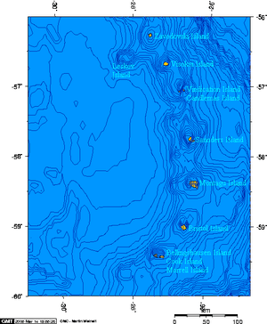
Vindication Island is a small uninhabited island in the South Sandwich Islands. It lies about 2 miles (3.2 km) from Candlemas Island, separated by the Nelson Channel.
Geography
This small island is part of the Candlemas Islands subgroup of the South Sandwich Islands. The island's highest point is Quadrant Peak at 430 m (1,411 ft), while the south-easternmost cape is Chinstrap Point. The island is mostly ice free.
Vindication Island is the eroded remains of a former volcanic complex.[1] Unlike neighboring Candlemas Island, where there is volcanic activity, the volcano on Vindication has shown no sign of activity for over 10,000 years.[2]
Buddha Rock lies 0.3 nautical miles (0.6 km) west of Vindication Island.
South Sandwich Islands
See also
References
- ↑ The South Sandwich Islands: Petrology of the Volcanic Rocks, P. E. Baker, Scientific Report of the British Antarctic Survey, Nr 93, Cambridge 1978, p. 7
- ↑ LeMasurier, W. E.; Thomson, J. W., eds. (1990). Volcanoes of the Antarctic Plate and Southern Oceans. American Geophysical Union. p. 512 pp. ISBN 0-87590-172-7.
Capital: King Edward Point | |
| General | |
| Settlements / Whaling stations | |
| South Georgia islands | |
| South Sandwich islands | |
| Landmarks |
|
This article is issued from
Wikipedia.
The text is licensed under Creative Commons - Attribution - Sharealike.
Additional terms may apply for the media files.