Prince Olav Harbour
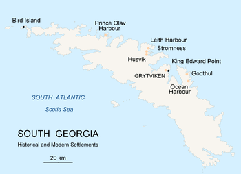
Prince Olav Harbour is small harbour in the south west portion of Cook Bay, entered between Point Abrahamsen and Sheep Point, along the north coast of South Georgia.[1]
Background
Throughout the 19th century South Georgia was a sealers' base and, in the following century, became a whalers' base. Prince Olav Harbour is the site of one of the seven main whaling bases established on South Georgia. Prince Olav Harbour was the location of a former Norwegian whaling station operational dating from 1911.
History
The whaling station was initially a floating factory site, a shore station being set up in 1916. The whaling station continued as a shore station until March 1931 and then was closed. The name was in use as early as 1912 and was given by Norwegian whalers for Crown Prince Olav of Norway.[2]
The wreck of the ship Brutus remains, semi-submerged, where she was deliberately beached to serve as a coaling station. The ship was built in Glasgow in 1883 as the Sierra Pedrosa, and measured 1,686 gross registered tons. Aftyer serving as a coal hulk at Cape Town, she was towed to South Georgia in about 1912. Brutus Island in the harbour is named after it.[3][4]
Named locations
Several locations in and around Prince Olav Harbour have been charted and named by various Antarctic survey and exploration groups.
Dinghy Point is a point on the south side of the harbor. It was charted and named "Pram Point" by Discovery Investigations in 1929. The name Dinghy Point was approved for this feature by the UK Antarctic Place-Names Committee in 1991 to avoid duplication with Pram Point at Leith Harbour in Stromness Bay.[5]
See also
References
- ↑ "Prince Olav Harbour". Geographic Names Information System. United States Geological Survey. Retrieved 2018-08-27.
- ↑ Whaling Stations on South Georgia (The James Caird Society) "Archived copy". Archived from the original on 2009-12-21. Retrieved 2009-06-01.
- ↑ "Sierra Pedrosa". Scottish Built Ships. Caledonian Maritime Research Trust. Retrieved 2 June 2018.
- ↑ "Shipwrecks". South Georgia Heritage Trust. Retrieved 2 June 2018.
- ↑ "Dinghy Point". Geographic Names Information System. United States Geological Survey. Retrieved 2012-01-19.
![]()
External links
- Plan of the Prince Olav Harbour whaling station
- Abandoned Whaling Station
- Prince Olav Harbour - South Georgia
- Prince Olav Harbour Whaling station
Coordinates: 54°4′S 37°9′W / 54.067°S 37.150°W
Capital: King Edward Point | |
| General | |
| Settlements / Whaling stations | |
| South Georgia islands | |
| South Sandwich islands | |
| Landmarks |
|