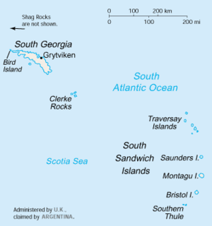
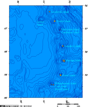
Saunders Island, South Sandwich Islands
 Saunders Island location | |
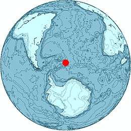 Location of Saunders Island | |
| Geography | |
|---|---|
| Coordinates | 57°47′S 026°27′W / 57.783°S 26.450°W |
| Archipelago | South Sandwich Islands |
| Length | 8.8 km (5.47 mi) |
| Highest elevation | 990 m (3,250 ft) |
| Highest point | Mount Michael |
| Administration | |
|
United Kingdom | |
| Demographics | |
| Population | Uninhabited |
Saunders Island is a crescent-shaped island 8.8 km (5.5 mi) long, lying between Candlemas Island and Montagu Island in the South Sandwich Islands, a part of the United Kingdom. It is a volcanic island composed of an active stratovolcano, 990-metre (3,248 ft) Mount Michael, (Named by Commander William Melvin Carey of the Discovery II, after his son Michael Carey). It's known to have erupted explosively in 1819, and has erupted repeatedly since 2000, most recently in 2005. The 700 m (2,297 ft) diameter summit crater is thought to possibly contain an active lava lake, one of only a handful in the world.
Saunders Island was discovered in 1775 by Captain James Cook, who named it for Sir Charles Saunders, First Lord of the Admiralty. It was charted in greater detail by Bellingshausen in 1819, and in 1930 by DI personnel on the Discovery II. The island was surveyed in 1964 by HMS Protector after whose captain, Captain Martin S. Ollivant, the westernmost point, Ollivant Point, is named.
Shackleton sometimes misspells it as "Sanders Island" in his book South.
See also
References
- "Michael". Global Volcanism Program. Smithsonian Institution.
- LeMasurier, W. E.; Thomson, J. W., eds. (1990). Volcanoes of the Antarctic Plate and Southern Oceans. American Geophysical Union. p. 512 pp. ISBN 0-87590-172-7.
- Volcano World: Mount Michael
Capital: King Edward Point | |
| General | |
| Settlements / Whaling stations | |
| South Georgia islands | |
| South Sandwich islands | |
| Landmarks |
|