Villeparisis
| Villeparisis | |
|---|---|
| Commune | |
 The town Hall of Villeparisis | |
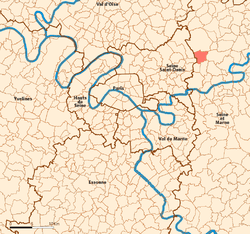 Location (in red) within Paris inner and outer suburbs | |
| Coordinates: 48°57′01″N 2°36′09″E / 48.9503°N 2.6025°ECoordinates: 48°57′01″N 2°36′09″E / 48.9503°N 2.6025°E | |
| Country | France |
| Region | Île-de-France |
| Department | Seine-et-Marne |
| Arrondissement | Meaux |
| Canton | Villeparisis |
| Intercommunality | CA Roissy Pays de France |
| Government | |
| • Mayor (2014–2020) | Hervé Touguet |
| Area1 | 8.29 km2 (3.20 sq mi) |
| Population (2013)2 | 25,889 |
| • Density | 3,100/km2 (8,100/sq mi) |
| Time zone | UTC+1 (CET) |
| • Summer (DST) | UTC+2 (CEST) |
| INSEE/Postal code | 77514 /77270 |
| Elevation | 53–133 m (174–436 ft) |
|
1 French Land Register data, which excludes lakes, ponds, glaciers > 1 km2 (0.386 sq mi or 247 acres) and river estuaries. 2 Population without double counting: residents of multiple communes (e.g., students and military personnel) only counted once. | |
Villeparisis is a commune in the Seine-et-Marne department in the Île-de-France region in north-central France. It is located in the north-eastern suburbs of Paris 21.8 km (13.5 mi) from the centre.
Transportation
Villeparisis is served by Villeparisis – Mitry-le-Neuf station on Paris RER line B.
Demographics
Inhabitants of Villeparisis are called Villeparisiens.
Twin towns


Notable residents
- Henri Cleutin, Sieur de Villeparisis, 16th-century diplomat
See also
References
External links
| Wikimedia Commons has media related to Villeparisis. |
- Official website (in French)
- 1999 Land Use, from IAURIF (Institute for Urban Planning and Development of the Paris-Île-de-France région) (in English)
This article is issued from
Wikipedia.
The text is licensed under Creative Commons - Attribution - Sharealike.
Additional terms may apply for the media files.