Reuil-en-Brie
| Reuil-en-Brie | |
|---|---|
| Commune | |
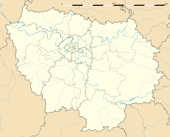
 Reuil-en-Brie Location within Île-de-France region  Reuil-en-Brie | |
| Coordinates: 48°57′41″N 3°08′51″E / 48.9614°N 3.1476°ECoordinates: 48°57′41″N 3°08′51″E / 48.9614°N 3.1476°E | |
| Country | France |
| Region | Île-de-France |
| Department | Seine-et-Marne |
| Arrondissement | Meaux |
| Canton | La Ferté-sous-Jouarre |
| Intercommunality | CA Coulommiers Pays de Brie |
| Government | |
| • Mayor (2008–2014) | Patrick Romanow |
| Area1 | 5.92 km2 (2.29 sq mi) |
| Population (2006)2 | 874 |
| • Density | 150/km2 (380/sq mi) |
| Time zone | UTC+1 (CET) |
| • Summer (DST) | UTC+2 (CEST) |
| INSEE/Postal code | 77388 /77260 |
| Elevation | 51–185 m (167–607 ft) |
|
1 French Land Register data, which excludes lakes, ponds, glaciers > 1 km2 (0.386 sq mi or 247 acres) and river estuaries. 2 Population without double counting: residents of multiple communes (e.g., students and military personnel) only counted once. | |
Reuil-en-Brie is a commune in the Seine-et-Marne department in the Île-de-France region in north-central France.
The settlement grew up around the monastery founded by Rado, a mayor of the palace of Burgundy,[1] in about 630, which from his name was called Radolium.[2] In later times it was a priory of Cluny.
Demographics
The inhabitants are called Reuillois.
See also
References
- ↑ Identified as "Rado (who, like Audoin, spent much of his career as court referendary), [and] was the founder of yet another monastery, 'Radolium,' at Reuil-en-Brie" (Barbara H. Rosenwein, Negotiating Space: Power, Restraint, and Privileges of Immunity in Early Medieval Europe 1999:62 and notes).
- ↑ quod ex suo nomine Radolium vocavit (Life of St. Agile, ca 684–690 (Acta Sanctorum, August VI:582), noted in Pierre-Henri Billy, Patrociny settlement names in France).
External links
| Wikimedia Commons has media related to Reuil-en-Brie. |
- 1999 Land Use, from IAURIF (Institute for Urban Planning and Development of the Paris-Île-de-France région) (in English)
- Map of Reuil-en-Brie on Michelin (in English)
This article is issued from
Wikipedia.
The text is licensed under Creative Commons - Attribution - Sharealike.
Additional terms may apply for the media files.