Émerainville
| Émerainville | ||
|---|---|---|
| Commune | ||
 The town hall of Émerainville | ||
| ||
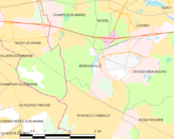 | ||
| Coordinates: 48°48′39″N 2°37′25″E / 48.8108°N 2.6236°ECoordinates: 48°48′39″N 2°37′25″E / 48.8108°N 2.6236°E | ||
| Country | France | |
| Region | Île-de-France | |
| Department | Seine-et-Marne | |
| Arrondissement | Torcy | |
| Canton | Pontault-Combault | |
| Intercommunality | CA Paris - Vallée de la Marne | |
| Government | ||
| • Mayor (2014–2020) | Alain Kelyor | |
| Area1 | 5.46 km2 (2.11 sq mi) | |
| Population (2013)2 | 7,444 | |
| • Density | 1,400/km2 (3,500/sq mi) | |
| Time zone | UTC+1 (CET) | |
| • Summer (DST) | UTC+2 (CEST) | |
| INSEE/Postal code | 77169 /77184 | |
| Elevation | 83–113 m (272–371 ft) | |
|
1 French Land Register data, which excludes lakes, ponds, glaciers > 1 km2 (0.386 sq mi or 247 acres) and river estuaries. 2 Population without double counting: residents of multiple communes (e.g., students and military personnel) only counted once. | ||

Émerainville (pronounced [emʁɛ̃vil]) is a commune in the Seine-et-Marne département in the Île-de-France region in north-central France.
Demographics
Inhabitants of Émerainville are called Émerainvillois.
Education
Primary school groups (combined preschools and elementary schools) include Bois d'Emery, Jean-Jaurès, La Mare l'Embûche, Lavoisier, and Malnoue II. There is one junior high school, Collège Vincent Van Gogh. There is one tertiary educational institution, Université de Technologie et d'Enseignement Consulaire.[1]
Parks and recreation
Athletic facilities:[1]
- Gymnase Jacques Anquetil
- Piscine d'Emerainville
- Stade Dominique Rocheteau
- Espace sportif Guy Drut (sports hall)
See also
References
- 1 2 "Equipement municipal." Émerainville. Retrieved on September 3, 2016.
External links
| Wikimedia Commons has media related to Émerainville. |
- Official Site (in French)
- 1999 Land Use, from IAURIF (Institute for Urban Planning and Development of the Paris-Île-de-France région) (in English)
- French Ministry of Culture list for Émerainville (in French)
- Map of Émerainville on Michelin (in English)
This article is issued from
Wikipedia.
The text is licensed under Creative Commons - Attribution - Sharealike.
Additional terms may apply for the media files.