Turkey Creek, Florida
| Turkey Creek, Florida | |
|---|---|
| Unincorporated community | |
 Turkey Creek  Turkey Creek | |
| Coordinates: 27°58′37″N 82°11′6″W / 27.97694°N 82.18500°WCoordinates: 27°58′37″N 82°11′6″W / 27.97694°N 82.18500°W | |
| Country | United States |
| State | Florida |
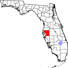
| County | Hillsborough |
| Time zone | UTC-5 (Eastern (EST)) |
| • Summer (DST) | UTC-4 (EDT) |
| ZIP codes | 33527 |
Turkey Creek is a rural unincorporated community located in eastern Hillsborough County, Florida, United States. The community is served by the 33527 ZIP Code.
Geography
Palm River is located at 27.977 North, 82.185 West,[1] or approximately three miles west-southwest of Plant City. The elevation of the community is 92 feet above sea level.
Description
Turkey Creek's approximate boundaries include Dover to the west, Interstate 4 to the north, Plant City to the east and State Road 60 to the south.
References
- ↑ "US Gazetteer files: 2010, 2000, and 1990". United States Census Bureau. 2011-02-12. Retrieved 2011-04-23.
External links
- Community of Turkey Creek information page
- Turkey Creek page from Hometown Locator
This article is issued from
Wikipedia.
The text is licensed under Creative Commons - Attribution - Sharealike.
Additional terms may apply for the media files.