Fish Hawk, Florida
| Fish Hawk, Florida FishHawk | |
|---|---|
| Census-designated place | |
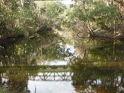 The Alafia River in Fish Hawk | |
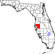
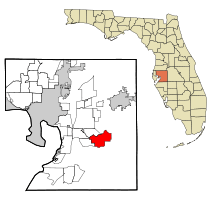 Location in Hillsborough County and the state of Florida | |
| Coordinates: 27°51′10″N 82°12′31″W / 27.85278°N 82.20861°WCoordinates: 27°51′10″N 82°12′31″W / 27.85278°N 82.20861°W[1] | |
| Country | United States |
| State | Florida |
| County | Hillsborough |
| Government | |
| • Type | CDD |
| Area | |
| • Total | 16.4 sq mi (42.4 km2) |
| • Land | 16.2 sq mi (42.0 km2) |
| • Water | 0.2 sq mi (0.4 km2) |
| Elevation | 62 ft (19 m) |
| Population (2010) | |
| • Total | 14,087 |
| • Density | 869/sq mi (335.5/km2) |
| Time zone | UTC-5 (Eastern (EST)) |
| • Summer (DST) | UTC-4 (EDT) |
| ZIP Code | 33547 |
| Area code(s) | 813 |
| FIPS code | 12-22387[2] |
| GNIS feature ID | 2402482[3] |
| Fish Hawk is the name of the CDP Fishhawk is the name of the creek it was named after. FishHawk is the name attached to many of the comunities within.[4][3] | |
Fish Hawk (or FishHawk) is an unincorporated area and census-designated place (CDP) in Hillsborough County, Florida, United States. It is a suburb of Tampa, Florida, and includes a portion of the community of Lithia. As of the 2010 census, the CDP had a population of 14,087,[4] up from 1,991 at the 2000 census. The place name is derived from Little Fishhawk Creek, a tributary of the Alafia River that joins the Alafia just west of Lithia Springs.
Geography
Fish Hawk is located in east-central Hillsborough County, bordered to the north by the Alafia River, which separates it from Valrico to the north and Bloomingdale to the northwest. Boyette road borders Fish Hawk from the south and Riverview to the southwest. Fish Hawk is 20 miles (32 km) southeast of downtown Tampa. The older community of Lithia is in the eastern part of the CDP.
According to the United States Census Bureau, the CDP has a total area of 16.4 square miles (42.4 km2), with 16.2 square miles (42.0 km2) of land and 0.2 square miles (0.4 km2), or 1.03%, of water.[4]
Description
FishHawk Ranch by Newland Communities is a planned community composed of several distinct villages over 3,000+ acres.[5] FishHawk Ranch contains several public common areas including the Park Square Town Center, the Lake House, the Palmetto Club clubhouse, the Osprey Club, the Aquatic Center, biking/walking trails, community swimming pools, gym facilities, tennis courts, lakes, and ponds. FishHawk Ranch was the first certified green new-home community in Hillsborough County.[6] The community is part of a Community Development District and residents pay a CDD fee for their respective CDD designation or subdivision.
Channing Park and the Enclave at Channing Park are located within the FishHawk area of Lithia.[7][8] Private amenities include a half-basketball court, skateboard park, playground with picnic facilities, dog park, soccer field, amenities center with fitness area, pirate splash zone and a resort style pool with spa.[8]
The FishHawk area is also noted for its high-ranking, A-rated schools.[9][10]
History
FishHawk Trails and FishHawk Ranch formerly operated as a ranch; these two subdivisions were built by two different companies in the 1990s.
Before these subdivisions were constructed, FishHawk Trails was a wooded location through which a CSX Transportation rail track path passed. The rail tracks were removed in the late 1980s. There was once a train station in the FishHawk area that was the main import/export area of supplies, mail, and food for Lithia residents.
Environmental impact
Starling at FishHawk and The Preserve were previously an undeveloped wildlife habitat. The Florida Green Building Coalition has named FishHawk as a "green" community, the first in Hillsborough County and the largest in the Tampa area. In 2003, the National Arbor Day Foundation honored the FishHawk community preservation efforts.[11]
Demographics
| Historical population | |||
|---|---|---|---|
| Census | Pop. | %± | |
| 2000 | 1,991 | — | |
| 2010 | 14,087 | 607.5% | |
| source:[12] | |||
At the time of the 2000 US Census[2], there were 1,991 people, 678 households, and 581 families residing in the community. The population density was 121.8 people per square mile (47.0/km²). There were 798 housing units at an average density of 48.8/sq mi (18.8/km²). The racial makeup of the community was 91.41% White, 4.12% Black, 0.15% Native American, 0.80% Asian, 2.06% from other races, and 1.46% from two or more races. Hispanic or Latino of any race were 6.08% of the population.
There were 678 households out of which 43.4% had children under the age of 18 living with them, 76.0% were married couples living together, 6.9% had a female householder with no husband present, and 14.3% were non-families. 10.6% of all households were made up of individuals and 2.7% had someone living alone who was 65 years of age or older. The average household size was 2.94 and the average family size was 3.16.
In the community, the population was spread out with 29.6% under the age of 18, 5.6% from 18 to 24, 35.7% from 25 to 44, 23.1% from 45 to 64, and 6.0% who were 65 years of age or older. The median age was 35 years. For every 100 females, there were 98.5 males. For every 100 females age 18 and over, there were 96.4 males.
The median income for a household in the community was $65,857, and the median income for a family was $67,286. Males had a median income of $42,321 versus $35,662 for females. The per capita income for the community was $26,540. About 2.0% of families and 3.3% of the population were below the poverty line, including 3.6% of those under age 18 and none of those age 65 or over.
The area was transformed by development throughout the following decade, with the population growing over 700%, from under 2,000 to 14,087 in the 2010 US Census, while the median household income also increased dramatically from $65,857 to $107,250.[13] To accommodate the rapid growth, the Hillsborough County School District opened several new schools in the area, including Newsome High School in 2003.
Education
Schools:
- Barrington Middle School (Public, 6-8)
- Bevis Elementary (Public, K-5)
- Bell Creek Academy (Charter, 6-9)
- FishHawk Creek Elementary (Public, K-5)
- Foundation Christian Academy (Private, Churches of Christ, K-12)
- Lithia Springs Elementary (Public, K-5)
- Newsome High School (Public, 9-12)
- Pinecrest Elementary (Public, K-5)
- Randall Middle School (Public, 6-8)
- St. Stephen's Catholic School (Private, Catholic, K-12)
- Stowers Elementary (Public, K-5)
- Valrico Lake Advantage Academy (Charter, K-5)
References
- ↑ "US Gazetteer files: 2010, 2000, and 1990". United States Census Bureau. February 12, 2011. Retrieved April 23, 2011.
- 1 2 "American FactFinder". United States Census Bureau. Retrieved January 31, 2008.
- 1 2 "Fish Hawk Census Designated Place". Geographic Names Information System. United States Geological Survey.
- 1 2 3 "Geographic Identifiers: 2010 Demographic Profile Data (G001): Fish Hawk CDP, Florida". American Factfinder. U.S. Census Bureau. Retrieved May 3, 2017.
- ↑ "FishHawk Villages". Newland Communities. Retrieved August 29, 2017.
- ↑ "FishHawk Ranch Amenities". Newland Communities. Retrieved August 29, 2017.
- ↑ "Google Maps". Google Maps. Retrieved January 25, 2018.
- 1 2 "The Enclave at Channing Park in Lithia, Florida - Taylor Morrison". www.taylormorrison.com. Retrieved January 25, 2018.
- ↑ "Great Schools Lithia Florida". Great Schools. Retrieved August 29, 2017.
- ↑ "Florida Department of Education School Grades". Florida Department of Education. Retrieved August 29, 2017.
- ↑ "National Arbor Day Foundation". ArborDay.Org. Retrieved May 9, 2018.
- ↑ "CENSUS OF POPULATION AND HOUSING (1790-2000)". U.S. Census Bureau. Retrieved July 17, 2010.
- ↑ "Fish Hawk CDP, Florida". United States Census Bureau. Archived from the original on August 15, 2012. Retrieved February 20, 2014.