Balm, Florida
| Balm, Florida | |
|---|---|
| Census-designated place | |
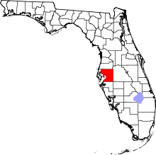
 Location of Balm in Hillsborough County, Florida. | |
 Balm Location of Balm in Hillsborough County, Florida.  Balm Balm (the US) | |
| Coordinates: 27°45′34″N 82°15′40″W / 27.75944°N 82.26111°WCoordinates: 27°45′34″N 82°15′40″W / 27.75944°N 82.26111°W | |
| Country | United States |
| State | Florida |
| County | Hillsborough |
| Area | |
| • Total | 10.2 sq mi (26.3 km2) |
| • Land | 10.0 sq mi (26.0 km2) |
| • Water | 0.1 sq mi (0.3 km2) |
| Elevation | 131 ft (40 m) |
| Population (2010) | |
| • Total | 1,457 |
| • Density | 145/sq mi (55.9/km2) |
| Time zone | UTC-5 (Eastern (EST)) |
| • Summer (DST) | UTC-4 (EDT) |
| ZIP code | 33503 |
| Area code(s) | 813 |
| FIPS code | 12-03375[1] |
| GNIS feature ID | 294664[2] |
Balm is an unincorporated census-designated place in Hillsborough County, Florida, United States. The population was 1,457 at the 2010 census.[1]
History
A post office was established here in 1902 and called "Doric"; it was renamed the next month to "Balm".[3] The community was so named on account of their "balmy" air.[4] Prior to 1902, the Seaboard Air Line Railway established Balm as a flag stop. The railroad built a one-room station and water tank. This made Balm a focal point, and a small community including a blacksmith, sawmills, a teacher, and a general store sprang up by 1911. In 1937, electricity arrived, soon followed by a community telephone, set up in a barn for all to use. By 1945 the area had a population of over a thousand.[5]
Geography
Balm is located in southern Hillsborough County, bordered by Riverview to the north, Apollo Beach to the west, Sun City Center to the southwest, and Wimauma to the south. U.S. Route 301 forms the western border of the Balm CDP, and leads north 12 miles (19 km) to the eastern outskirts of Tampa and southwest 28 miles (45 km) to Bradenton.
According to the U.S. Census Bureau, the Balm CDP has a total area of 10.2 square miles (26.3 km2), of which 10.0 square miles (26.0 km2) are land and 0.1 square miles (0.3 km2), or 1.03%, are water.[1]
Demographics
| Historical population | |||
|---|---|---|---|
| Census | Pop. | %± | |
| U.S. Decennial Census[6] | |||
Economy
Originally a rail stop and logging town, the economy is mostly agricultural, largely citrus. The University of Florida's Tomato Breeding Program is located in Balm.[7] In 2005, the Bradenton REC was merged with the Dover REC to become the Gulf Coast Research and Experiment Center, which was relocated to Balm.[8] Other activities at the GCREC include hops research.[9] Tropical fish farming has also been a significant industry in the area.[10]
References
- 1 2 3 "Geographic Identifiers: 2010 Demographic Profile Data (G001): Balm CDP, Florida". American Factfinder. U.S. Census Bureau. Retrieved May 1, 2017.
- ↑ "Balm". Geographic Names Information System. United States Geological Survey.
- ↑ "Post Offices". Jim Forte Postal History. Retrieved 5 January 2017.
- ↑ Moyer, Armond; Moyer, Winifred (1958). The Origins of Unusual Place-Names. Keystone Pub. Associates. p. 10.
- ↑ "Hillsborough County Historic Resources Survey Report" (PDF). October 1, 1998. Retrieved 5 January 2017.
- ↑ "Census of Population and Housing". Census.gov. Retrieved June 4, 2016.
- ↑ "Univ. of Florida/IFAS Tomato Breeding Program". Retrieved 5 January 2017.
- ↑ "IFAS News". University of Florida. Retrieved 5 January 2017.
- ↑ "UF/IFAS to hop into hops varieties for microbreweries". University of Florida. 23 February 2016. Retrieved 5 January 2017.
- ↑ Wang, Stephanie (9 June 2011). "Widow selling tropical fish farms, more at auction". Tampa Bay Times. Retrieved 5 January 2017.
External links