Touffailles
| Touffailles | ||
|---|---|---|
| Commune | ||
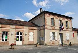 The town hall of Touffailles | ||
| ||
 Touffailles Location within Occitanie region  Touffailles | ||
| Coordinates: 44°16′26″N 1°03′05″E / 44.2739°N 1.0514°ECoordinates: 44°16′26″N 1°03′05″E / 44.2739°N 1.0514°E | ||
| Country | France | |
| Region | Occitanie | |
| Department | Tarn-et-Garonne | |
| Arrondissement | Castelsarrasin | |
| Canton | Pays de Serres Sud-Quercy | |
| Government | ||
| • Mayor (2001–2008) | André Couderc | |
| Area1 | 24.34 km2 (9.40 sq mi) | |
| Population (2006)2 | 384 | |
| • Density | 16/km2 (41/sq mi) | |
| Time zone | UTC+1 (CET) | |
| • Summer (DST) | UTC+2 (CEST) | |
| INSEE/Postal code | 82182 /82190 | |
| Elevation |
118–276 m (387–906 ft) (avg. 220 m or 720 ft) | |
|
1 French Land Register data, which excludes lakes, ponds, glaciers > 1 km2 (0.386 sq mi or 247 acres) and river estuaries. 2 Population without double counting: residents of multiple communes (e.g., students and military personnel) only counted once. | ||
.svg.png)
Touffailles is a commune in the Tarn-et-Garonne department in the Occitanie region in southern France.
Geography
The Séoune forms parts of the commune's south-eastern border.
See also
References
| Wikimedia Commons has media related to Touffailles. |
This article is issued from
Wikipedia.
The text is licensed under Creative Commons - Attribution - Sharealike.
Additional terms may apply for the media files.