Montbeton
| Montbeton | ||
|---|---|---|
| Commune | ||
 | ||
| ||
 Montbeton Location within Occitanie region  Montbeton | ||
| Coordinates: 44°00′43″N 1°17′09″E / 44.0119°N 1.2858°ECoordinates: 44°00′43″N 1°17′09″E / 44.0119°N 1.2858°E | ||
| Country | France | |
| Region | Occitanie | |
| Department | Tarn-et-Garonne | |
| Arrondissement | Montauban | |
| Canton | Montech | |
| Intercommunality | Pays de Montauban et des Trois Rivières | |
| Government | ||
| • Mayor (2014–2020) | Michel Weill | |
| Area1 | 15.98 km2 (6.17 sq mi) | |
| Population (2012)2 | 3,597 | |
| • Density | 230/km2 (580/sq mi) | |
| Time zone | UTC+1 (CET) | |
| • Summer (DST) | UTC+2 (CEST) | |
| INSEE/Postal code | 82124 /82290 | |
| Elevation |
76–105 m (249–344 ft) (avg. 100 m or 330 ft) | |
|
1 French Land Register data, which excludes lakes, ponds, glaciers > 1 km2 (0.386 sq mi or 247 acres) and river estuaries. 2 Population without double counting: residents of multiple communes (e.g., students and military personnel) only counted once. | ||
.svg.png)
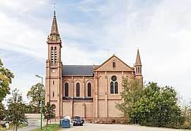
Montbeton is a commune in the Tarn-et-Garonne department in the Occitanie region in southern France.
See also
References
| Wikimedia Commons has media related to Montbeton. |
This article is issued from
Wikipedia.
The text is licensed under Creative Commons - Attribution - Sharealike.
Additional terms may apply for the media files.